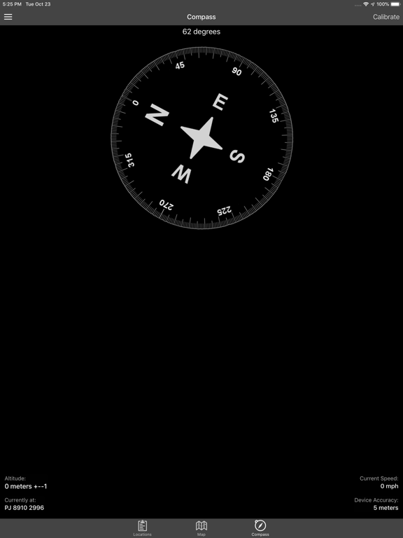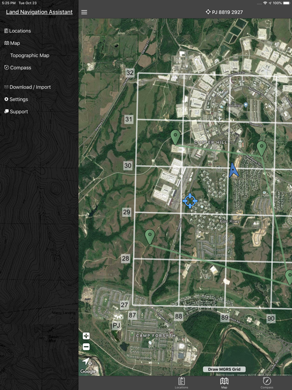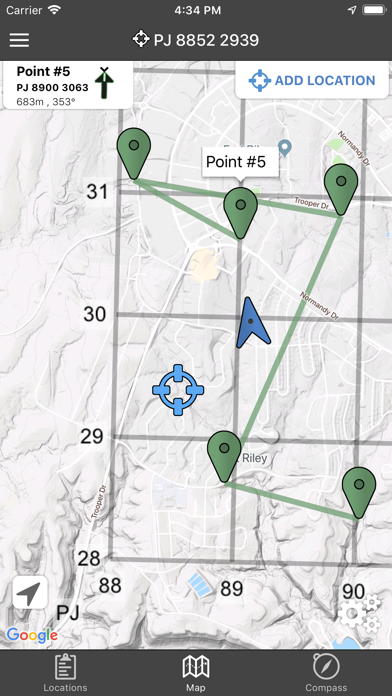
Land Nav Assistant
GPS MGRS & LatLng for Military
$1.99
2.2for iPhone, iPad and more
Age Rating
Land Nav Assistant Screenshots
About Land Nav Assistant
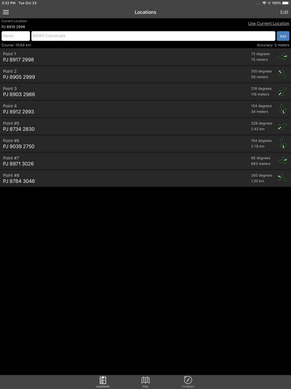
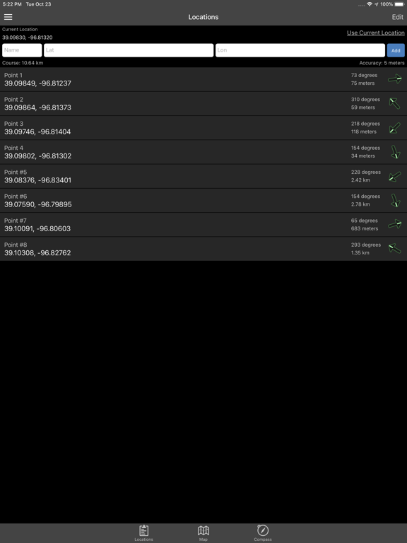
Land Nav Assistant accepts MGRS (Military Grid) or Latitude / Longitude coordinates and visually navigates you to each point.
This app was designed with Army, Marine, and other military personnel in mind. Use it to correct your Land Nav technique by analyzing your pace count and tendency to veer left and right.
Available Input: 8 digit MGRS, 10 digit MGRS, Lat/Lon decimal, Lat/Lon dms, and map input.
Angles: degrees or mils
Distance: meters/km or feet/miles
Speed: kph or mph
Use the simple arrow interface or map to direct you to your locations. Your distance, direction, speed, and bearing are shown as you navigate.
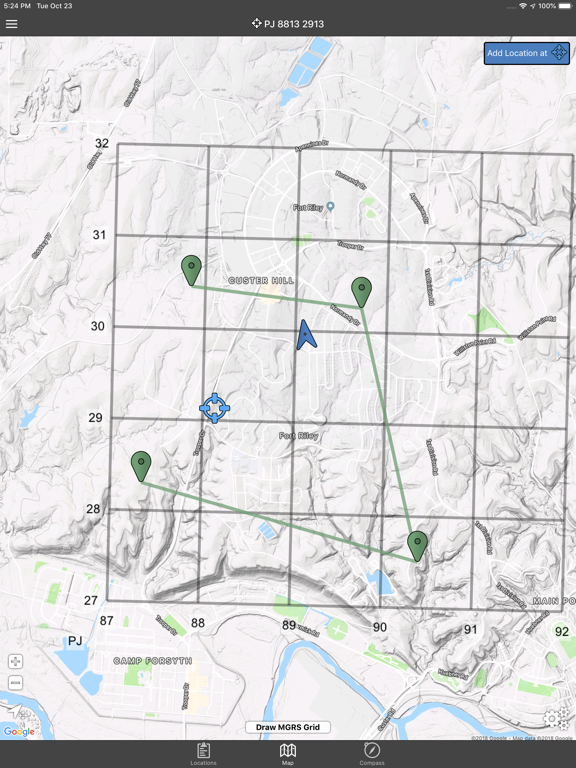
Long-tap anywhere on the map to get the coordinate for that location. Easily add locations via the Map interface.
Plan your course by ordering points, or use the course optimization tool which will help you calculate the shortest path possible!
Get distance/direction between two points by tapping the path drawn between them.
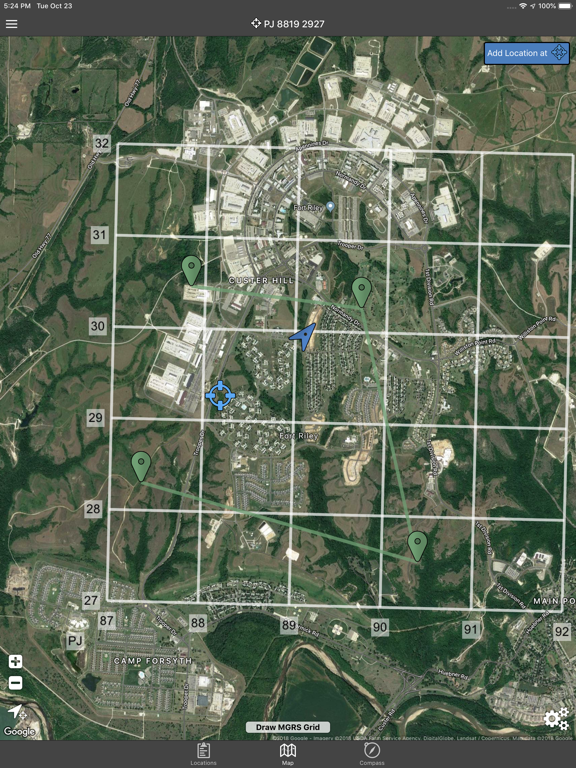
Satellite, Terrain, Road, and basic Topographic maps show you, your locations, and lets you enter in new ones.
Overlay a 1000m or 100m MGRS grid anywhere on the map.
Displays distance/direction from your currentl location to all points, or between any two points.
Download your Locations as a spreadsheet to save anywhere, or to share with anyone you choose.
Import a large set of locations via the web import utility, available at: https://www.gammonapplications.com/land-navigation-services/import
This app uses the Military Grid Reference System (MGRS) and Latitude / Longitude.
Choose to display your locations as MGRS 10-digit, MGRS 8-digit, or LatLon Decimal.
D:M:S can be input in the format DD:MM:SS followed by the appropriate direction (NSWE). Default direction is N, W.
DO NOT use this application while learning Land Navigation. Land Navigation is a valuable skill, and should be mastered before using this application. Do not rely solely on this application for navigation, especially when lost. Always be aware of your surroundings.
Show More
What's New in the Latest Version 2.2
Last updated on Apr 8, 2019
Old Versions
Draw MGRS Grid Overlays anywhere on the map (1000m, 100m)
iOS 12 Optimization
Screen improvements for iPhone X, XS, and XR
iOS 12 Optimization
Screen improvements for iPhone X, XS, and XR
Show More
Version History
2.2
Apr 8, 2019
Draw MGRS Grid Overlays anywhere on the map (1000m, 100m)
iOS 12 Optimization
Screen improvements for iPhone X, XS, and XR
iOS 12 Optimization
Screen improvements for iPhone X, XS, and XR
2.1
Sep 26, 2017
Bug fixes affecting iOS 11
2.0
Jun 14, 2017
-Modernized UI
-Improved mapping functionality.
-Edit Details, Reorder Locations
-Course Planning, total distance calculations
-Find any coordinate quickly by touching the map
-Get the Distance/Direction between any two points by touching their connecting path
-More specific Unit of Measure settings
-Path Optimization, tell the app where you want to start and end, and it will find the shortest path
Thank you all for your patience with this upgrade! Please don't hesitate to reach out with questions or suggestions via the app.
1.8
Jun 6, 2014
-You can now add locations by touching the Map
-Full compass view
-MGRS points are spaced out for readability
-Import/Share your locations with the new spreadsheet upload utility at https://www.gammonapplications.com/landnavimport/
-Full compass view
-MGRS points are spaced out for readability
-Import/Share your locations with the new spreadsheet upload utility at https://www.gammonapplications.com/landnavimport/
1.6
Feb 18, 2014
-Fixed issue where the last two points on the locations list were hidden off the screen
-Option to display your grids as 8 digit or 10 digit
-Added option for mils under settings
-Increased text sizes to increase readability
-Added option to increase text size even more
-Option to display your grids as 8 digit or 10 digit
-Added option for mils under settings
-Increased text sizes to increase readability
-Added option to increase text size even more
1.3
Nov 13, 2013
- iPhone 5 Optimization (about time!)
- Modernized Interface
- Additional Satellite Map Functionality
- Export your points to a spreadsheet
- Included a link for help/support
- Modernized Interface
- Additional Satellite Map Functionality
- Export your points to a spreadsheet
- Included a link for help/support
1.2
Aug 23, 2012
Degree:Minutes:Seconds input added.
1.1
Jul 31, 2012
Version 1.1
-Topographic Map with location overlays
-Latitude/Longitude mode
-Interface improvements
-Topographic Map with location overlays
-Latitude/Longitude mode
-Interface improvements
1.0
May 18, 2012
Land Nav Assistant FAQ
Click here to learn how to download Land Nav Assistant in restricted country or region.
Check the following list to see the minimum requirements of Land Nav Assistant.
iPhone
Requires iOS 9.0 or later.
iPad
Requires iPadOS 9.0 or later.
iPod touch
Requires iOS 9.0 or later.
Land Nav Assistant supports English
Related Videos
Latest introduction video of Land Nav Assistant on iPhone

