New samples
- Query features with Arcade expression
- Create mobile geodatabase
Enhancements
- Redesigned UI for a few samples.
- Refactored Show callout to show the WGS 84 projected coordinates instead of Web Mercator.
- Updated Show device location using indoor positioning with a publicly accessible web map.
- Renamed Generate Geodatabase -> Generate geodatabase replica from feature service to better differentiate geodatabase samples.
- Updated CQL JSON queries in Query with CQL filters to use the latest CQL2-JSON format.
- Added reset buttons to Clip geometry and Cut geometry.
- Removed Google Analytics from the app to comply with organization requirements.
Bug fixes
- Fixed invalid data and services.
- Fixed identify tolerance within Identify KML features.
- Fixed error handling in Generate offline map.
- Fixed offline data in Navigate route with rerouting.
- Fixed online data in ArcGIS vector tiled layer (custom style).
- Various project housekeeping fixes: linting, project build warnings, phrasing in README, etc.
New samples
- Query features with Arcade expression
- Create mobile geodatabase
Enhancements
- Refactored Show callout to show the WGS 84 projected coordinates instead of Web Mercator.
- Updated Show device location using indoor positioning with a publicly accessible web map.
- Renamed Generate Geodatabase -> Generate geodatabase replica from feature service to better differentiate geodatabase samples.
- Updated CQL JSON queries in Query with CQL filters to use the latest CQL2-JSON format.
- Added reset buttons to Clip geometry and Cut geometry.
Bug fixes
- Fixed identify tolerance within Identify KML features.
- Fixed error handling in Generate offline map.
- Fixed offline data in Navigate route with rerouting.
- Fixed online data in ArcGIS vector tiled layer (custom style).
- Various project housekeeping fixes: linting, project build warnings, phrasing in README, etc.
New samples
• Set max extent
• Display route layer
• Apply unique values with alternate symbols
Enhancements
• Updated Display feature layers to use new feature layer constructor.
• Added new "Favorites" category to access favorited samples quickly.
Bug fixes
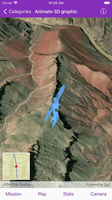
• Fixed popup with animation statistics for Animate 3D graphic.
• Leveled initial scene viewpoint in Explore scenes in flyover AR.
• Fixed authentication prompt for Token authentication.
New sample:
• Query related features from non-spatial table
Enhancements:
• Updated various samples to utilize applyEdits method on AGSServiceGeodatabase
• Updated all scene samples to use basemapStyle API.
Bug fixes:
• Updated ordered anchor points for data used in Dictionary renderer with graphics overlay.
• Fixed data tags for Display feature layers.
• Fixed missing labels in Show labels on layer in 3D.
• Fixed incorrect basemap in List KML contents.
• Updated mobile map package workflow in Apply scheduled updates to preplanned map area.
• Updated data in Raster layer (service).
Bug fixes
• Fixes crashing within scene views
New Samples
• Add features with contingent values
• Display feature layers
• Show device location using indoor positioning
Enhancements
• Feature layer definition expression is now titled Filter by definition expression or display filter
• Updated Feature layer definition expression to add display filter support
• Updated Browse building floors
• Updated Display device location with NMEA data sources
• Updated Add graphics with renderer
• Updated all basemap constructors to basemapStyle
• Updated Dictionary Renderer Graphics Overlay sample to use Ordered Anchor Points
• Removed Feature layer (feature service), Feature layer (geodatabase), Feature layer (geopackage), Feature layer (shapefile)
Bug fixes
• Fixed various bugs in the following samples: Route around barriers and Graphics overlay (dictionary renderer) 3D
The following samples have been added:
• Display information > Filter by time extent
• Features > Toggle between feature request modes
• Layers > Export vector tiles
• Layers > Select ENC features
• Maps > Display a map SwiftUI
• Layers > Display dimensions
• Maps > Browse building floors
The following samples have been updated:
• Display information > Sketch on the map
• Geometry > Nearest vertex
• Layers > OpenStreetMap layer
The following samples have been removed:
• Features > Service feature table (cache)
• Features > Service feature table (manual cache)
• Features > Service feature table (no cache)
• Layers > ArcGIS vector tiled layer (URL)
In addition, this release includes the following changes:
• Updated app info page
• Updated main README with instructions for installing SDK manually
• Fixed various bugs in the following samples: Identify raster cell, Map reference scale, and Show legend
• Updated READMEs
• Updated Display KML network links service
The following samples have been added:
• Features > Toggle between feature request modes
• Layers > Export vector tiles
• Layers > Select ENC features
• Maps > Display a map SwiftUI
The following samples have been updated:
• Display information > Sketch on the map
• Layers > OpenStreetMap layer
The following samples have been removed:
• Features > Service feature table (cache)
• Features > Service feature table (manual cache)
• Features > Service feature table (no cache)
In addition, this release includes the following changes:
• Updated app info page
• Updated main README with instructions for installing SDK manually
• Fixed various bugs in the following samples: Identify raster cell, Map reference scale, and Show legend
The following samples have been added:
• Display information > Display information using Geotriggers
• Features > Toggle between feature request modes
• Scenes > Orbit camera around object
The following samples have been updated:
• Display information > Add graphics renderer
• Display information > Show legend
• Maps > Create and save map
• Maps > Open Map (URL)
In addition, this release includes the following changes:
• Updated licensing instructions
• Updated deprecated utility network property
• Updated `OptionsTableViewController`
• Removed 3 functionally duplicate samples
The following samples have been added:
• Layers > Browse OGC API feature service
• Layers > Display OGC API collection
• Layers > Query OGC API with CQL filters
The following samples have been updated:
• Features > Add delete related features
• Maps > Create and save map
• Maps > Show location history
• Route and directions > Navigate route
• Utility networks > Perform valve isolation trace
In addition, this release includes the following changes:
• Updated README documentation
• Updated authentication methods for offline map samples
• Updated samples to use `AGSLabelDefinition`
• Updated geocode locators
• Updated tile packages
The following sample has been added:
• Scenes > Display 3D labels in scene
• Utility network > Display content of utility network container
The following samples have been updated:
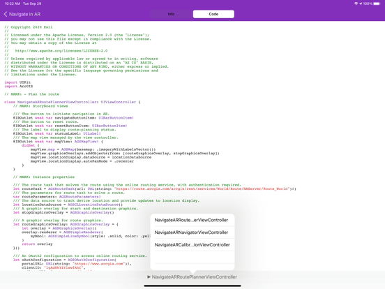
• Augmented reality > Navigate in AR
• Features > Add delete related features
• Features > Generate geodatabase
• Layers > Display subtype feature layer
• Layers > Show labels on layers
• Maps > Display device location with NMEA data sources
• Utility network > Create load report
In addition, this release includes the following changes:
• Updated Dark Mode support for various components: callout, progress HUD
• Updated the utility network samples to use service geodatabase
• Updated the default branch name to `main`
• Updated the SDK installation to use Swift Package Manager
• Updated README documentation
• Added error handling for insufficient route tracking privilege of Lite license key
The following samples have been added:
• Augmented reality > View hidden infrastructure in AR
• Display information > Create symbol styles from web styles
• Geometry > Buffer list
• Layers > Add ENC exchange set
• Maps > Display device location with NMEA data sources
• Route and directions > Navigate route with rerouting
• Utility network > Create load report
The following samples have been updated:
• Augmented reality > Flyover AR
• Display information > Custom dictionary style
• Edit data > Edit and sync features
• Geometry > Spatial operations
• Layers > Edit KML ground overlay
• Layers > Export tiles
• Layers > ArcGIS vector tiled layer (custom style)
• Layers > Group layers
• Layers > Apply mosaic rule to rasters
• Layers > Identify KML features
• Maps > Change basemap
• Scenes > Create terrain from local tile package
• Scenes > Add integrated mesh layer
In addition, this update includes the following changes:
• Added Dark Mode support
• Slightly improved coding style
• Updated build phases and path to the new ArcGIS Framework
• Incorporated API key and new basemap initializers
• Replaced pixelated Brest basemap
• Fixed the build error that occurs in the first clean build
• Updated the demo Sample Server used in utility network samples
The following samples have been added:
• Augmented reality > Navigate in AR
• Display information > Show popup
• Edit Data > Edit features with feature-linked annotation
• Edit Data > Edit with branch versioning
• Features > Feature collection layer (portal item)
• Layers > Identify raster cell
• Layers > Apply mosaic rule to rasters
• Layers > Apply raster rendering rule
• Scenes > Animate images with image overlay
• Scenes > Realistic lighting and shadows
• Utility network > Display utility associations
• Utility network > Configure subnetwork trace
The following samples have been updated:
• Augmented reality > Display scenes in tabletop AR
• Edit data > Create and save KML file
• Edit data > Edit and sync features
• Edit data > Offline edit and sync
• Features > Feature layer selection
• Geometry > Convex hull
• Geometry > Nearest vertex
• Geometry > Spatial operations
• Layers > Group layers
• Maps > Show location history
• Maps > Display layer view state
• Route and directions > Navigate route
• Scenes > Surface placements
• Scenes > Open a scene (portal item)
In addition, this update includes the following changes:
• Updated documentation to a universal format
• Updated app color scheme
The following samples have been added:
• Display Information > Custom Dictionary Style
• Edit Data > Create and Save KML File
• Geometry > Convex Hull
• Geometry > Nearest Vertex
• Layers > Display Annotation
• Layers > Display Subtype Feature Layer
• Route & Directions > Find Closest Facility to an Incident (Interactive)
• Route & Directions > Navigate Route
• Utility Network > Perform Valve Isolation Trace
• Utility Network > Trace Utility Network
In addition, this update includes the following changes:
• Removal of the Connected Trace sample
• Improvements to the Display Scenes in Tabletop AR sample
• Improved visibility of search bar text
• iOS 11 is no longer supported
Fixed the Connected Trace sample.
The following samples have been added:
• Maps > Apply Scheduled Updates to Preplanned Map Area
• Scenes > Get Elevation at a Point
Explore what's new in version 100.6.0 of the ArcGIS Runtime SDK for iOS with the following new samples:
• Augmented Reality > Collect Data in AR
• Augmented Reality > Display Scenes in Tabletop AR
• Augmented Reality > Explore Scenes in Flyover AR
• Cloud & Portal > Authenticate with OAuth
• Cloud & Portal > Token Authentication
• Edit Data > Edit and Sync Features
• Geometry > Project
• Layers > Colormap Renderer
• Layers > Control Annotation Sublayer Visibility
• Layers > Dictionary Renderer with Feature Layer
• Maps > Download Preplanned Map
• Maps > Honor Mobile Map Package Expiration Date
• Maps > Show Location History
• Route & Directions > Find Closest Facility to Multiple Incidents (Service)
• Scene > Create Terrain Surface from a Local Raster
• Scene > Create Terrain Surface from a Local Tile Package
• Utility Network > Connected Trace
Enjoy the following enhancements throughout the app:
- Fixed appearance issues on iOS 13
- Fixed issue with Choose Camera controller sample
- Fixed issue with Unique Value Renderer sample
Explore what's new in version 100.5.0 of the ArcGIS Runtime SDK for iOS with the following new samples:
• Cloud & Portal > Integrated Windows Authentication
• Display Information > Graphics Overlay (Dictionary Renderer) 3D
• Display Information > Read Symbols from a Mobile Style
• Features > Feature Layer Rendering Mode (Scene)
• Geometry > Buffer
• Geometry > Clip Geometry
• Geometry > Densify and Generalize
• Layers > Browse WFS Layers
• Layers > Display a WFS Layer
• Layers > Group Layers
• Layers > Load WFS with XML Query
• Layers > Play a KML Tour
• Layers > Show Label on Layers
• Maps > Generate Offline Map (Basemap by Reference)
• Maps > Map Reference Scale
• Maps > Set Min/Max Scale
• Scenes > Add a Point Scene Layer
• Scenes > Add an Integrated Mesh Layer
• Scenes > Change Atmosphere Effect
• Scenes > Choose Camera Controller
• Scenes > Open Mobile Scene (Scene Package)
• Scenes > Sync Map and Scene Views
• Scenes > View Content Beneath the Terrain Surface
• Scenes > View Point Cloud Data Offline
Enjoy the following enhancements throughout the app:
• Route Around Barriers: Fixed animation on appearance
• Animate 3D Graphic: Fixed animation bug
• ArcGIS Tiled Layer (Tile Cache): Added support for TPKX files
• Refactored several modal views
• Removed support for iOS 10
Explore what's new in version 100.4.0 of the ArcGIS Runtime SDK for iOS with new samples:
- Display KML: open KML files from various sources in a map
- List KML Contents: navigate the hierarchy of a KML file and set a scene viewpoint for a KML node
- Identify KML Features: find the KML node for a tap and display a callout
- Display KML Network Links: automatically load remote data referenced from a KML file
- Generate Offline Map (w/ Overrides): specify what should be downloaded when taking a map offline
Rediscover existing features of the SDK with a new sample:
- OpenStreetMap Layer: easily use an OpenStreetMap basemap with correct attribution
Enjoy enhancements throughout the app:
- Integrated search bar that shows results instantly as you type
- Large category titles for a modern look
- New data sources for a variety of samples
- Nicer launching experience
- Better error alerts
- Standardized fonts
- Other assorted bug fixes and behind-the-scenes improvements
Fixed crash on opening the Line of Sight (Geoelement) sample.
• New samples in this version include:
- Maps
- Read a Geopackage
- Layers
- WMTS Layer
- WMS Layer
- Raster Layer (service)
- Raster Layer (Geopackage)
- Raster Function (service)
- Style WMS Layer
- Query a Map Image Sublayer
- Display Information
- Display Grid
- Features
- Feature Layer (Shapefile)
- Feature Layer (Geopackage)
- Time Based Query
- Feature Layer Rendering Mode (Map)
- Feature Layer (Shapefile)
- Geometry
- List Transformations by Suitability
- Geodesic Operations
- Cut Geometry
- Spatial Relationships
- Analysis
- Line of Sight (GeoElement)
- Distance Measurement Analysis
- Line of Sight (location)
- Viewshed (Geoelement)
- Viewshed (Camera)
- Viewshed (Location)
- Statistics query
- Statistical query (group and sort)
- Scenes
- Open a Scene (Portal Item)
- Scene Layer Selection
- Feature layer extrusion
Other improvements :
• Added support for iPhone X.
• Analyze Viewshed: Renamed to Viewshed (Geoprocessing).
• Map Rotation: Fixed compass not rotating.
• Display Drawing Status: Fixed drawing state not being updated before view appears.
• Viewshed (Location): Settings persist while in the sample.
• Display Grid: Settings persist while in the sample.
• Feature Layer (Shapefile): Renamed to Symbolize Shapefile.
Updated app to use v100.1 of ArcGIS Runtime SDK for iOS.
New samples in this version include :
- Map
- Generate offline map
- Layers
- Change sublayer renderer
- Manage sublayers
- Web tiled layer
- Raster layer (file)
- Display Information
- Format coordinates
- Features
- List related features
- Add/delete related features
- Route & Directions
- Find service area interactive
- Cloud & Portal
- Search for webmap
- Scenes
- Animate 3D graphic
- Scene Layer (URL)
- Terrain exaggeration
- Distance composite symbol
- On demand downloading of sample data that was previously bundled with the app. Makes the initial app download smaller and faster for the impatient, and also allows it to be downloaded over the cellular network.
- Updated app to Swift 3, `coz thats what the cool kids use
- New Analysis samples : Analyze viewshed, Analyze hotspots
- New Cloud & Portal samples : List portal group users