The Bay-Delta Live App gives users access to the most recent California and Sacramento San Joaquin Bay-Delta Environmental Conditions data and information including fisheries, reservoir conditions, seasonal snowpack and precipitation, algal bloom tracking, weir conditions, and water quality. Developed by 34 North, the application is updated with new data and content daily.
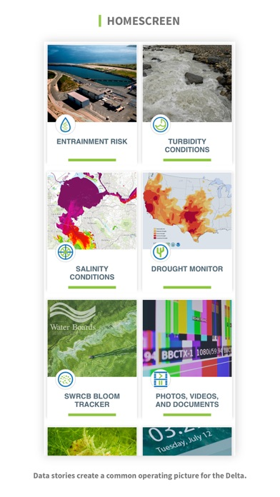
The app experience includes:
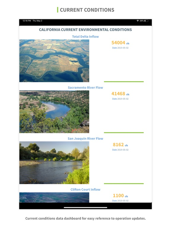
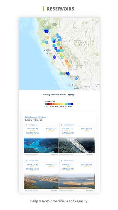
1) Environmental Conditions Data: Access data from hundreds of real-time sensors throughout the region. Data is aggregated from multiple entities including the California Data Exchange Center (CDEC), the U.S. Geological Survey National Water Information System (NWIS), and the Department of Water Resources.
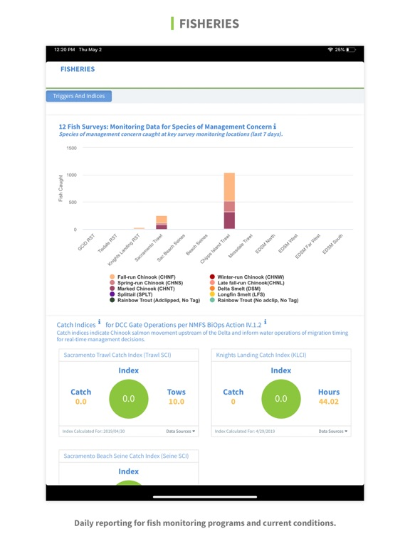
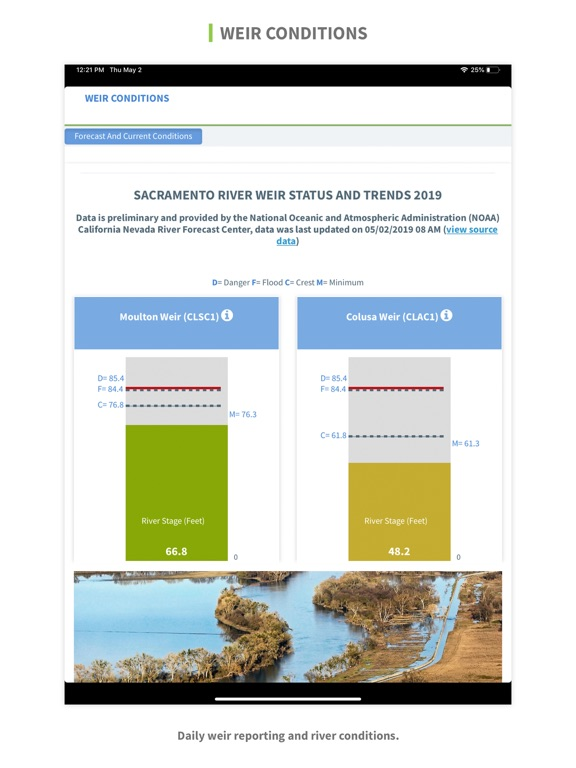
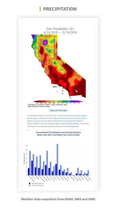
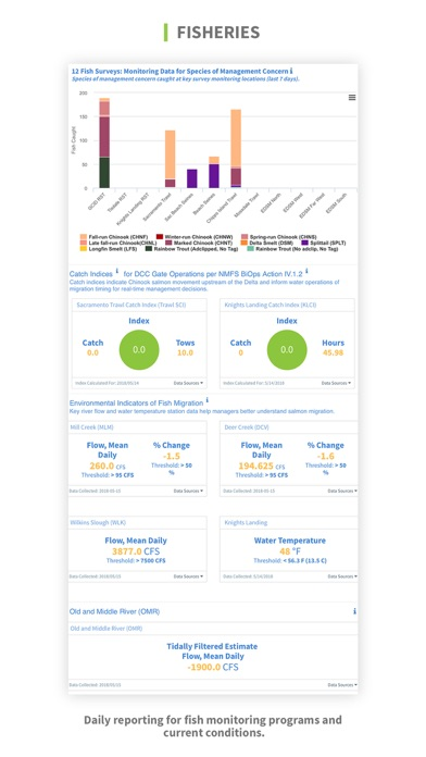
2) Operations Data: Explore daily reporting data and indices relevant to water operations including hydrologic conditions, reservoir levels, fish surveys, gate operations, key turbidity and salinity conditions, water supply updates and more.
3) Interactive Mapping: Explore hundreds of maps that describe land use, vegetation, infrastructure, hydrology and more. Users also have access to a selection of curated, interactive maps that describe key Delta conditions.
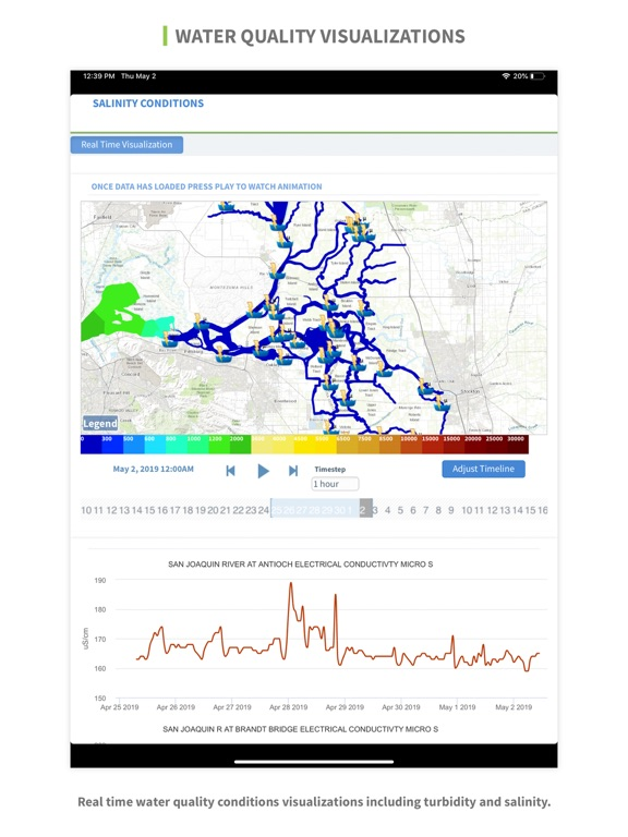
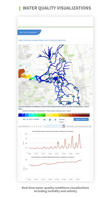
4) Turbidity and Salinity Data Visualizations: View near real-time data interpolations of turbidity and salinity across the Bay Delta. From 30-day models to daily forecasts, this service is published as critical hydrologic conditions are met throughout the season, including first flush, fish migration seasons, and key winter conditions.
5) Environmental Reporting Dashboards: View summaries and data dashboards that describe critical environmental conditions impacting management and operations in the Bay Delta. These summaries include fisheries, water quality, reservoir conditions, seasonal snowpack and precipitation, algal bloom tracking, weir conditions, and operations.
6) Recent News and Updates: Access news headlines and direct push notifications about the latest happenings in the Delta.
7) Photos, Videos, and Documents: Browse the extensive document library, which hosts hundreds of images, videos, science journals, presentations, and articles.