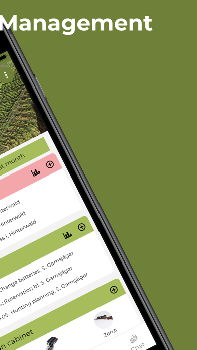
We have further improved some things in the app:
+ Sending invitation links improved
+ Faster loading of image galleries
+ Bite recording further developed
+ District licenses improved
We continued to work on the Deermapper and introduced the following innovations:
+ Introduction of community licenses for hunting grounds
+ Plan and carry out bite recordings
+ Activation of cameras using QR codes improved
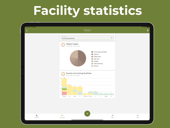
+ Improved camera statistics
We have made some improvements to the app again:
+ Improved invitations to the hunting area and cameras
+ Control of the motion sensor to activate/deactivate the Deermapper trail cameras
+ Camera editing may only be carried out by buyers
+ Filtering blank camera images
In the current version we have improved a few small things for the control of Deermapper trail cameras and for use in businesses.
+ Trail camera control: timer improved
+ Show businesses in the app
+ Creation of new hunting grounds improved
We've made a few internal improvements, such as testing the PRO version.
We have introduced additional new features and simplified existing features. It is now possible to invite people to hunting grounds or cameras via messenger service (WhatsApp, iMessage, SMS,...) or by email. The following improvements are included in the current update:
+ Simplifying invitations to hunting grounds and cameras
+ Display of the next full moon and the full moon after next
+ Improvement in displaying multiple trail cameras
+ General bug fixes
We've made some innovations and improvements to our maps.
It is now possible to display heatmaps and distribution maps of shootings, observations and carrion on the map. This makes it possible to identify key areas in the district at a glance.
We have also expanded the integration of additional external map data, such as KG boundaries or background maps.
+ Distribution maps of shootings, carrion and observations
+ Selection of map layers improved
+ Fixed crash when equipping standard equipment
In this version some things have been improved and introduced. These include:
+ Edit lines and areas
+ Set favorites when creating
+ Statistics for each trail camera
We have corrected the following errors:
+ Enter times for events and facilities
+ Creation and display of ammunition
We've made the following improvements in this update:
+ Fixed deleting trail camera images
+ Easier to enter phone number for camera control
+ Reduced app data usage
Fixed selection of object types.
We've improved some things in the wildlife camera overview and fixed bugs in the management of weapons, ammunition and dogs.
+ Speed up switching wildlife cameras
+ Improved weapon cabinet management
+ Management of the kennel improved
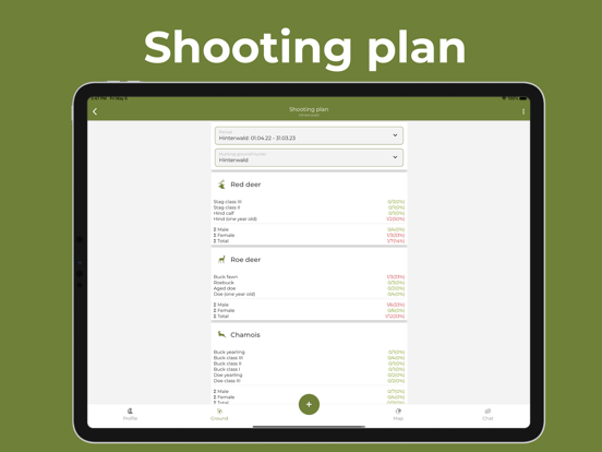
Fixed bugs when creating hunting grounds and in the overview of shooting plans.
AI is now also finding its way into Deermapper. We've started automatically classifying trail camera images with artificial intelligence. All trail camera images can be displayed to show whether they contain a wild animal, a person or a vehicle. This makes it possible, for example, to filter all empty images or only display images with animals.
In addition, we've made some significant improvements in app speed. Above all, the app should now run much faster on older devices.
In summary, the following points have been improved:
+ AI for trail camera images
+ Speed improvement for older devices
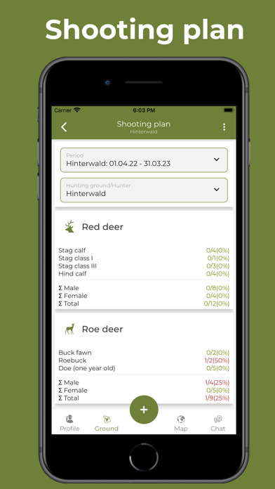
+ Improvements when creating kill plans
Adjusted the structure of the weapon cabinet and carried out bug fixes on the profile dashboard.
Fixed a crash when setting the start screens and improved the display in night mode.
Revision of the map display:
+ Scale dependent icon sizes and labels
+ Three switchable map modes like in popular map apps
+ Improved measurement of lines and areas
To do this, we have added the number of pieces observed to the statistics of the observations and made internal improvements.
From now on, the display settings on the map for district boundaries, district part boundaries and distance circles are permanently saved. The representation of hunting ground facilities on the map has been made clearer and a bug in the control of the deemapper cameras has also been fixed.
Improved facility event reloading.
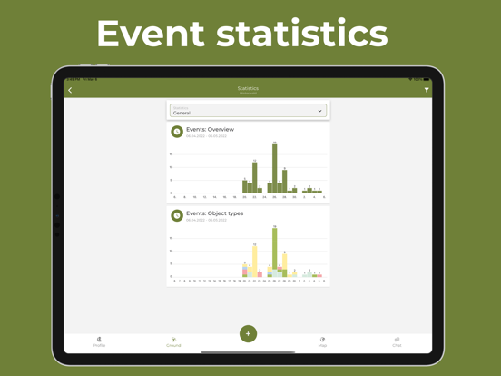
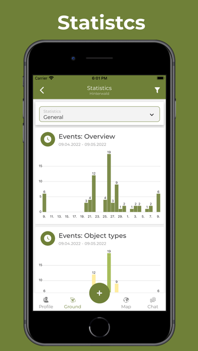
We have revised the statistics: fixed inconsistencies and introduced new statistics. To do this, we have adjusted the design on tablets and fixed some reported bugs.
+ Statistics revised
+ Improved display on tablets
+ Moon times revised with date picker
+ Improved wild camera filtering
+ Improved facility editing
Issues fixed from last Update 2.1.10.
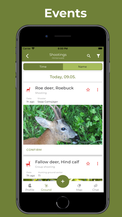
It is now possible for companies or hunting communities to customize the entry of game species, event types or object types and to adapt them to their own requirements. The administrator of the company or hunting community can specify which game species, which event types or which object types are to be entered by fellow hunters can be detected. For example, it is possible that within a hunting ground on the farm only shots for the game species red deer and roe deer can be recorded. All other types of events, such as observations, wildlife alerts, etc. can then no longer be available to the hunters.
Furthermore, it is now possible to control our 3.5G cameras from the app. Another novelty is the graphical display of camera parameters in the app. The current network reception, the battery status, the SD card memory, the temperature and, for the 4G cameras, the GPS position of the last 10 days are displayed. The prerequisite for this is that the camera sends a daily report. This setting can be found on the 3.5G cameras in the camera menu under 3G > Daily report. With our 4G cameras, nothing else needs to be set.
In addition, we improved the display for small screens and made internal improvements. In summary, there are the following innovations:
+ Individualization of the input options for fellow hunters
+ Control of 3.5G cameras
+ Graphic display of camera parameters
+ Improved display on small devices
+ Performance improvements on older devices
We have continued to work on improving the app performance, e.g. forwarding to wildlife camera images is much faster. It is now also possible to control our 4G cameras from the Deermapper app via SMS. Legacy 3.5G camera controls will be released in the coming weeks.
In summary, the following new functions are available:
+ SMS control of our Deermapper 4G wildlife cameras
+ View daily report of Deermapper wildlife cameras
+ Search by date for events
+ Date selection in the map
+ Date selection for sun and moon
Several internal improvements and bug fixes applied.
We have again improved some small things in the app:
+ Navigation to facilities and events
+ Orientation of the map either to the north or in the direction of movement
+ Editing the type of a district facility
+ Improved display in night mode
+ Improved sharing of facilities and events