Elafonisos topoguide is a digital field guide for hiking and tourism in Elafonisos Island.
It includes routes, descriptions and photos for 6 hiking trails and 3 mountain bike routes.
The application offers detailed offline maps and an extensive introduction on geography, geology, the most important settlements and monuments, and the nature of Elafonisos Island.
The app offers also a useful list of POIs (all island's accommodations are included) with a search feature on the map screen.
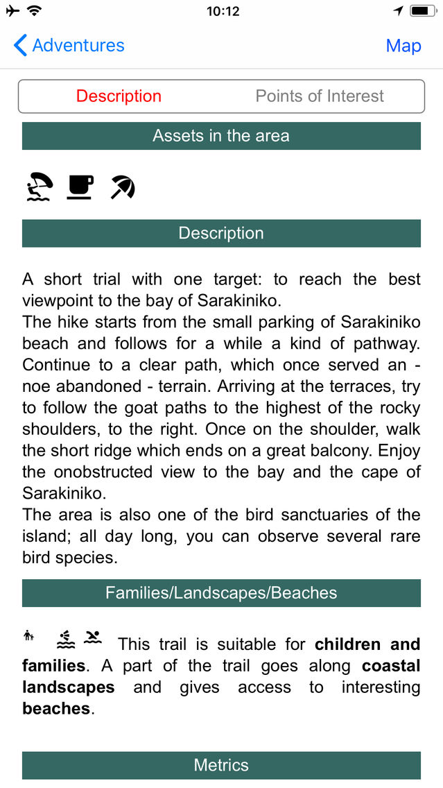
In the field, the app identifies the nearest adventure, guides you to it and then along it by displaying messages and warnings on every junction or other important location. On each Point of Interest, photos and texts are displayed on the map. If the hiker gets off-trail, the app indicates the shorter way to get back safely.
Also, a navigation feature allows to calculate routes and distances along roads and paths anywhere on the island.
The cartographic company Topoguide, creator of the application, has issued hundreds of hiking maps for Greece (eg. maps of Santorini, Crete, Mt. Olympus, Zagori, Sifnos, Naxos and other Aegean islands).
To build the application and ensuring data accuracy, all tracks and cartographic information have been recorded during June 2016.
DISCLAIMER
During track recording, continued use of GPS can dramatically decrease battery life.