Feltregistrering allows you to collect information in field regardless of mobile coverage. Maps, map layers and forms are defined on the web by the client's administrator and are made available in the app upon login. Role-based access management ensures correct access to data.
Adaptive is a web-based map solution provided by Asplan Viak Internet AS for managing the customer's geographical data. Feltregistrering is an offer to our Adaptive customers who need to register and view data using a mobile device in addition to on the web.
Via our own administrator, our customers can do the following in the browser:
- Add background maps and map layers
- Define your own data collection forms
Both simple and more advanced forms can be set up:
- Text
- Numeric fields with min / max
- Yes/No
- Lists
- Lists with free text fields
- Pictures and video
- Visibility of fields based on selections in lists and Yes / No
- Individual forms and forms with relationships
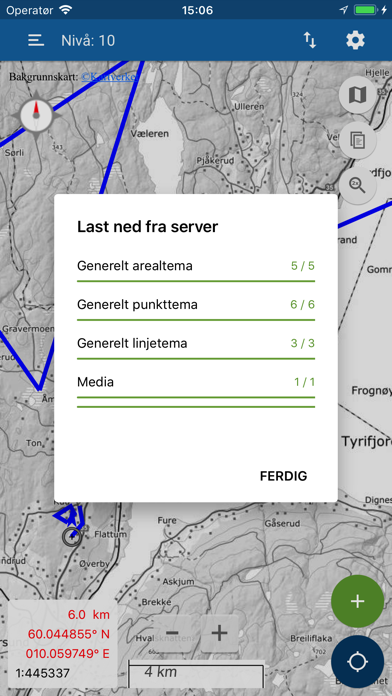
When logging in to your Adaptive instance, Feltregistrering will be configured with maps, map layers and forms set up by the administrator. Maps can be pre-stored so that data can be registered without mobile coverage. When one is back online, all collected data, images and video can be uploaded to the server.
Terms of use:
https://norgeskart.wiki/en/terms-of-use-feltregistrering/
Privacy policy:
https://norgeskart.wiki/en/privacy-policy-feltregistrering/