flyNav Flight Navigation

flyNav Flight Navigation


$29.99

1.51for iPhone, iPad and more
2.9
2 Ratings
Walter Greger
Developer
4.1 MB
Size
Feb 4, 2024
Update Date
Navigation
Category
4+
Age Rating
Age Rating
4+
Apps in this category do not contain restricted content.
9+
Apps in this category may contain mild or occasional cartoon, fantasy or real-life violence, as well as occasional or mild adult, sexually suggestive or horrifying content and may not be suitable for children under 9 years of age.
12+
Apps in this category may contain occasional mild indecent language, frequent or intense cartoon or real-life violence, minor or occasional adult or sexually suggestive material, and simulated gambling, and may be for children under 12 years of age.
17+
You must be at least 17 years old to access this App.
Apps in this category may contain frequent and intense offensive language; Frequent and intense cartoon, fantasy or realistic violence: frequent and intense adult, scary and sexually suggestive subjects: as well as sexual content, nudity, tobacco, alcohol and drugs, may not be suitable for children under 17 years of age.
flyNav Flight Navigation Screenshots
flyNav Flight Navigation posterflyNav Flight Navigation posterflyNav Flight Navigation poster

About flyNav Flight Navigation

flyNav is a flight navigation app for VFR.

Overview Features:
- Moving map flight navigation with vector based maps
- Airspaces for USA & Europe included
- About 20.000 airfields & airports worldwide
- Navaids VOR, DME, NDB for Europe
- Supported devices: Apple iPhone, Apple iPad and Apple Watch
- Easy-to-read Navigation Display
- On-route weather & NOTAM information


Detailed Feature:
- Waypoints database with about 20.000 airfields & airports worldwide
- Airspaces for USA, Canada, Germany, France, Italy, Swiss, Austria, Belgium, Hungary, Finnland,...
- Moving map with vector based data (offline available!)
- Navigation display with course and bearing indicator incl. waypoint distance and ETA
- Altimeter with flight level support (using barometric sensor)
- Plan a route directly in map via touch & drag
- Automatic link of map orientation to airplane course
- 5 minutes indicator
- Manual route planner with ICAO & city search
- Load & save routes
- Automatic detection of take off time and touch down time
- Track your flights via GPX
- Emergency function: find nearest airfield and check if it's reachable
- Import additional airspaces via openair format, e.g. traffic circuits
- On-route NOTAM
- On-route weather
- Flight-log in PDF-format (printable & exportable)

The handbook can be downloaded at http://www.flynav-app.com
Show More

What's New in the Latest Version 1.51

Last updated on Feb 4, 2024
Old Versions
- Fixed issue with dark mode
Show More
Version History
1.51
Feb 4, 2024
- Fixed issue with dark mode
1.50
Oct 20, 2023
- Fixed a bug of the weather service which resulted in an app crash.
1.49
Mar 5, 2023
- Fixed some bugs in the graphical-user-interface
1.48
Jan 17, 2023
- New feature: reset user-settings & routes
1.47
Oct 1, 2022
- Fixed to run on iOS16
1.46
May 19, 2021
- added Option to reset zoom factor for NAV view
1.45
Mar 20, 2021
- added setting for orientation (portrait or landscape)
1.44
Oct 25, 2019
- Fixed bug which resulted in an app crash if OSM offline maps are selected in setup menu
- Fixed bug which resulted in an app crash if email feature were used and no email account is configured
1.43
Oct 21, 2019
- Fixed display problem of phone information top bar
- Implemented geodesic routes -> correct route regarding projection error of map
- Fixed problem of airfield search bar for iOS13 which could result in a crash
1.42
Nov 3, 2018
- Added option to insert manual wind data for waypoints
- Fixed bug: Unit failure on Apple Watch (indipendent of setting, always km/h)
1.41
Sep 23, 2018
- Solved a bug in the airfield database which occured with iOS12
1.40
Sep 16, 2018
- Added feature to store self defined waypoints and airfields to local airfield database
- Added feature to edit GPS-waypoints
- Added feature to append waypoints to route several times (for round courses)

For exmplantion please download flynav handbook: https://www.flynav-app.com/english/support-video-tutorials/
1.36
Aug 13, 2018
Fixed bug of wind direction calculation for on-route segment wind
1.35
Jun 26, 2017
- Flightplan: Solved bug of wrong calculated total duration and gas consumption
- Flightplan: Airprint paper orientation is setted to landscape
1.34
Feb 24, 2017
- Several bug fixes (e.g. unit errors)
1.33
Jan 21, 2016
- Changed behaviour of context menu. Just hold your finger on the display until the menu appears
- Fixed a bug that results in wrong radius on navigation display of watch
- Added option to activate/deactivate METAR for flight log
1.32
Dec 10, 2015
- Fixed a bug regarding the snapping function of VRPs.
1.31
Dec 3, 2015
- Support for VRP (visual report point), added German database
- Added flight book manager (auto record of departing airport, destination airport, to- & td-time in UTC, flight duration & visualization of recorded track)
- Switch altimeter to STD pressure (1013,25 hPa / 29.92 inHg). Using barometer of iPhone 6, iPad Air 2, iPad Mini 4 or iPad Pro or newer). Just make a tap on the altimeter during your navigation to switch to/from STD pressure
1.30
Nov 25, 2015
- On-route weather information
- Added Navaids VOR, DME, NDB for Europe
- Offline maps
- Updated flight planner with weather and fuel consumption
1.20
Oct 26, 2015
- Flight-Log with print and export option (new button in route view)
1.13
Oct 17, 2015
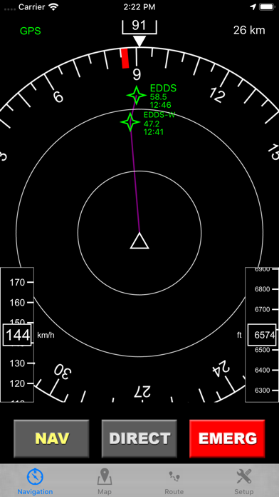
Improved Navigation display:
- Smooth zooming via Pan or pinch gestures (pan up to zoom in, man down to zoom out)
- Clipped navigation screen
1.12
Oct 13, 2015
- Improved Airspace-Analyzer: Airspaces are displayed in altitude order with a class icon
- Improved performance Map-View: Airspaces and airports are now only parsed if changes are available. This leads to much faster response time if you switch between the views.
- Fixed bug in OpenAir parser: Some airspace levels were not displayed correctly.
- Added over 200 microlight/ultralight airfields (in addition to World2000 database)
1.11
Oct 9, 2015
- Solved a major bug of the openair parser regarding coordinate conversion. Airspaces of GB were affected
- Solved issue with database cache
- Show the airspace name in the airspace analyzer
- Changed auto hide of airports for low zoom level due to memory problems. Now 20k airfields can be loaded.
1.10
Oct 9, 2015
- On-route NOTAM
- Airports & airfields elevation
- Nav button in map view
1.01
Oct 7, 2015
- Airports & airfields: New symbols which indicate the runway direction
- Airspace analyzer: Tap on a point to get airspaces information (class, floor, ceiling) for this point
- Info button for airports: Get runways & frequencies for airport (if available)
- Autosize airspace labels & airport symbols: For high zoom levels size of symbols won't increase so no important map information will be covered
- Ghost-Track: Record & display your actual flight on the map

flyNav Flight Navigation FAQ

flyNav Flight Navigation is available in regions other than the following restricted countries:
China
flyNav Flight Navigation supports English
Click here to learn how to download flyNav Flight Navigation in restricted country or region.
Check the following list to see the minimum requirements of flyNav Flight Navigation.
iPhone
Requires iOS 12.0 or later.
iPad
Requires iPadOS 12.0 or later.
Apple Watch
Requires watchOS 5.1 or later.
iPod touch
Requires iOS 12.0 or later.

flyNav Flight Navigation Alternative

You May Also Like

Get more from Walter Greger