Hawaii Pocket Maps

Hawaii Pocket Maps


Hawaii Outdoor Guide


FreeOffers In-App Purchases

6.3for iPhone, iPad and more
8.9
6 Ratings
Alex Gugel
Developer
89.3 MB
Size
Mar 13, 2024
Update Date
Travel
Category
4+
Age Rating
Age Rating
4+
Apps in this category do not contain restricted content.
9+
Apps in this category may contain mild or occasional cartoon, fantasy or real-life violence, as well as occasional or mild adult, sexually suggestive or horrifying content and may not be suitable for children under 9 years of age.
12+
Apps in this category may contain occasional mild indecent language, frequent or intense cartoon or real-life violence, minor or occasional adult or sexually suggestive material, and simulated gambling, and may be for children under 12 years of age.
17+
You must be at least 17 years old to access this App.
Apps in this category may contain frequent and intense offensive language; Frequent and intense cartoon, fantasy or realistic violence: frequent and intense adult, scary and sexually suggestive subjects: as well as sexual content, nudity, tobacco, alcohol and drugs, may not be suitable for children under 17 years of age.
Hawaii Pocket Maps Screenshots
Hawaii Pocket Maps posterHawaii Pocket Maps posterHawaii Pocket Maps posterHawaii Pocket Maps posterHawaii Pocket Maps posterHawaii Pocket Maps poster
Hawaii Pocket Maps posterHawaii Pocket Maps posterHawaii Pocket Maps posterHawaii Pocket Maps posterHawaii Pocket Maps posterHawaii Pocket Maps posterHawaii Pocket Maps poster

About Hawaii Pocket Maps

Be prepared! Plan your next trip to one of the great Hawaii parks. Download maps and guides before you venture into the Wi-Fi free wilderness.

Discover

- 50+ national parks, state parks, monuments, forests
- 20+ neatly folded maps by the National Park Service, Bureau of Land Management, United States Forest Services, and other agencies.
- 20+ campgrounds and campsites
- 300+ trails and trailheads
- 12,000+ points of interests

Plan

- Download maps, park brochures, and newspapers. These downloads are ready when you are offline and off the grid in the great outdoors.
- Download arbitrary map sections as offline packs.
- Photo galleries, panorama views.
- Share links to parks and maps with friends

Have fun

- GPS and GPX support: record your hikes, import GPX routes, tracks and waypoints for your hiking trails.
- Detailed national park information: alerts, news, visitor centers, campgrounds, driving directions, weather.
- Open your favorite maps app to get a route to the selected park.
- Current weather conditions, easy access to multi-day forecasts, sunrise and sunset times.
- Push notifications for park alerts, park news, weather warnings

So download maps and guides for:
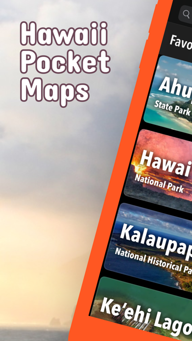
Ala Kahakai
Haleakalā
Hawaii Volcanoes
Honouliuli
Kalaupapa
Kaloko-Honokōhau
Pearl Harbor
Puukoholā Heiau
Puuhonua o Hōnaunau

There are additional useful information and brochures for many Hawaii state parks:

Ahukini, Ahupuaa O Kahana, Akaka Falls, Diamond Head, Hāena, Īao Valley, Kealakekua Bay, Kaena Point, Kaiwi, Keaīwa Heiau, Kekaha Kai (Kona Coast), Kīholo, Kōkee, Lapakahi, Lava Tree, Mākena, Nāpali Coast, Pālāau, Polihale, Polipoli Spring, Russian Fort Elizabeth, Ulupō Heiau, Waiānapanapa, Wailua River, Waimea Canyon, Waimea, Wailuku River

- FULL ACCESS is available for a for $3.49/three month (after a free 3-days trial period) or $2.49/two months or $7.49/year. You can subscribe and pay through your iTunes account. The account will be charged for renewal within 24-hours prior to the end of the current period, and identify the cost of the renewal. Your subscription will automatically renew unless canceled at least 24 hours before the end of the current period. Auto-renew can be turned off anytime by going to your Account Settings in iTunes after purchase.

- Continued use of GPS running in the background can dramatically decrease battery life.

LEGAL
Terms of Use: https://www.icoat.de/pocketmaps/terms
Privacy Policy: https://www.icoat.de/pocketmaps/privacy
Show More

What's New in the Latest Version 6.3

Last updated on Mar 13, 2024
Old Versions
Early Spring 2024

Updates: Contains the latest data by the National Park Service (NPS), Bureau of Land Management (BLM), United States Forest Service (USFS) and recreation.gov.
Show More
Version History
6.3
Mar 13, 2024
Early Spring 2024

Updates: Contains the latest data by the National Park Service (NPS), Bureau of Land Management (BLM), United States Forest Service (USFS) and recreation.gov.
6.2
Jan 20, 2024
Winter 2023/2024

New: USGS 7.5 minute topo maps.
Updates: Contains the latest data by the National Park Service (NPS), Bureau of Land Management (BLM), United States Forest Service (USFS) and recreation.gov.
6.1
Dec 24, 2023
Early Winter 2023/2024

Updates: Hawaii Volcanoes
Updates: Contains the latest data by the National Park Service (NPS), Bureau of Land Management (BLM), United States Forest Service (USFS) and recreation.gov.
6.0
Nov 3, 2023
Fall 2023

Updates: Contains the latest data by the National Park Service (NPS), Bureau of Land Management (BLM), United States Forest Service (USFS) and recreation.gov.
5.9
Aug 28, 2023
Summer 2023

New: Watch some interesting videos and audios, produced by the National Park Service.

Updates: Contains the latest data by the National Park Service (NPS), Bureau of Land Management (BLM), United States Forest Service (USFS) and recreation.gov.
5.8
Jul 11, 2023
Early Summer 2023

Updates: Contains the latest data by the National Park Service (NPS), Bureau of Land Management (BLM), United States Forest Service (USFS) and recreation.gov.
5.7
May 27, 2023
Late Spring 2023

New: We remastered all maps for higher quality and optimized data usage.

Updates: Contains the latest data by the National Park Service (NPS), Bureau of Land Management (BLM), United States Forest Service (USFS) and recreation.gov.
5.6
Apr 20, 2023
Spring 2023

Updates: Kaloko-Honokōhau
Updates: Contains the latest data by the National Park Service (NPS), Bureau of Land Management (BLM), United States Forest Service (USFS) and recreation.gov.
5.5
Feb 18, 2023
Early Spring 2023

Updates: Pearl Harbor, War in the Pacific
Updates: Contains the latest data by the National Park Service (NPS), Bureau of Land Management (BLM), United States Forest Service (USFS) and recreation.gov.
5.4
Dec 25, 2022
Winter 2022/23

New: Earth isn't flat anymore! Check out the new globe view when you zoom way out.
Updates: Contains the latest data by the National Park Service (NPS), Bureau of Land Management (BLM), United States Forest Service (USFS) and recreation.gov.
5.3
Nov 14, 2022
Late Fall 2022

New: Current weather data and 10-day forecast powered by Apple Weather
New: Hyperlocal weather data for every Point of Interest (POI).
Updates: Contains the latest data by the National Park Service (NPS), Bureau of Land Management (BLM), United States Forest Service (USFS) and recreation.gov.
5.2
Oct 13, 2022
Fall 2022

Updates: Contains the latest data by the National Park Service (NPS), Bureau of Land Management (BLM), United States Forest Service (USFS) and recreation.gov.
5.1
Aug 7, 2022
Summer 2022

New: Redesigned for iPad!
Updates: Contains the latest data by the National Park Service (NPS), Bureau of Land Management (BLM), United States Forest Service (USFS) and recreation.gov.
5.0
Jul 1, 2022
Summer 2022

Updates: Use the new POI search feature and find more than 12.000 campgrounds, trailheads, lakes and other points of interest.
Updates: Contains the latest data by the National Park Service (NPS), Bureau of Land Management (BLM), United States Forest Service (USFS) and recreation.gov.
4.9
Jun 3, 2022
Early Summer 2022

New: Use the new search feature and find trail heads, campgrounds and all other points of interest in no time.
4.8
May 2, 2022
Spring 2022

Updates: With the latest data by the National Park Service
4.7
Mar 15, 2022
Spring 2022

Updates: With the latest data by the National Park Service
4.6
Feb 16, 2022
Winter 2021/2022

Updates: improved 3D maps
4.5
Jan 13, 2022
Winter 2021/2022

New: Maps in 3D!
4.3
Dec 5, 2021
Winter 2021

Updates for iOS 15 and iPad
4.2
Sep 22, 2021
Fall 2021

updates: with latest data by NPS, USFS, BLM.
4.0
Jun 18, 2021
Summer 2021

new: Download maps directly from the new "maps" menu
new: Reorder maps
3.8
Apr 4, 2021
Spring 2021

fixed: app didn't start on iOS 12 devices
3.7
Feb 27, 2021
Spring 2021

new: National Park tours
new: streamlined navigation
new: better off-the-grid support and new low data settings
new: National Park passport stamps
new: improved photo gallery
new: shows operating hours for National Parks, NPS visitor centers and NPS campgrounds
updated: NPS webcams
3.5
Dec 28, 2020
Winter 2020/21

new: Easily show/hide any category of map markers: trail heads, visitor centers, campgrounds, campsites, restrooms, picnic areas, interpretive exhibits, viewing areas, public transit, parking, things to do, webcams, people, articles, land markers, other sites

Hawaii Pocket Maps FAQ

Click here to learn how to download Hawaii Pocket Maps in restricted country or region.
Check the following list to see the minimum requirements of Hawaii Pocket Maps.
iPhone
Requires iOS 15.0 or later.
iPad
Requires iPadOS 15.0 or later.
iPod touch
Requires iOS 15.0 or later.
Hawaii Pocket Maps supports English, German
Hawaii Pocket Maps contains in-app purchases. Please check the pricing plan as below:
access all pro features
$3.49
access all pro features
$2.49
access all pro features
$7.49

Hawaii Pocket Maps Alternative

You May Also Like

Get more from Alex Gugel