The app guides your walk along the Huntley to Minsterworth section of the Abberley and Malvern Hills Geopark Way – a 109 mile walk running between Bridgnorth in Shropshire England to Gloucester Cathedral. The trail is divided into 17 sections, with an app for each section.
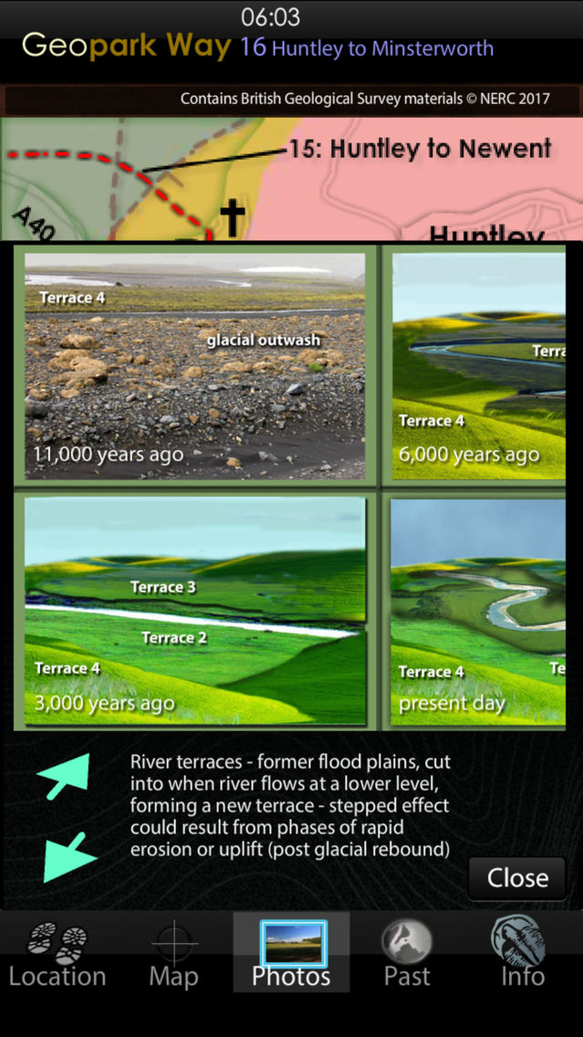
From the village of Huntley the path heads over fields until reaching the banks of the River Severn at the village of Minsterworth. The geology is almost entierly Triassic Mercia Mudstone, but with isolated outcrops of the transitional beds from arid Triassic times through to marine Jurassic. These early Jurrasic outliers occur as patches of river terrace.
The app has 5 core views, the default is the Map of the trail, overlain on a geology map derived from the British Geological Survey DiGMapGB-50 (1:50,000 scale) data for the Huntley to Minsterworth area. You have this map built into the app, along with all the associated BGS data, which is then always available as you walk, served to your position by GPS or, by simply touching the map if using the app away from the area, or on a device without GPS. The map can be zoomed to x4.
The Photos view contains a series of pictures taken along the walk, from the perspective of someone walking in either direction – you select which direction to view. When you use the app in the area, images and information relevant to your location are served to you. You can also virtually walk the path – perhaps to get a feel in advance of how challenging the terrain will be. Linked to the Photos view are 3D sections of the geology and reconstructions of ancient environments.
The Location view provides position data and optionally will record your walk and provide an updated estimate of how long to it will take you to complete.
The Past view places the rocks under you, into their global tectonic setting, of plate positions along with data for past CO2, oxygen, temperature, sea level and species extinction rate. Recreations of possible ancient landscapes of the GeoPark are provided, together with maps of past landmasses and oceans such as the Iapetus, Rheic and Tethys.
The Information view provides links to the organisations, including the Herefordshire and Worcestershire Earth Heritage Trust, who founded and continue to promote and manage the Geopark and the trail.
The app has all required data loaded and does not require cellular or WiFi connectivity in the field – just a charged battery.