- various bug fixes
- iOS 16 adaptations
- various bug fixes
- added new icons for your waypoint markers
- We have added house numbers (this requires updating the map data on the device)
- various bug fixes
- various bug fixes
- adaptation for new iPhone devices
- various bug fixes (sharing tours, missing elements on map)
- Plan your tour even better: The dashboard now displays estimated walking and cycling times for selected routes in real time
- Tour organizer: For all your tours, walking and cycling times are given. With a tap on the times you can switch between: walking, cycling or the recorded time
- Map improvements and bug fixes
- fixed a crash on some devices during startup
- Optimized manual map rotation behavior
- Added setting to disable manual map rotation altogether
- Minor bug fixes
- fixes some new bugs
3.4:
- Rotate the map freely in any direction you like
- Search has been completely revised: better, search-as-you-type results, distance display and the possibility to add waypoints from the search results
- Improved map style
- Many reported bugs fixed (e.g. export of ZIP files with special characters, dashboard problems and more)
- fixed some altitude display related bugs
- improved ascent/descent calculation
- improved recording of tours
- fixed some bugs
By popular request: In the tour organizer you can now make a multi-selection of tours and share, edit or move several elements in one go
- Added icons for mines, quarries and springs
- Improvements in the mountain bike overlay, supplemented by a dot pattern to indicate difficulty
- Enhancements to contour lines and text labels
- iOS 13 adjustments
- Added icons for fireplaces and playgrounds
- Bug fixes (mostly in export / backup)
- Bulk export / backup of all tours (Settings – Tour Organizer – Backup Tours)
- Minor bug fixes
- Improvements for Dutch cyclists
- Workaround for Garmin Connect interoperability
- New round of bug fixes
- Many reported bugs have been fixed
- Added new setting to permanently display map scale
Version 3.2
- Colors! Select different colors for your waypoints and tours
- Choose unique icons for your waypoints
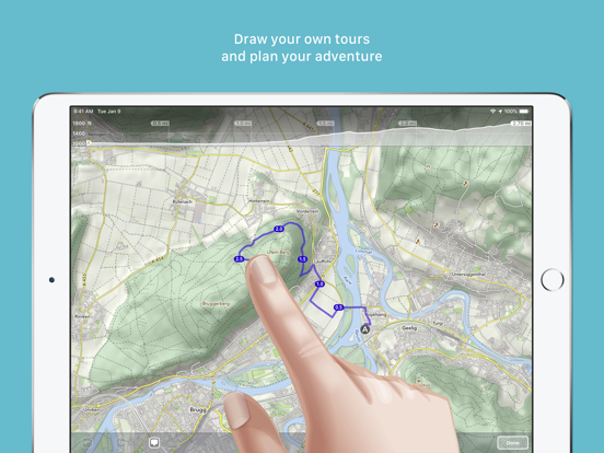
- Drawing/routing tours has been enhanced: You can now choose between different routing options (hiking, biking, shortest and freeform) and select the street width and elevation preference
- Many improvements to our map style: We now added much more icons for rural areas to find drinking water, picnic sites, shelters/huts, caves, etc.
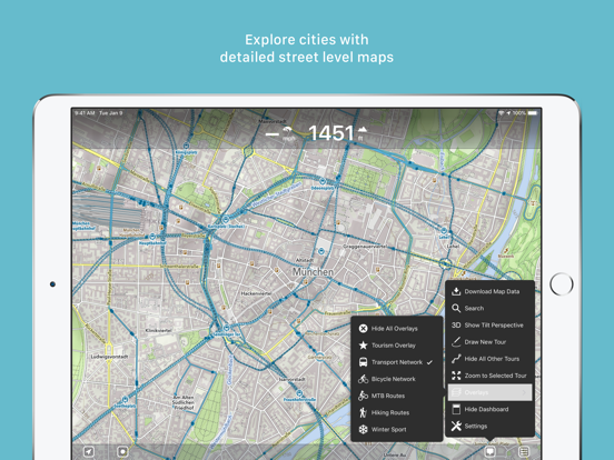
- Overlays are now selectable directly on the main menu
- Colors! Select different colors for your waypoints and tours
- Choose unique icons for your waypoints
- Drawing/routing tours has been enhanced: You can now choose between different routing options (hiking, biking, shortest and freeform) and select the street width and elevation preference
- Many improvements to our map style: We now added much more icons for rural areas to find drinking water, picnic sites, shelters/huts, caves, etc.
- Overlays are now selectable directly on the main menu
- A lot of reported bugs have been fixed