Montenegro seen from the sea
Free
4.0.1for iPhone, iPad
Age Rating
Montenegro seen from the sea Screenshots
About Montenegro seen from the sea
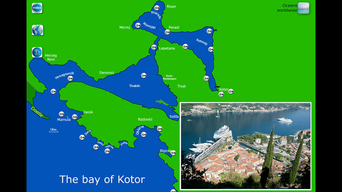
A cruise in Montenegro, from Kotor to Ulcinj.
The tour presents a series of 37 map-driven slideshows (368 photos). It starts in the bay of Kotor, seen as the Europe southernmost fjord, and continues all along the shores of Montenegro.
The best way to choose where to go... or not to go!
Once on the spot, you can use your the embarked accurate maps of the app for geolocation, even if there is no access to the internet.
Show More
What's New in the Latest Version 4.0.1
Last updated on Oct 21, 2013
Old Versions
IOS 7 compatible
Show More
Version History
4.0.1
Oct 21, 2013
IOS 7 compatible
3.3
Oct 3, 2012
Montenegro seen from the sea FAQ
Click here to learn how to download Montenegro seen from the sea in restricted country or region.
Check the following list to see the minimum requirements of Montenegro seen from the sea.
iPhone
iPad
Montenegro seen from the sea supports English, French