The application will be useful to yachtsmen and skippers of all categories, as well as for those who prepare to become one.
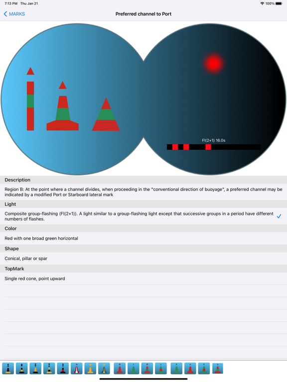
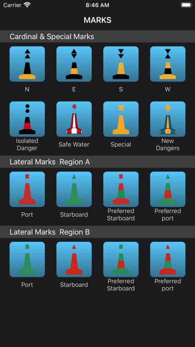
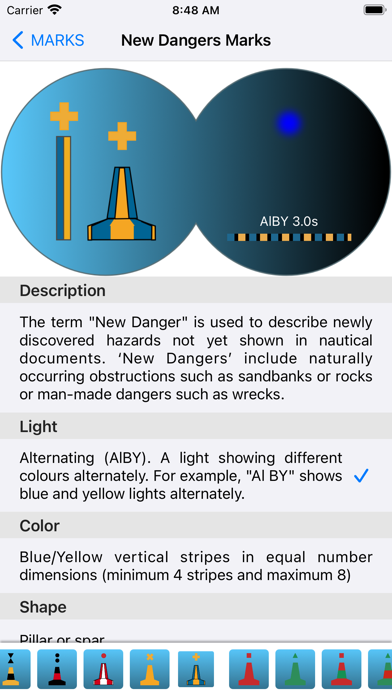
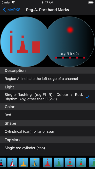
This handy reference guide has a description of all navigation marks of the IALA Maritime Buoyage Systems: lateral marks of Regions A and B, cardinal marks, isolated danger mark, safe water mark, special marks, new danger mark.
The app provides information that is necessary to identify sea marks at any time of the day: it demonstrates their different shapes, colours and light characteristics.
We welcome any comments and suggestions to our e-mail: support@appsforeach.com