SeaNav NP
Maritime Navigation & Charts
$27.99
5.4.5for iPhone, iPad and more
5.5
4 Ratings
Pocket Mariner Ltd.
Developer
65.7 MB
Size
Apr 4, 2024
Update Date
Navigation
Category
4+
Age Rating
Age Rating
SeaNav NP Screenshots
About SeaNav NP
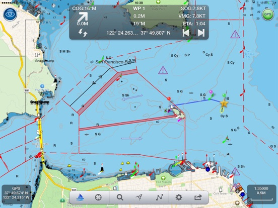
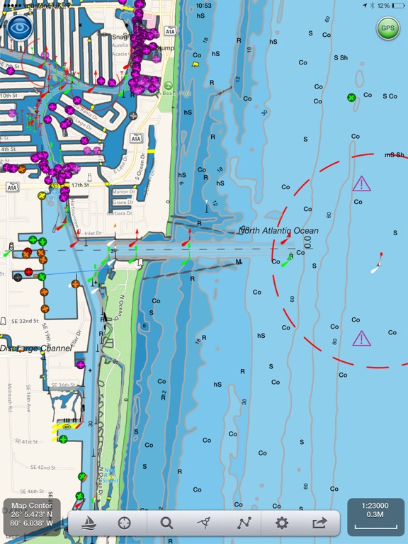
Explore, Plan and Navigate in real time and outstanding high-resolution with the latest Digital Vector Marine charts and powerful route planning and navigation tools.
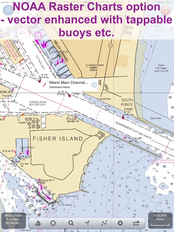
Our free version includes all our navigation and trip planning tools. High resolution vector charts derived from official NOAA and UKHO ENC chart data (including US,CA,UK,IE,NL,BE,DE,FI,NZ) and live AIS and Augmented Reality views (AR) are available by In App Purchase (IAP). Each chart purchase provides free updates for a 12 month period.
Free features:-
- Instruments
- Normal, satellite and hybrid view maps
- Route Planning and real-time tracking
- North up and course up displays
- Charts work offline
- Route export, import and sharing
- Share routes via Dropbox
- Built-in tutorial mode including demo charts.
- NMEA GPS, AIS, Wind Speed and Direction gauges
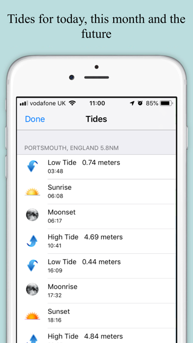
- Tide, moon and sun times
- Weather including wave height and period
- Apple Watch App
- Favourite Places
Additional features available via In App Purchases (auto-renewing subscriptions):-
- Marine Vector charts - all buoys, lights etc. are tappable
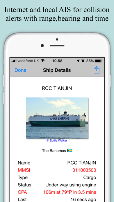
- Live AIS Ship positions
- Live Augmented Reality camera view plus support for the FLIR ONE Infra-red camera.
- Air Draft: Check your boat's clearance under bridges and cables
- Real time local wind feed and 7 day forecast (IAP)
Our unique AR view mode allows you to view buoys, lights, ships, waypoints and track overlaid on your iPhone or iPad live camera view. With "AR LockOn" you can select a target on the chart and then be guided to it in the AR camera view. See ships and MOBs at night and in the fog too with our world leading AR FLIR ONE camera support.
The app’s HUD shows your position on route, Course (COG), Speed(SOG), Vector Made Good (VMG), Estimated Time of Arrival (ETA), Distance and bearing to next Waypoint. Waypoint reached alerts, auto-routing to the next waypoint and flashing AIS collision alerts.
All our in-app purchases are 1 year subscriptions, which automatically renew at the end of the subscription period unless auto-renew is turned off at least 24-hours before the end of the current period. Payment will be charged to your iTunes Account at confirmation of purchase, and will be charged for renewal within 24-hours prior to the end of the current period. Subscriptions may be managed by the iTunes account holder and auto-renewal may be turned off by going to Account Settings after purchase. No cancellation of the current subscription is allowed during active subscription period.
Our privacy policy and terms and conditions may be viewed here:-
Terms of Use: http://seanav.net/termsofuse.php
Privacy Policy: http://seanav.net/privacy.php
Support: help@pocketmariner.com
Requirements:
iPhone or iPad. GPS only required for real time route navigation. Optional Real time AIS, Tides and Weather information require an active internet connection.
Real-time route navigation requires a GPS location. iPhone devices and iPads with a cellular modem already have a built-in GPS, even if they do not have an active service plan.
If you have a WiFi-only iPad or iPod you will need an external GPS receiver to enable navigation. Inexpensive 3rd Party units are available to add these accurate location capabilities to your device via bluetooth.
Please note that continued use of GPS running in the background can dramatically decrease battery life.
Third Party Licenses and Notices
NOTICE: US Marine Charts are derived from official NOAA Electronic Navigational Charts.
“THIS PRODUCT IS NOT TO BE USED FOR NAVIGATION” The use of this product for the planning and execution of passages will not meet the requirements of SOLAS
“NOTICE: Instituto Hidrográfico de la Marina (IHM) and the UK Hydrographic Office (UKHO) make no warranties or representations, express or implied, with respect to this product. The Instituto Hidrográfico de la Marina (IHM) and the UKHO have not verified the information within this product or quality assured it.”
Show More
What's New in the Latest Version 5.4.5
Last updated on Apr 4, 2024
Old Versions
French sample charts added for Cote d'Azur (near Toulon)
French demo route added for users in France ( region set to France in device settings).
Improvements for iOS iPad version running on apple Silicon Macs (route and track menu items) plus share location.
French demo route added for users in France ( region set to France in device settings).
Improvements for iOS iPad version running on apple Silicon Macs (route and track menu items) plus share location.
Show More
Version History
5.4.5
Apr 4, 2024
French sample charts added for Cote d'Azur (near Toulon)
French demo route added for users in France ( region set to France in device settings).
Improvements for iOS iPad version running on apple Silicon Macs (route and track menu items) plus share location.
French demo route added for users in France ( region set to France in device settings).
Improvements for iOS iPad version running on apple Silicon Macs (route and track menu items) plus share location.
5.4.3
Apr 21, 2023
Apple Watch App greatly improved Nav, Waypoint, Map ,CPA Alerts & new real time wind display
Realtime local wind instrument using SeaNav's Weather feed (IAP) or NMEA over Wifi
Improved Instruments for Nav (inc. Depth), Waypoints & Wind
Live and predicted Tidal Streams for the UK & IE
Export tracks and routes as GPX (e.g to MFDs, Chart plotters and Navionics)
Export and import all POIs
Settings for Auto/Day/Night mode display
User guide and FAQ now available in multiple languages.
My Boat Details now lets you set the type - e.g. Sail, Pleasure, Fishing.
Own boat icon now bigger so more easily viewed and colour shows boat type.
Bridges, Shoreline and Traffic zones UI improvements
Flashing light patterns updated for South Cardinals
iOS16 ready
5.2
Dec 3, 2019
NaviPlotter is now called SeaNav NP. All your existing NaviPlotter charts and IAPs will still work and there are several new exciting new features with this release.
Support for iPhone X full screen - charts now go all the way to the edges.
Detailed animated weather forecast maps including wind, waves & pressure from now up to the 2 weeks ahead based on GFS model as used by NOAA and other leading Met Offices (IAP required).
Simulation/Demo mode lets you experience all the IAP features for free.
Fix for NOAA US Raster charts not displaying if locale set to UK
4.7.1
Oct 25, 2018
German Vector and New Zealand and Finland Raster Marine Charts now available (IAP)
Fix for app crashing when launching the free NaviPlotter Watch App.
Ship AIS Safety Messages now shown ( ship icon will flash if it is broadcasting a Type 14: Safety-Related Broadcast Message)
Collision detection Time to Collision and Distance collision guards can now be changed from the default of 200m in 10 minutes to any distance and time and can also be disabled by setting CPA Time to 0 - See Boat Details in SeaNav Settings..
POI Manage/Add new POI bug fix.
Fixes for using local AIS over Wifi for own boat location ( AIVDO message - speed and heading now correct)
NMEA Wind, Depth and Boat Speed instruments added.
Updated Apple Watch app including crown support and adjustable countdown timer.
Fixed Notifications and alerts for iOS and Watch.
Improved search function.
General UI fixes and updates.
Fix for GPS speed, heading and CPA alerts when using AIVDO message for position ( local AIS transponder over Wifi feed)
4.7
Jul 14, 2018
iOS11 ready.
NMEA Wind, Depth and Boat Speed instruments added.
Updated Apple Watch app including crown support and adjustable countdown timer.
Fixed Notifications and alerts for iOS and Watch.
Improved search function.
General UI fixes and updates.
GDPR updates
NMEA Wind, Depth and Boat Speed instruments added.
Updated Apple Watch app including crown support and adjustable countdown timer.
Fixed Notifications and alerts for iOS and Watch.
Improved search function.
General UI fixes and updates.
GDPR updates
4.3
Sep 18, 2017
iOS11 ready
NMEA Wind, Depth and Boat Speed support added to instruments.
NMEA Wind, Depth and Boat Speed support added to instruments.
4.2
Aug 16, 2017
Favourite Places (POIs):- Add markers for places you want to remember, add a photo and share them with friends and the NaviPlotter community too. Add fishing spots with a photo of the one that didn't get away, diving locations, cosy anchorages, hazards, reminders to call in on a VHF channel etc.
Air Draft: See if your boat will fit under a bridge or cable you are approaching in our unique augmented reality view.
Augmented Reality bearing and distance measure.
Air Draft: See if your boat will fit under a bridge or cable you are approaching in our unique augmented reality view.
Augmented Reality bearing and distance measure.
4.1
Jun 6, 2017
Route plan exchange in RTZ format compatible with NaviPlanner and as used in conjunction with ECDIS to IEC 61174.
The route plan exchange format is based on standardising a route plan. A route plan consists of waypoints where each waypoint contains information related to the leg from the previous waypoint. The route exchange format is a file - RTZ - containing an XML coded version of the route plan. The route plan exchange format is intended be used for many purposes. For example it can be used onboard for route plan exchange between main and backup ECDIS, ECDIS and radar, ECDIS and optimisation systems, etc. Another example use is between ship and shore where it can be used to inform the shore about the plan of the vessel, the shore can recommend a route, the shore can optimise a route, etc. Routes can be exchanged via email or Dropbox™.
Dropbox v2 API support for route sharing and archiving.
4.0
Apr 18, 2017
SeaNav NP FAQ
Click here to learn how to download SeaNav NP in restricted country or region.
Check the following list to see the minimum requirements of SeaNav NP.
iPhone
Requires iOS 11.0 or later.
iPad
Requires iPadOS 11.0 or later.
Apple Watch
Requires watchOS 2.0 or later.
iPod touch
Requires iOS 11.0 or later.
SeaNav NP supports English, Danish, French, German, Spanish
SeaNav NP contains in-app purchases. Please check the pricing plan as below:
US & Great Lakes
$24.99
Pro Features
$14.49
Norwegian Charts
$24.99
Wind and Waves
$5.49
New Zealand Charts
$16.99
French Charts (N & W)
$29.99
Spanish Charts
$26.99
Canadian Charts
$30.99
UK & IE Charts
$25.99
Portuguese Charts
$19.99
Related Videos
Latest introduction video of SeaNav NP on iPhone

