OzRunways - Australia's #1 Electronic Flight Bag (EFB) is now available internationally.
APPROVED BY Australian CASA under CASR 175.
(See https://support.ozrunways.com/kb for information).
Download now for a 1 month free trial.
Download aeronautical publications onto your iPhone & iPad. See your position on every aviation map.
Properly licensed documents ensure you will stay up-to-date with the latest amendments of:
- Australian MAPS (Every updated VTC, VNC, WAC, ERC High/Low & PCA), ERSA, DAPS and AIP.
- New Zealand ERC, VNC, Topographic 250k/50k, Vol 1-4 and LINZ Satellite maps.
- Latin America maps and approach charts
- South African 500k/1M/250k aero maps, plus entire continent TPC, ONC and OpenStreetMap.
- Select European maps and charts
- Global custom-made OpenStreetMap with airspace.
- Skyvector global ERC and VNC maps
Features:
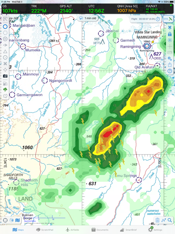
- Weather radar with lightning
- Live flight tracking over cellular network
- Weight & Balance
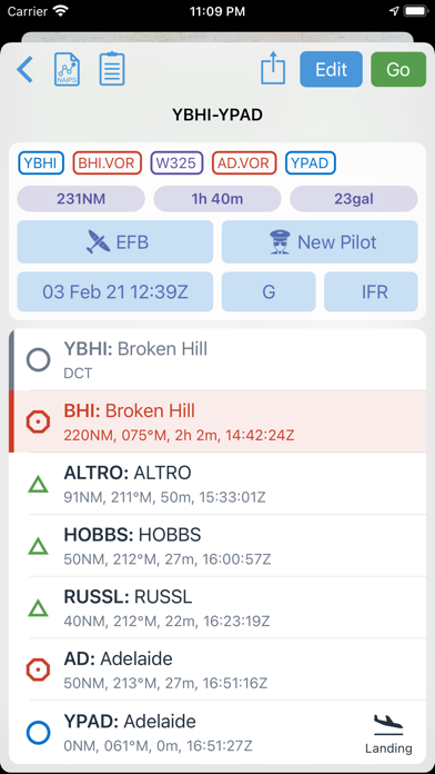
- Flight planner
- See your aircraft position on selected approach plates and taxi diagrams
- GPS Moving maps with every waypoint/Navaid in the world from official databases.
- Online and offline street address search.
- Download all maps and charts for offline use.
- Print documents to compatible printers using Apple AirPrint.
- Full text search of AIP.
- Download on demand (then save), or download all documents at home for offline use.
- Annual subscription based login, so you aren't paying full price for a publication 1 week before it expires.
- Night-time mode on iPad to reduce brightness.
Use must be in accordance with applicable aviation regulations.
Note: Continued use of GPS running in the background can dramatically decrease battery life.
See https://support.ozrunways.com/kb FAQ for details.