Phototrails – trails guide

Phototrails – trails guide


Free

2.0.3for iPhone, iPad
Age Rating
4+
Apps in this category do not contain restricted content.
9+
Apps in this category may contain mild or occasional cartoon, fantasy or real-life violence, as well as occasional or mild adult, sexually suggestive or horrifying content and may not be suitable for children under 9 years of age.
12+
Apps in this category may contain occasional mild indecent language, frequent or intense cartoon or real-life violence, minor or occasional adult or sexually suggestive material, and simulated gambling, and may be for children under 12 years of age.
17+
You must be at least 17 years old to access this App.
Apps in this category may contain frequent and intense offensive language; Frequent and intense cartoon, fantasy or realistic violence: frequent and intense adult, scary and sexually suggestive subjects: as well as sexual content, nudity, tobacco, alcohol and drugs, may not be suitable for children under 17 years of age.
Phototrails – trails guide Screenshots
Phototrails – trails guide posterPhototrails – trails guide posterPhototrails – trails guide posterPhototrails – trails guide posterPhototrails – trails guide poster

About Phototrails – trails guide

Phototrails is here to help everyone discover and enjoy access to the countryside, tailored to their own needs and preferences. This helps lovers of the outdoors to find locations where they can enjoy the enormous benefits of recreation in the great outdoors.

Phototrails provides
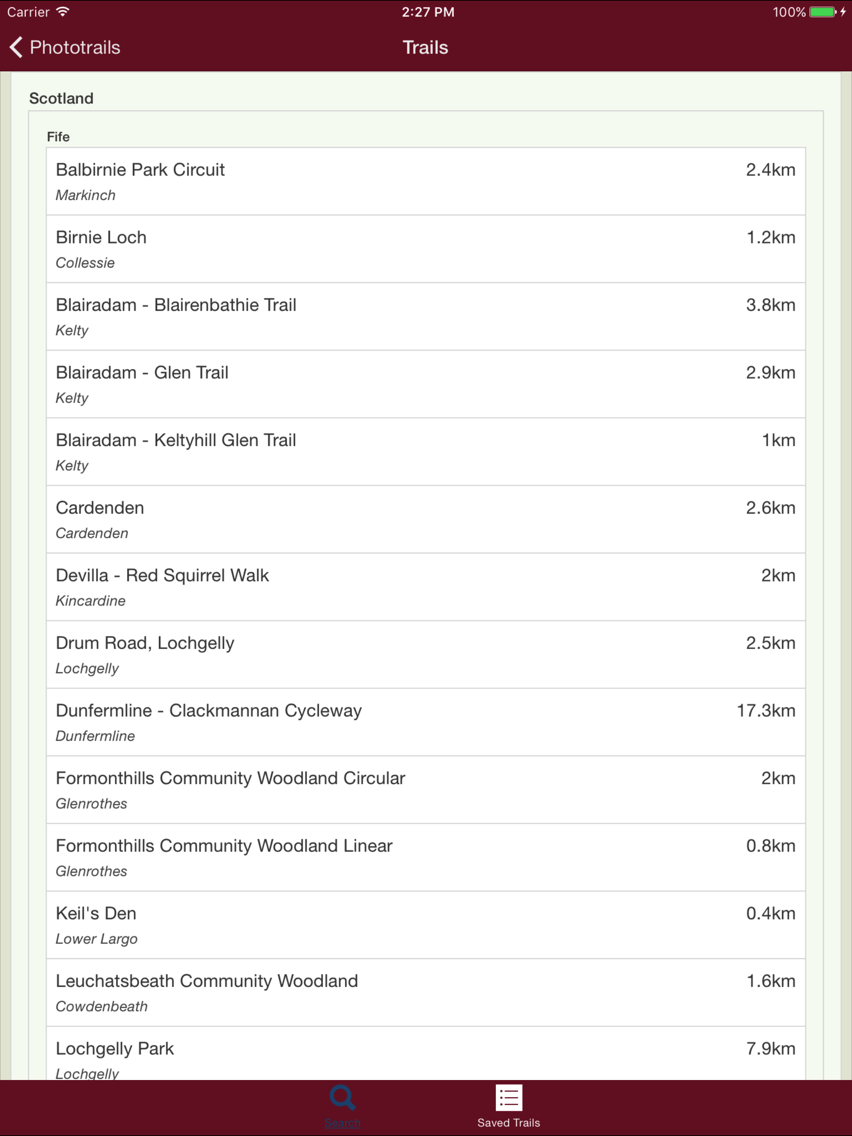
a searchable database of trails
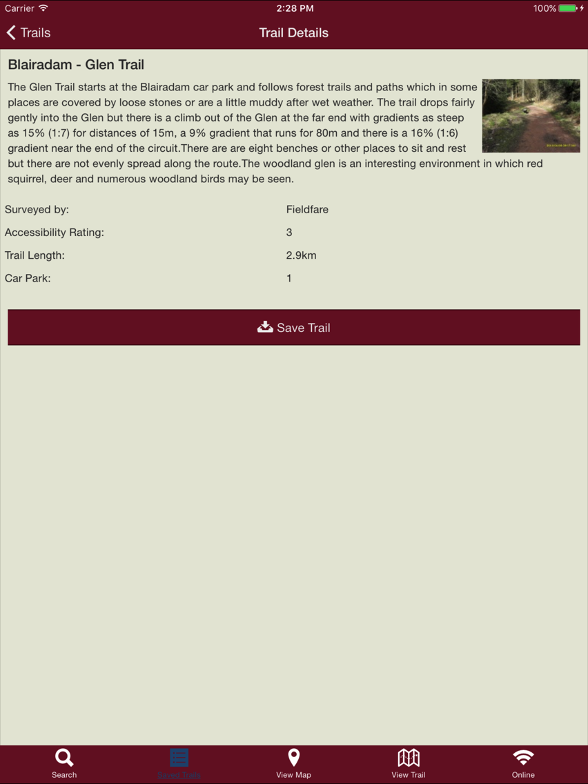
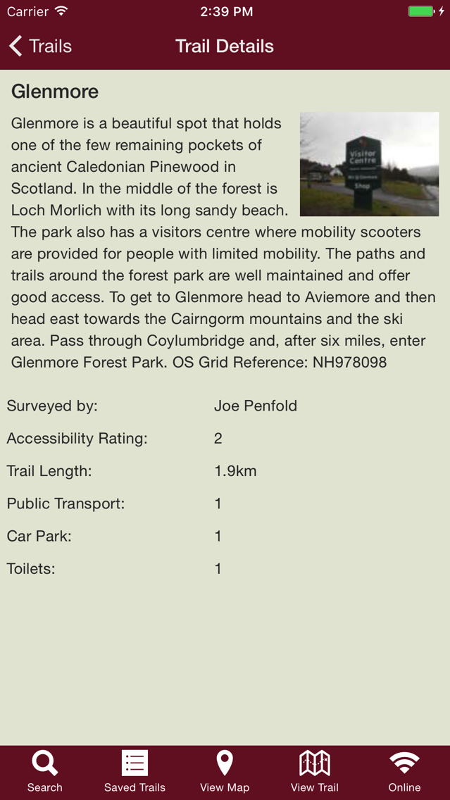
a map of each trail
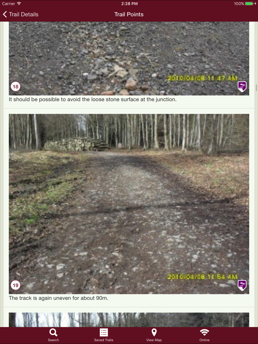
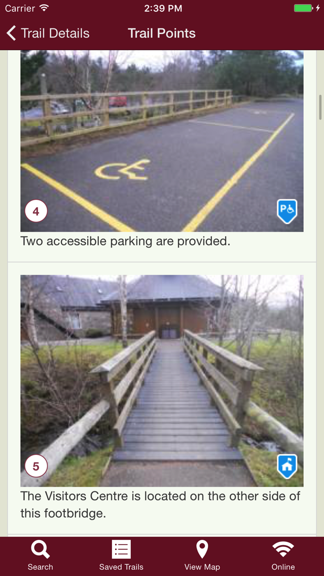
a filmstrip of photographs which let you see just what the walk is like.
information on the surrounding environment, the walk distance and the features and highlights that you will find along the way.
information on path gradients, widths and surfaces can also be provided by surveyors.
an accessibility rating for each trail to help you decide whether a trail meets your needs
the option to download your chosen trail information to your device so that you can still view the information when you're offline.

Phototrails was developed by the Fieldfare Trust to provide you with more information, and therefore more choice, about where to spend your day out in the countryside. As a charity that actively promotes countryside access for people with disabilities, Fieldfare understands the importance of providing “pre-visit” information on trail features and site amenities, such as whether disabled parking and accessible toilets are available.

Please let us know if any ratings don’t meet your expectation so we can help future users make informed choices about the other trails.

When navigating your way around our featured trails, please note that photos have been taken in the direction of travel and from the perspective of the photographer’s height. Do also take into consideration the weather and season when planning your visit, as the condition of countryside trails can deteriorate during the winter months.

You can search for walks near to where you live or, you can plan routes that you might do while visiting friends or taking a holiday.

Why not become a surveyor?. You can now post your own favourite trails up on our website – just go to www.phototrails.org/surveyor – log in and follow the instructions.
Show More

What's New in the Latest Version 2.0.3

Last updated on Jun 5, 2018
Old Versions
Update of libraries.
Added better support when app is failing.
Improve Android version compatibility.
Fix of select list issue on the search page.
Fix of reading and saving trailpoints.
Fix of reading and saving trails.
Fix of correct response when URL doesn't exist.
Fix of CORS issue.
Show More
Version History
2.0.3
Jun 5, 2018
Update of libraries.
Added better support when app is failing.
Improve Android version compatibility.
Fix of select list issue on the search page.
Fix of reading and saving trailpoints.
Fix of reading and saving trails.
Fix of correct response when URL doesn't exist.
Fix of CORS issue.

Phototrails – trails guide FAQ

Click here to learn how to download Phototrails – trails guide in restricted country or region.
Check the following list to see the minimum requirements of Phototrails – trails guide.
iPhone
iPad
Phototrails – trails guide supports English

Phototrails – trails guide Alternative

You May Also Like