FUNCTIONS OF THE APPLICATION
- Access geolocated tourist information : Wikipédia articles, lodging, restaurants, museums, tourist attractions, …
- Get the weather forecasts for the next 4 days for your position on the map.
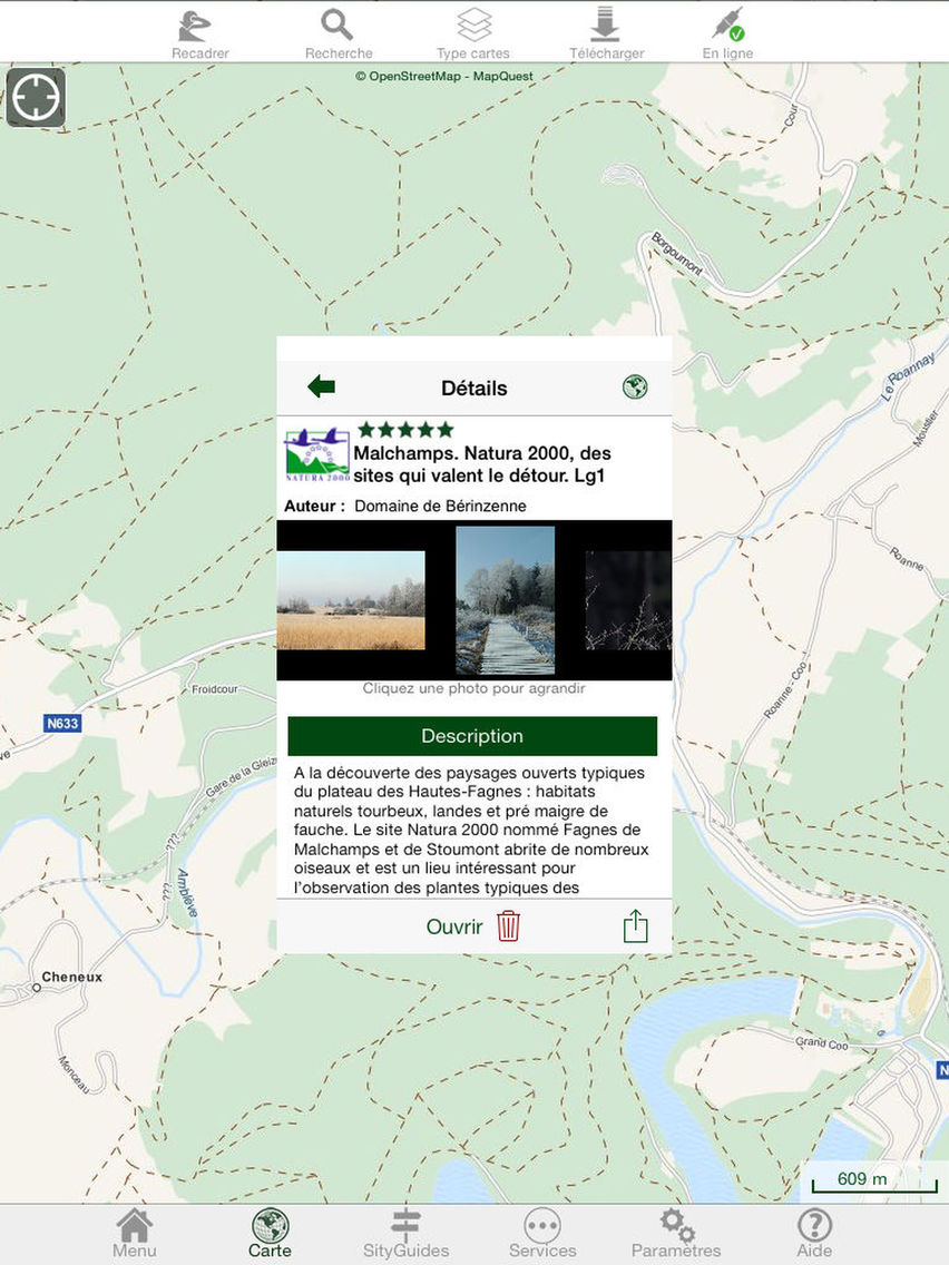
- Download quality SityGuides from tourist offices and associated maps and multimedia content.
WARNING : At the moment, SityGuides from tourist offices are mainly available in Belgium, France and Switzerland. In some other countries, there may not be any available SityGuide at the moment.
- After downloading, SityGuides can be followed without any Internet connection.
- Points of interest are automatically triggered and texts can be read with voice synthesis.
- Alarm when you leave the track of the SityGuide.
- Several languages are supported.
- Get directions to a point of interest or the start point of a SityGuide.
- View trails and cycle networks from several tourist offices on the OpenStreetMap map, for exemple, in Walloon Region, the RAVeL network and the cycle network of "Pays de Famenne".
- QRCode reader.
- Save flags on the map.
WARNING : Continued use of GPS running in the background can dramatically decrease battery life.