VicTraffic
Free
3.2.1for iPhone, iPad and more
Age Rating
VicTraffic Screenshots
About VicTraffic
VicTraffic is the official traffic app from VicRoads.
The app stays up to date by automatically downloading new content when it is available.
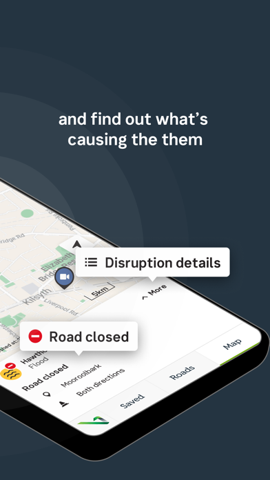
Road Closures and Traffic Alerts are generally uploaded to the application during peak traffic periods of Monday to Friday, 6:45am to 6:45pm and after hours during significant emergency events.
Details include location, impacts and any special instructions such as detours.
Pre-planned interruptions such as Roadwork’s and Events are available up to 48hours in advance.
Freeway travel times and live traffic camera images from around Melbourne provide you with a live image of how traffic is looking there and then.
Features include:
- Locality Search
- Zoom to your location (location services)
- Customisable settings for different data types
- Region and Municipality filters
Show More
What's New in the Latest Version 3.2.1
Last updated on May 23, 2023
Old Versions
Additional Notifications for users on changes to App
Show More
Version History
3.2.1
May 23, 2023
Additional Notifications for users on changes to App
3.2.0
Mar 28, 2023
- Additional disruptions information and icons
- New map experience
- Performance and stability improvements
- New map experience
- Performance and stability improvements
3.0.6
Mar 4, 2021
Bug fixes and improvements
3.0.5
Feb 9, 2020
- Reinstating some app features with improved clarity for road closure information.
3.0.4
Jan 8, 2020
Improved clarity for road closure information.
3.0.3
Dec 11, 2019
Minor updates and enhancements
3.0.2
Feb 15, 2017
Bug fixes and design updates.
3.0.1
Oct 17, 2016
Complete rework of the user experience from the ground up. A Plan View allows you to easily filter on incidents and alerts depending on your map's position and zoom. Plan a journey with VicTraffic find out if there are any road closures, traffic incidents or special events on the way. VicTraffic is designed to be used before your journey not during. Activate Google traffic overlays or customise what alerts show up on the map via the settings cog. You can save your journey to a dashboard for a quick view on the current travel time alongside your favourite freeways and cameras.
3.0
Oct 7, 2016
Complete rework of the user experience from the ground up. An intuitive and smooth Plan View allows you to easily filter on incidents and alerts depending on your map's position and zoom. Plan a journey with VicTraffic find out if there are any road closures, traffic incidents or special events on the way. VicTraffic is designed to be used before your journey not during. You can now save your journey to a dashboard for a quick view on the current travel time alongside your favourite freeways and cameras.
2.2.0
Jan 15, 2015
App has been updated for iOS8.
2.1.4
Aug 13, 2014
- KML enhancements
- Miscellaneous Bug Fixes
- Miscellaneous Bug Fixes
2.1.3
Jun 6, 2014
This update fixes an issue where CCTV images weren't reloading correctly under some circumstances.
2.1.2
Jan 9, 2014
Fixed display issue with walkthrough screens (certain iOS versions).
2.1.1
Dec 14, 2013
Added capability to handle major road closures.
2.1
Nov 19, 2013
Updated appearance for iOS 7.
Added Wizard for first time users and updated Traffic Safety warnings.
Added Wizard for first time users and updated Traffic Safety warnings.
2.0
Jun 26, 2013
The June 2013 release is a complete overhaul of its predecessor and features a smart map based interface that reveals more data as you zoom in further.
Content includes:
• Road Closures
• Traffic Alerts
• Detours
• Roadworks
• Events
• Tow Allocations
• Travel Times
• Live Traffic Cameras
Features include:
• Locality Search
• Zoom to your location (location services)
• Customisable settings for different data types
• Region and Municipality filters
1.03
Dec 2, 2010
This is a maintenance release:
- Fixed issue with table scrolling.
- Fixed issue with Alert index & map.
- Stability improvements.
- Tested in iOS4.2.
- Fixed issue with table scrolling.
- Fixed issue with Alert index & map.
- Stability improvements.
- Tested in iOS4.2.
1.02
Oct 13, 2010
Bug fixes for a number of user interface issues. Alerts "near me" update with better reliability.
1.01
Sep 29, 2010
Added support for iOS 3.x devices.
1.0
Sep 2, 2010
VicTraffic FAQ
Click here to learn how to download VicTraffic in restricted country or region.
Check the following list to see the minimum requirements of VicTraffic.
iPhone
Requires iOS 11.0 or later.
iPad
Requires iPadOS 11.0 or later.
iPod touch
Requires iOS 11.0 or later.
VicTraffic supports English


