Xavion has always given red-alert terrain and obstacle warnings,
but now we give an advance yellow-alert warning as well, about 200 miles out,
if the HOOPS you are flying are going to intersect terrain or obstacles.
This gives you time to PLAN to enter higher enroute altitude with a yellow-alert,
and gives URGENT notice for maneuvering with a red-alert.
More responsive FMS: We now get a quicker response, even on older pads and phones.
Slightly more conservative braking requirements after touch-down for all runways, since you will not have all your weight on the gear at the start of braking.
Hoops smoothed out a bit more with gentler bank-in and bank-out to allow more gradual pitching and rolling in flight.
Small UI and hoop geometry tweaks.
Small internal RAM optimizations.
The emergency hoops now set you up with a bit more touch-down room than before to allow more gentle braking on touch-down, if the runway length allows it.
Updated hoop profiles:
The INSTRUMENT approaches now have refined altitudes to help fly your altitudes on the approaches a bit more accurately.
The EMERGENCY approaches now give you more room for braking on the longer runways by bringing you down a little sooner, when runway length permits.
Various user-interface tweaks:
When you select an approach in the FMS, you can change the altitude, fixes enroute, etc, without having to re-select the approach for the new route.
You can drag the mouse and the FMS waypoints more easily in the FMS page, dragging anywhere on the screen.
The hoops are slightly re-sized and re-spaced to be as easy as possible to fly.
The traffic icons are have a darker background so the numeric data on them really shows up.
Now you can create custom FIXES as well as custom airports!
This is in the left-most NAV SETUP menu.
And remember to run Xavion on the same local network to send your custom fixes and airprots to your other devices!
New FMS detail:
The map is now drawn on the FMS screen... see your plan updating as quick as you can type in fixes!
You may notice that the emergency hoops start a little ways farther in FRONT OF YOU NOW, especially if you cruise well above you nominal gliding speed.
This is intentional!
Now, the FIRST hoop is plotted the END of your deceleration from cruise speed to nominal glide speed.
This deceleration gives you a few moments to run engine-out checklists as you approach the gliding hoops, without having to climb, turn, or descend at the same time.
A bunch of UI tweaks based on user feedback:
ADSb receiver vertical input smoothed for smoother updating of altitude and vertical speed.
We now show the pre-flight weather even if you only enter a destination, not departure airport as well!
In the event you only enter a destination airport, not departure airport, then Xavion will just use your CURRENT location as your departure.
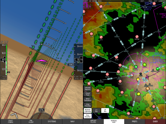
Now we have the glide ranges showing on the sectional and low and high enroute maps, not just the default Xavion terrain-map.
Now we have larger arrows showing the direction of other traffic on the traffic map.
Now the AOA indicator now does not turn red until you get close to the stall... it was turning red too early on the previous build.
Downwind take-off and landing warnings only happen now if you are actually on or over a runway!
Minor bug-fix: You can now pinch-zoom on the hot-spots, alternate minimums, etc, just to make that text larger and easier to read.
Updated horizon colors "Lake Champlain": Brightness and color of sky and water are based on a winter afternoon at this lake... very natural to fly by.
PREFLIGHT turbulence weather model removed: The European Union wanted some data removed from the free weather stream (so they could charge money for it, apparently?) So... now we have turbulence estimates IN-flight (because we still have American ADsB in flight!) but not PRE-flight (because the European Union suppressed the internet data).
New synthetic vision colors, with much more natural presentation of water and sky colors. This is really important for IFR flight if the terrain is to be rendered in an intuitive manner.
As well, recently:
Now with some really interesting performance charts:
In the SET ACF menu, enter the climb and cruise speeds and fuel flows for your airplane.
Then go to PRE-FLIGHT menu, WHERE-TO tab and enter 2 space-separated airports in the little mini-FMS there.
Then go to TRIP TIME / TRIP FUEL menu and see your time vs fuel: This is the time-vs-money question that all airplanes answer.
You'll see what power settings will take what time... and what money (fuel burn!) for each power setting.
Now you can make that time-vs-money trade-off with complete information. This chart considers the wind of course, if you have the internet service to get that data.
Now, you've seen time-vs-money, but what you really SHOULD be asking is, for this trip, in this wind, how do you save BOTH?
The next tab is trip SCORE. The scores is 100 DIVIDED BY the time and fuel burned: The higher the score, the less time and fuel you spend!
Choose the altitude and power setting with the highest SCORE and you'll know you're spending a minimum of time and money to run the flight.
This tells you the most efficient way to operate your airplane, on this trip, in this wind, every time.
ENHANCEMENT:
If you have entered your climb cruise performance data, then the new "TRIP PERF" tab shows you the time and fuel you will use for the trip for each power setting you entered.
Now for each power setting, you can see the time and fuel expense for choosing it for the flight! This is based on current winds of course.
A really nice way to see time and money for each power setting.
SMALL UI ADJUSTMENT:
Enroute winds in the pre-flight planner now aim their arrows as you will see them in the PFD in the real airplane:
Pointing straight down is a headwind, pointing straight up is a tailwind!
BUG-FIX:
If you drive Xavion with X-Plane for ground-based training, the altitude data should now come across as well!
Bug fix: You can now see all of the other iPads on the local network to exchange aircraft files, or have Xavion be driven by X-Plane, which is useful to practice Xavion.
Bug fix: No intermittent crash when first switching from real-use to being driven by X-Plane.
Bug-Fix:
Now you can send the airplanes you made to other iPhones and iPads.
This feature was broken by an Apple security update, but now fixed.
Bug-Fix:
The weight and balance now follows different arms for main and aux fuel tanks,
so we still get proper W/B plots even if they are not at the same longitudinal station.
Now you can choose from a few default airplanes to get you started with some good settings!
We have a 172, 182, Cirrus SR-22 and my Lancair now, with more to come.
See the ACF menu, SEL sub-menu to select!
New subtle refinements to the emergency hoops:
Xavion now gives more importance to SHALLOW turns and LONG final approach courses simply to help you have time to set up your approach with no low-and-slow maneuvering.
As well, Xavion assumes lower braking capability to handle wet or snowy conditions, giving you more room to run out on the roll while still centering your roll-out on the runway in the longitudinal dimension.
Bug fix: The user interface now shows the altitudes for the climb and cruise performance, so you can fill them in accurately!
Small UI tweaks:
-FMS keeps you higher for efficiency for enroute nav, including descent to the IAF, but then gets you low past the IAF to get out of the clouds.
-when flying with standard magenta hoops for navigation, the primary hoops are magenta and the standby emergency hoops are cyan, to make it clear which hoops are for current use and which are standby.
-airways preferences hidden when in raster maps, which have all appropriate airways as simply part of the raster image.
-airways visible at larger zoom ranges.
-we only show fixes for the missed approach... in the missed approach! this simplifies and de-clutters the display.
-bug fix: other traffic heading was shown incorrectly in track-up view: now fixed.
Previous update internally overhauled the WEATHER code to be more reliable. This update overhauls the HOOP-GENERATION code for performance and stability.
One way you will see this is that the FMS now adds instrument approaches to the end of flight plans. This lets you enter complex flight plans, including long airways sections, with instrument approaches at the end, to really plan all the way to landing.
Bug fix: SID and STAR plates now available... they were not shown in the previous version.
Internal clean-up for RAM-savings and better management of the internal weather system, giving more accurate estimated indicated airspeed displays, even at jet-stream altitudes.
A few bug-fixes on weather-management and display, and clarity-improvements in the UI as well.
Be sure to enter your aircraft climb and cruise performance to see your speed vs fuel, and range vs speed, both book and wind-corrected for this trip, to prove how fast, and high, you want to go!
Source for wind, temperature, and baro pressure are now shown on the PFD so you can verify where your info is coming from.
This matters when you have manually-entered baro pressure, internet weather, and ADSB weather all coming in at once.
Crash-bug fixed in the "Where-to?" preflight FMS.
Other recent improvements:
Now you can choose your altitude in the FMS per-fix: Hitting a crossing altitude is as easy as: Aiming at the crossing fix.
By looking at it and flying to it.
The instrument approaches keep you as HIGH as possible for safety BEFORE descending to the IAF, and then getting you as LOW as possible for safety to break out!
Dozens of user interface tweaks, almost all to make the UI fit better on more devices.
Just a UI bug fix that overlapped the fuel capacity and tail number, now fixed.
Other recent upgrades are speed and range charts based on the performance you enter, both with and without the current wind, and a best-range pointer on your airspeed indicator (corrected for wind!) which might come in useful in a pinch!
More fuel-efficient instrument approaches:
-Xavion now plans for power-off from top of descent for the smoothest-possible continuous descent during instrument approaches. Enter you IAF altitude into the FMS if you want to hop down the IAF ASAP.
More accurate fuel/range planner:
-You can now enter more cruise data, and the planner uses that data to dial in the fuel and time expense for the trip.
New stall-warning indication: Teeth that come down from above: Stay under them!
-Be sure to enter your max AOA in aircraft settings!
Small tweaks:
-No more map 'flickering' as you move between airports, as would occasionally happen.
-No more duplicate aircraft icon when using instrument approach plate overlay, which now tracks both north-up and track-up properly.
-No more accidentally zooming in on airports when making weather selections on the map page.
New feature: Runway light consideration!
We now consider runway LIGHTS when choosing an airport in dark conditions.
But how do we know what conditions are dark when the light varies with so many things, including visibility and cloud cover?
We make this decision based on the light level you are actually seeing at the moment... as determined by the brightness setting you set on your iPad!
If your biPad brightness is set to a high level, I assume you are in bright conditions and consider the runway lights of little or no value when choosing an emergency airport.
If your iPad brightness is at very low levels, I assume you are operating in dark conditions, and give preference to LIT runways for emergency selection.
As well, Xavion interpolates in between, giving some modest preference to lit runways in the twilight and dusk hours when you have your iPad set to intermediate brightness.
So, be sure to keep that brightness set as appropriate for the conditions you are actually in: You've been doing that anyway, but now Xavion is using that as your indication of how bright or dark your environment is, and considering runway lighting accordingly when choosing the best airport to glide to in the event of power-loss.
Some UI tweaks:
When you zoom in on an airport, runway length and width now display correctly at all map orientations... they were previously sometimes inverted.
Warnings for airports that are marginal for emergency use are now displayed on the PFD even if you are doing routine navigation... they were previously hidden if you were doing routine enroute navigation.
Flight Director data-entry buttons moved to never interfere with the menu bar.. they could previously sit behind the menus when in PFD-only mode.
Directional Gyro always visible... it could previously be partially hidden behind the menus in some cases.