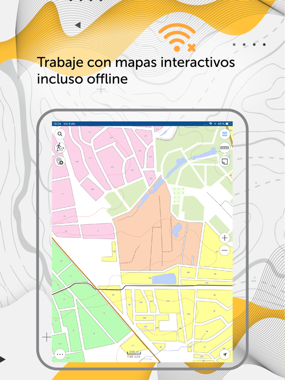
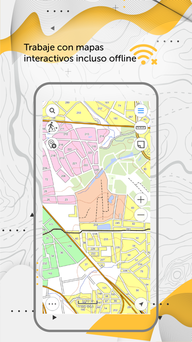
La aplicación CarryMap ofrece un completo conjunto de funciones para recopilar, procesar y analizar datos espaciales en equipo. Trabajo completo con mapas interactivos en modo offline, sin registro ni compras integradas.
Está diseñado para trabajar con mapas en el formato especial para móviles CMF2. Para exportar sus mapas de ArcGIS a este formato, utilice el CarryMap Builder, un módulo complementario de ArcGIS Desktop.
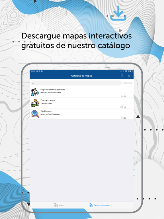
Gestión de mapas
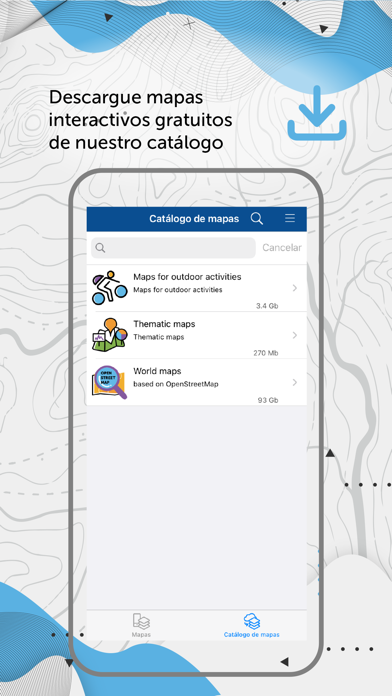
- Descargue mapas sólo de las zonas que necesite y guárdelos en un cómodo catálogo. Los mapas del catálogo se basan en el proyecto OpenStreetMap.
- Cargue sus mapas de ArcGIS en la aplicación y trabaje con ellos sin conexión.
- Utilice métodos fiables para proteger sus mapas.
- Cree proyectos completos en los que trabajar y que incluyan toda la información que necesite.
- Guardar las áreas del mapa seleccionadas como marcadores para un acceso más rápido.
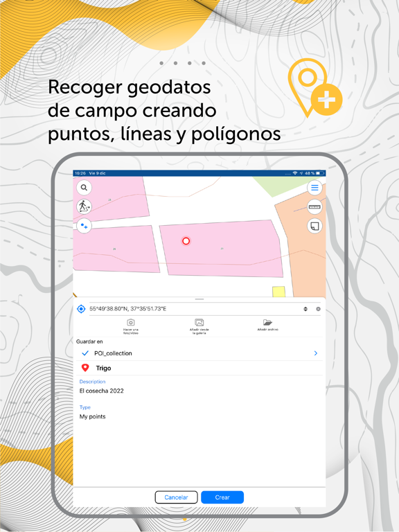
Trabajar con objetos
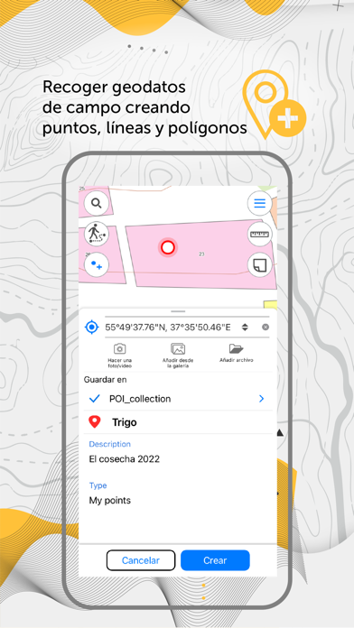
- Crea y edita características de puntos, líneas y polígonos en el mapa.
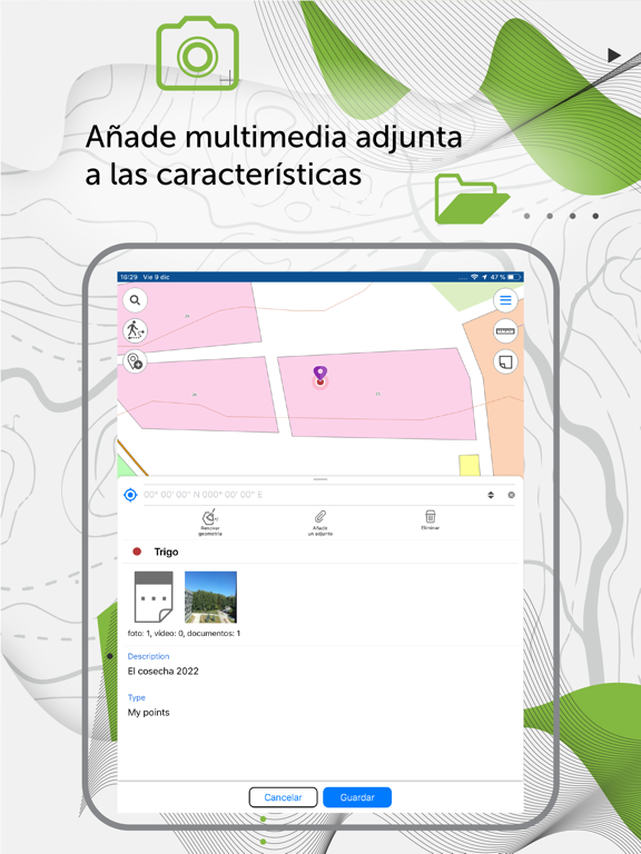
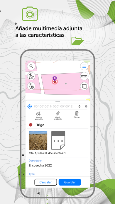
- Agrega archivos multimedia (fotos, videos y documentos) a los objetos.
- Graba comentarios de voz al crear y describir objetos en el mapa.
- Crea puntos sobre la marcha con la cámara de tu dispositivo.
- Crea puntos en el mapa con un solo toque mientras te mueves; agrega una descripción más tarde si es necesario.
- Añadir marcas gráficas en forma de texto, flechas o gráficos a mano alzada al mapa móvil.
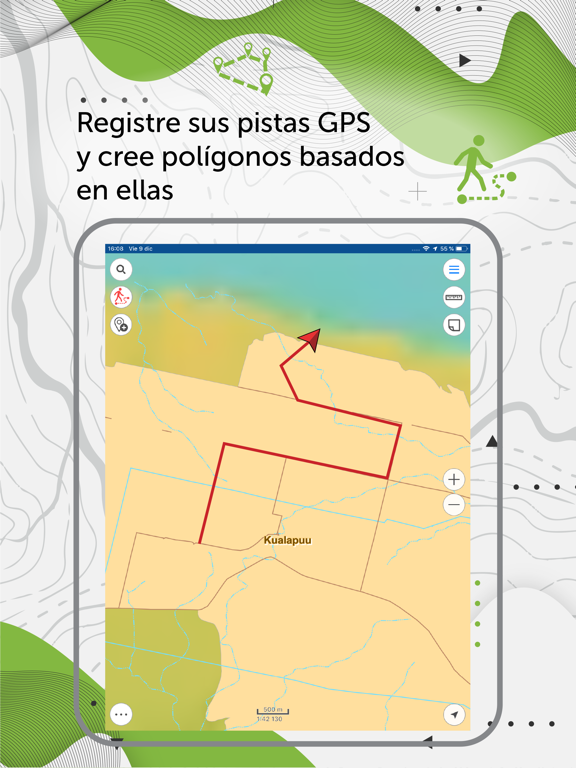
Rutas GPS y navegación
- Utilizar receptores GPS Bad Elf para encontrar tu localización actual.
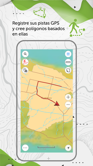
- Guarda rutas automáticamente, sin la distracción de editarlas sobre la marcha.
- Utilizar las características del mapa como puntos de referencia o de destino.
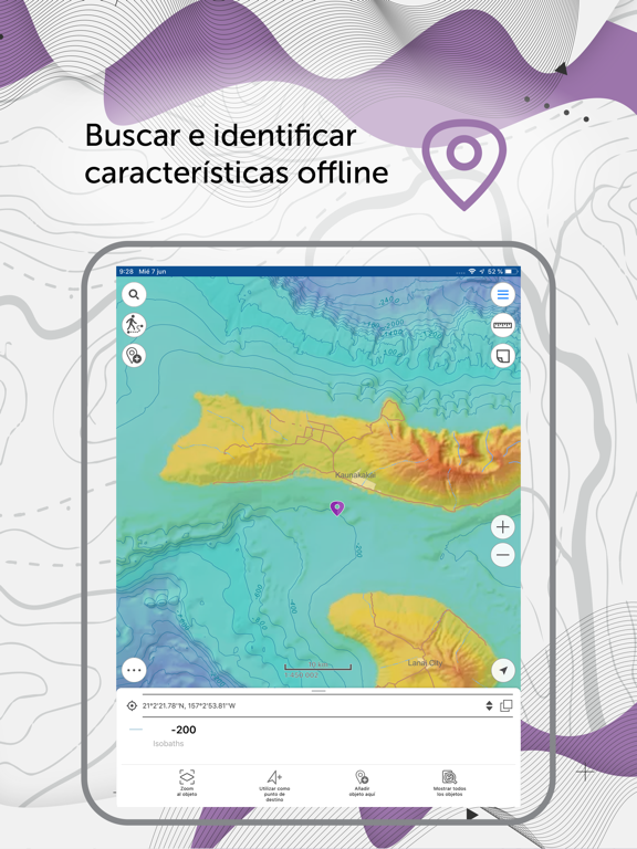
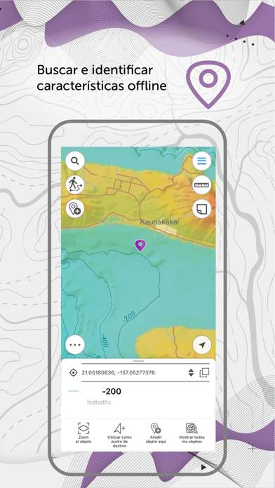
- Buscar e identificar características offline.
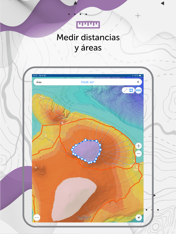
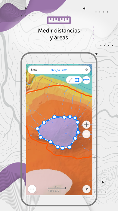
- Medir distancias y áreas.
Exportación de datos
- Comparte las coordenadas de tu mapa enviando un archivo o enlace.
- Descarga mapas en formato MBTILES*.
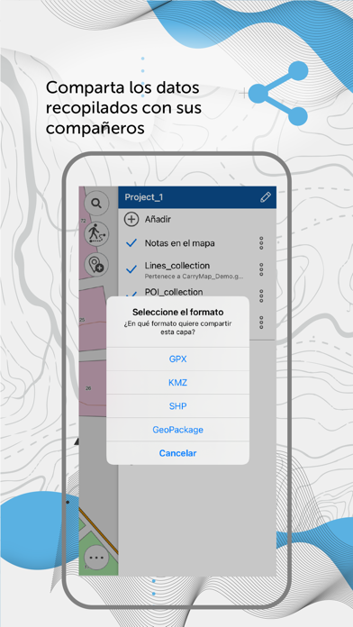
- Compartir los datos recogidos en formatos GPKG (GeoPackage), KML/KMZ, GPX y SHP.
*Sólo se admiten mapas en formato MBTILES con tiles de tipo raster.
La aplicación está disponible para una amplia gama de usuarios, independientemente de sus conocimientos de SIG, y puede utilizarse en diversos campos, como la electricidad, la agricultura, la geología, la geodesia, la protección del medio ambiente, la vivienda y los servicios públicos, la gestión del agua y el suelo, la ecología, la gestión de incidentes, la gestión de ciudades y otros.
Aproveche la oportunidad de crear su propio visor cartográfico móvil basado en CarryMap y su propia aplicación cartográfica móvil para su empresa. Más información:
https://carrymap.com/en/features/branding/
Visite https://builder.carrymap.com/en/ para saber más sobre CarryMap Builder.
Para saber más sobre la aplicación CarryMap, visite https://carrymap.com/en/overview/
Suscríbase a nuestro canal de YouTube https://carrymap.com/en/overview/
Sus preguntas o comentarios son bienvenidos a support@xtools.pro