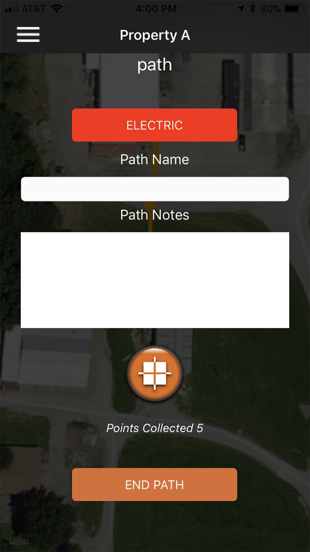
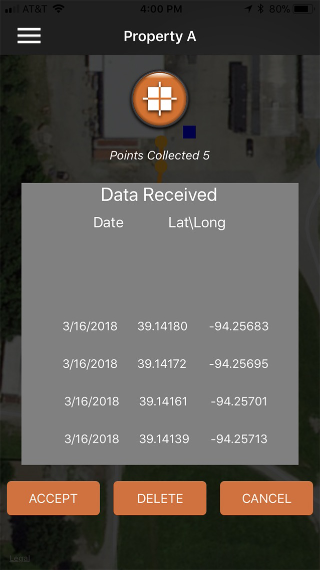
PathTraq allows users to create and share maps of utility lines and other paths using location data obtained via their mobile device or Bluetooth from a RYCOM GPS device.
Features:
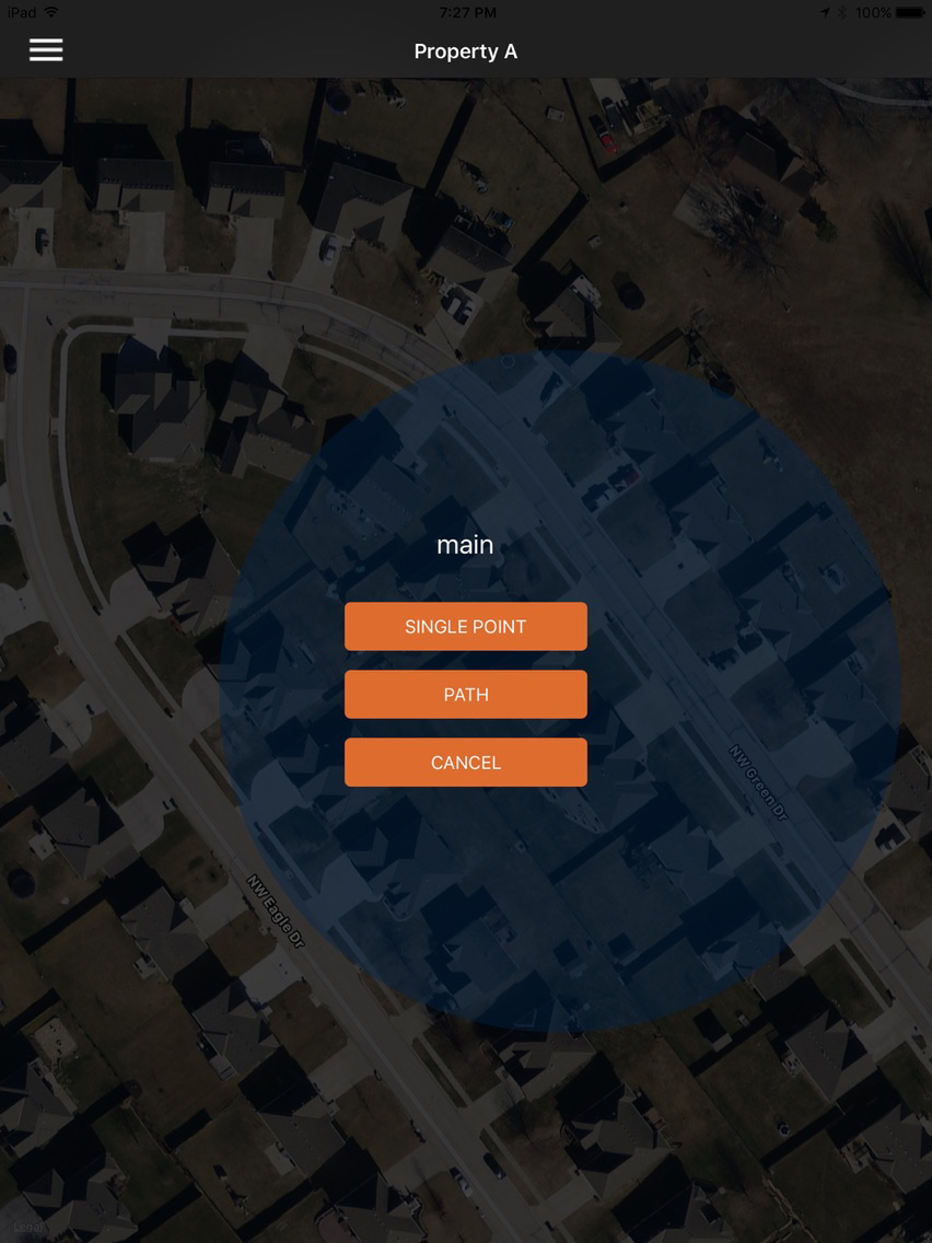
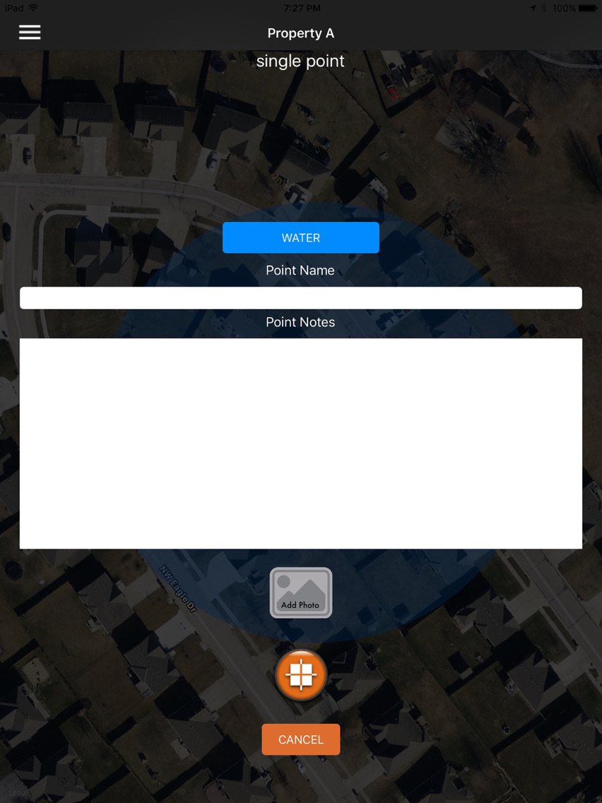
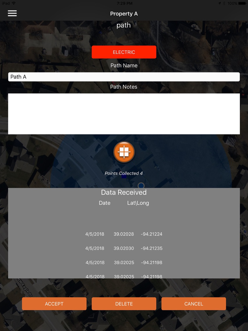
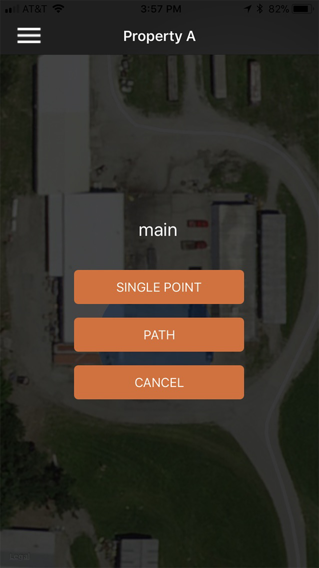
- Interfaces with Google Maps to log and view both individual points and underground utility paths.
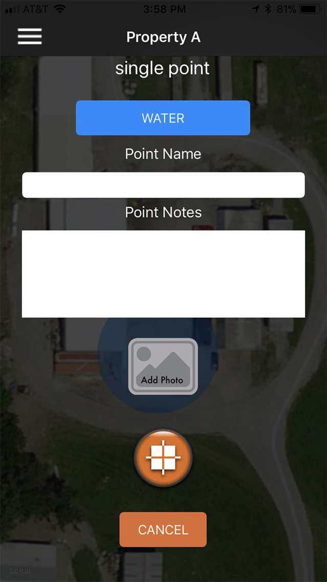
- Photographs can be associated with a particular point.
- Each user device can store multiple maps; each map can have multiple points, paths and utilities.
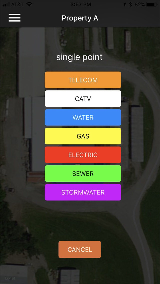
- Users have the ability to add, delete and edit categories, including default categories.
- All map data is stored locally and can be emailed as a .KMZ file.