World Ensigns is a visual encyclopedia of naval ensigns. The navigation in World Ensigns is intuitive and language independent. Thanks to the numerous index functions of World Ensigns you can easily find flags of ships and their respective countries. World Ensigns includes 260 interactive pages for 242 countries or regions and and includes a total of 1005 flags.
In World Ensigns you will find ensigns for all countries and regions that the ITU (International Telecommunication Union) has assigned a MMSI (Maritime Mobile Service Identity) to.
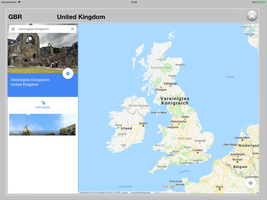
No matter whether you will encounter a ship whose ensign you don't know or whether you see the MMSI or the call sign of a ship with the AIS function of a ship's chart plotter. World Ensigns can quickly show you the ship's country of origin as well as further information about the countries geographic location, timezones and official languages. In addition to the different flags used in this country you will get information about the geographic location of the country, it's timezones and the official languages.
World Ensigns is the ideal compact and mobile reference book for all sailors, motor boat drivers, people on cruise lines, ship spotters, navigators and all with itchy feet: the perfect maritime lifestyle tool.
World Ensigns offers you the following features
Search functions:
• alphabetical search by name of the country
• search with known MMSI
• search with known call sign
• visual search using geometrical attributes and colors
Available information for each ensign:
• IOC code of the country
• international name of the country
• capital
• visual location and coordinates of the capital
• timezone(s)
• official languages
• groups of MMSI
• groups of call signs
Types of flags:
• naval ensigns
• authority flags
• navy flags
• national flags
• optional regional courtesy flags