i-Boating: Nautisch Karten

i-Boating: Nautisch Karten


Marine, Angeln & Segeln GPS


GratisOffers In-App Purchases

141.0.0for iPhone, iPad and more
8.9
2K+ Ratings
Bist LLC
Developer
51,9 MB
Size
Apr 25, 2024
Update Date
#199
in Navigation
4+
Age Rating
Age Rating
4+
Apps in this category do not contain restricted content.
9+
Apps in this category may contain mild or occasional cartoon, fantasy or real-life violence, as well as occasional or mild adult, sexually suggestive or horrifying content and may not be suitable for children under 9 years of age.
12+
Apps in this category may contain occasional mild indecent language, frequent or intense cartoon or real-life violence, minor or occasional adult or sexually suggestive material, and simulated gambling, and may be for children under 12 years of age.
17+
You must be at least 17 years old to access this App.
Apps in this category may contain frequent and intense offensive language; Frequent and intense cartoon, fantasy or realistic violence: frequent and intense adult, scary and sexually suggestive subjects: as well as sexual content, nudity, tobacco, alcohol and drugs, may not be suitable for children under 17 years of age.
i-Boating: Nautisch Karten Screenshots
i-Boating: Nautisch Karten Plakati-Boating: Nautisch Karten Plakati-Boating: Nautisch Karten Plakati-Boating: Nautisch Karten Plakati-Boating: Nautisch Karten Plakati-Boating: Nautisch Karten Plakati-Boating: Nautisch Karten Plakati-Boating: Nautisch Karten Plakat

About i-Boating: Nautisch Karten

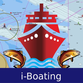
Diese App bietet offline Seekarten, See- & Flussnavigationskarten für Angeln, Kajak fahren, Rudern und Segeln. Abgedeckt sind See-Vektorkarten, Karten von Süßwasserseen und Binnenschifffahrtskarten (mit HD/1 ft/3 ft Bathymetrie, sofern verfügbar). Erste seetaugliche GPS-App mit Routenassistent und Sprachansage für die Seenavigation. Sie können neue Schiffsrouten erstellen oder vorhandene GPX/KML-Routen importieren. Unterstützung von Seekarten mit Kursausrichtung oben. Vorhersage von Gezeiten & Strömungen enthalten.

MERKMALE
– schöne und detaillierte Hardware/GPU mit schnellen Vektorkarten (Text bleibt bei Rotation aufrecht )
– Eingehende Informationen zu Seeobjekten (Bojen, Beleuchtung, Hindernisse usw.).
– anpassbare Einheiten von Tiefe (Ft/Fathom/Meter) und Distanz (km/mi/NM)
– anpassbare Anzeige von Untiefen.
– Aufzeichnungen, Autofollow mit Echtzeit-Track-Overlay & vorhergesagtem Pfadvektor.
– Ansagen für Seenavigation (GPS erforderlich)
– 1 ft/3 ft-Tiefenlinienkarten für Angler für ausgewählte Binnenseekarten.
– unterstützt GPX/KML für die Bearbeitung/den Import von Schiffsrouten.
– Vorhersage von Gezeiten & Strömungen.
– nahtloses Quilten von Diagrammen. Kartendetails zu Küsten, Seewegen, Häfen, Inland-ENCs (Flüsse) und allgemeine ENC-Karten werden automatisch der richtigen Zoomstufe angepasst
– Eingabe oder Import von Wegpunkten.

– KARTEN
Ihnen werden sämtliche Details angezeigt, die Sie auch in Ihren Kartenplottern finden!
(Weitere Regionen werden wöchentlich hinzugefügt) Bitte besuchen Sie die Website. Enthält unbegrenzte Updates für 1 Jahr.
Deutschland: Die Karten enthalten alle ENC-Karten abgeleitet von BSH (Bundesamt für Seeschifffahrt und Hydrographie). Des Weiteren sind ENCs von Binnenflüssen und Wasserstraßen einschließlich der Karten von Donau und Rhein enthalten.
√USA
√Canada
√UK/Ireland
√Europe Inland Rivers:Donau/Dunaja,Rhine,Garonne,Moselle,Drava,Sava,etc
√Australia
√Norway
√Finland
√Sweden
√Croatia
√Netherlands
√Ukraine(Black Sea)
√Caribbean
√New Zealand
√Spain
√Brazil
√Argentina
√Cyprus
√Falklands
√Seychelles & Mauritius
√Denmark
√Malta,Cyprus & S. Mediterranean
√S. Chine & Malaysia
√South Africa

– ROUTENMANAGEMENT/TOURENPLANUNG
– Routen erstellen/bearbeiten
– Rückfahrten
– Wegpunkte eingeben, verschieben, hinzufügen, löschen, umbenennen
– GPX-, KML- & KMZ-Dateien importieren
– Routen kartieren/bearbeiten
– Gemeinsame Nutzung und Export von Routen, Tracks & Markern

– FEATURES
– Autofollow
* Track-Overlay in Echtzeit
* Vorhergesagter Pfadvektor
* Kurs oben (Text bleibt aufrecht)
* Geschwindigkeit & Richtung
– Routenassistent mit Sprachansage
* Ansagen bei Annäherung an Schiffsroutenmarkierung
* Ständige Aktualisierung von Distanz & ETA
* Warnungen beim Verlassen der Route
* Warnungen bei Fahrten in verkehrter Richtung
– Aufzeichnungen

– GEZEITEN & STRÖMUNGEN
* Für die USA, Kanada, Großbritannien, Deutschland & Neuseeland
* Flut/Ebbe
* Vorhersage von Gezeitenströmen
* Stationen aktiver Strömungen

– GEMEINSAME NUTZUNG
* Teilen Sie sich Tracks/Routen/Marker auf Facebook & Twitter
* Exportieren Sie Tracks/Routen/Marker als komprimierte GPX-Dateien.

Beispiel-Seekarten (Für eine vollständige Liste siehe http://gpsnauticalcharts.com/main/folio-catalog-nautical-charts-app )
SEEWEG ZUM NORD-OSTSEE-KANAL
BREMEN
►Dysentery
►Berlin-Spandau navigation canal
►Spree-Oder Waterway
►Rhine-Herne Canal
►Wesel-Datteln Canal
►Elbe-Havel Canal
►Lower Havel Waterway (Spandau - Plaue)
►Saar
►Dortmund-Ems Canal
►Elbe Lateral Canal
►Weser
►Rhine-Main-Danube Canal
►Havel-Oder Waterway
►West Or
►Neckar
►Danube
►Moselle
►Mittellandkanal
►Main
►North Sea
►Rhine
►Elbe
►Baltic Sea
Show More

Was ist neu in der neuesten Version 141.0.0

Last updated on Apr 25, 2024
Alte Versionen
- MAJOR UPDATE
Relief Shading: i-Boating relief shading is like Google Street View, but for underwater terrain (Sea View). It's a visual representation of what the underwater terrain looks like. If you were to drain the oceans/lakes of all the water, that is the kind of view relief shading attempts to show.
Show More
Version History
141.0.0
Apr 25, 2024
- MAJOR UPDATE
Relief Shading: i-Boating relief shading is like Google Street View, but for underwater terrain (Sea View). It's a visual representation of what the underwater terrain looks like. If you were to drain the oceans/lakes of all the water, that is the kind of view relief shading attempts to show.
139.0.0
Jan 17, 2024
Major Update:
Lake Temperature Maps: Identify Fishing Hot Spots using Thermoclines accurate to 1°F (0.5° C).
138.0.0
Dec 4, 2023
- Major update
- Custom shading for marine weather forecasts - wave, wind, gust, precipitation, pressure, temperature
- Eyeball safe zones
- Compiled with latest version of Xcode
137.0.0
Oct 25, 2023
- Auto Routing algorithm improvements
- New lakes and updates for Florida, Minnesota, Ontario, California
- Compiled with latest version of Xcode
136.0.0
Aug 8, 2023
- Major improvements in Fishing Hotspots AI for an extensive rollout
- Weather forecast enhancements for Wave heights an direction
- Compiled with latest version of Xcode
135.0.0
Aug 1, 2023
- Marine Weather Forecast Improvements
- Fishing AI++ enhancements
- Compiled with latest version of Xcode
134.0.0
Jun 23, 2023
- Fishing AI Improvements
- Compiled with latest version of Xcode
133.0.0
Jun 15, 2023
- Fishing AI support: This is a major update that has the bits for Fishing AI.
- Compiled with latest version of Xcode.
132.0.0
Apr 16, 2023
- NMEA Alarm support - Wind Speed + Depth
- HD Bathymetry improvements for upcoming fishing season
- Compiled with latest version of Xcode
131.0.0
Feb 27, 2023
- NMEA & AIS improvements
- Compiled with latest version of Xcode
130.0.0
Jan 18, 2023
- Support for new home screen actions and shortcuts
- Compiled with latest version of Xcode
129.0.0
Dec 13, 2022
- Ice Fishing Lake improvements
- Compiled with latest version of Xcode
128.0.0
Nov 3, 2022
- Vector iconography
- Compiled with latest version of Xcode
127.0.0
Oct 19, 2022
- Hi-Def contours/bathymetry for selected inland rivers (Ohio, Missouri, Green etc)
- Compiled with latest version of Xcode.
126.0.0
Aug 29, 2022
- Comprehensive Marine Weather Support
1. Wind
2. Wave Heights
3. Precipitation
4. Pressure (MSL)
5. Air Temperature
6. Gust

-Compiled with latest version of Xcode
125.0.0
Aug 11, 2022
- Marine weather forecasts - wind + wave
- Animate forecasts across time
124.0.0
Jul 15, 2022
-Compiled with latest version of Xcode
-MS River ENC rendering improvements
122.0.0
Jun 28, 2022
- This update adds support for automatic routing for major inland lakes. If we have missed your lake, please us know at support@gpsnauticalcharts.com so that we can prioritize it.
- If you like the app, please help spread the word by leaving us a review.
121.0.0
Jun 22, 2022
- GPX improvements
- Compiled with latest version of Xcode
120.0.0
May 20, 2022
-Hi-Res contours for major lakes and rivers
-Compiled with latest version of Xcode
118.0.0
May 9, 2022
- Night mode / Dark mode color scheme can now be enabled under Settings
- Incorporated feedback regarding slip to slip automatic boat routing
- Compiled with latest version of Xcode
116.0.0
Apr 5, 2022
- Incorporated feedback for Slip to Slip Automatic Routing
115.0.0
Mar 28, 2022
MAJOR UPDATE
-Pier to Pier Automatic Routing based on Boat's Draft
112.0.0
Sep 15, 2021
- Offline Canada tides support
- Bathymetry update for KY, CU, TN, MO and OH rivers
111.0.0
Aug 17, 2021
- UK tide and currents supports (incl offline T&C graphs)
- New lakes and lake updates for Rhode Island
- Lake Okanagan and Lake Shuswap now have ENC/vector coverage.

i-Boating: Nautisch Karten FAQ

Klicken Sie hier, um zu erfahren, wie Sie i-Boating: Nautisch Karten in eingeschränkten Ländern oder Regionen herunterladen können.
Überprüfen Sie die folgende Liste, um die Mindestanforderungen von i-Boating: Nautisch Karten zu sehen.
iPhone
Erfordert iOS 8.0 oder neuer.
iPad
Erfordert iPadOS 8.0 oder neuer.
iPod touch
Erfordert iOS 8.0 oder neuer.
i-Boating: Nautisch Karten unterstützt Deutsch, Englisch, Finnisch, Französisch, Niederländisch, Norwegisch (Bokmål), Russisch, Schwedisch
i-Boating: Nautisch Karten beinhaltet In-App-Käufe. Bitte überprüfen Sie den folgenden Preisplan:
USA - Marine Charts
$19.99
USA : Marine Charts / Fishing
$19.99
USA - Marine Charts / Fishing
$21.99
USA - Marine Charts / Fishing
$21.99
USA - Marine Charts / Fishing
$20.99
USA - Fishing / Marine Charts
$19.99
USA - Marine Charts & Fishing
$19.99
USA - Boating & Fishing Maps
$19.99
GPS Nautical Charts - USA
$19.99
Canada & USA - Marine Charts
$25.99

Ähnliche Videos

Latest introduction video of i-Boating: Nautisch Karten on iPhone

i-Boating: Nautisch Karten Alternative

Das könnte Ihnen auch gefallen

Erhalte mehr von Bist LLC