iGleitschirmfliegen

iGleitschirmfliegen


Gleitschirmfliegen


2,99 €Best Deal Ever
12.1for iPhone, iPad and more
3.9
1 Ratings
Yannick VENNET
Developer
31,7 MB
Size
Jul 1, 2019
Update Date
Navigation
Category
4+
Age Rating
Age Rating
4+
Apps in this category do not contain restricted content.
9+
Apps in this category may contain mild or occasional cartoon, fantasy or real-life violence, as well as occasional or mild adult, sexually suggestive or horrifying content and may not be suitable for children under 9 years of age.
12+
Apps in this category may contain occasional mild indecent language, frequent or intense cartoon or real-life violence, minor or occasional adult or sexually suggestive material, and simulated gambling, and may be for children under 12 years of age.
17+
You must be at least 17 years old to access this App.
Apps in this category may contain frequent and intense offensive language; Frequent and intense cartoon, fantasy or realistic violence: frequent and intense adult, scary and sexually suggestive subjects: as well as sexual content, nudity, tobacco, alcohol and drugs, may not be suitable for children under 17 years of age.
iGleitschirmfliegen Screenshots
iGleitschirmfliegen PlakatiGleitschirmfliegen PlakatiGleitschirmfliegen PlakatiGleitschirmfliegen PlakatiGleitschirmfliegen Plakat

About iGleitschirmfliegen

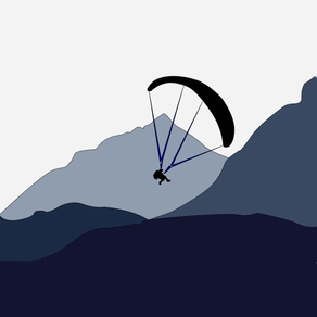
Anwendung ideal für Gleitschirmfliegen.
- Sichern Sie Ihre 3D GPS-Track (KML,IGC,CSV,GPX,PDF)
- Luftraum : Germany, All Africa, Austria, Australia, Belgium, Canadian, Croatia, Denmark, Spain, France, Italia,Israel,Greece,Hungary,Finland, Macedonia, Norway, Netherlands,Poland, Portugal, Latvia, Lithuania,Czechrepublic, Slovakia,Slovenia, Sweden, Switzerland, Royaume-unis,Russia, Roumanie, South Africa, Brasil, Colombia, New Zélande, USA, United Kingdom.
- Berechnen des Wind
- Logbuch
- Livetrack24.com
- Planen Sie Ihren Flug durch Hinzufügen von Wegpunkt. Die Navigation zwischen Wegpunkt ist automatisch.
- Haben Sie einen grafischen Variometer mit Tonalarm für den thermischen Bereich (Klettergeschwindigkeit oberhalb von 0,5 m / s).

Disclaimer: "Continued use of GPS running in the background can dramatically decrease battery life." NOT to be used as a primary navigational aid. ALWAYS refer to current charts for definitive information. This app is provided with no warrantees, expressed or implied. USER ASSUMES ALL RISK OF USE.

This app may use your location even when it isn’t open, which can decrease device battery life
Show More

Was ist neu in der neuesten Version 12.1

Last updated on Jul 1, 2019
Alte Versionen
- add radius around waypoint
- bug fixed
Show More
Version History
12.1
Jul 1, 2019
- add radius around waypoint
- bug fixed
12.0.5
Feb 19, 2018
- auto-start indication on the home and map page;
- after a first auto-start, option will automatically disabled since next start
12.0.4
Dec 14, 2017
bug fixed
12.0.3
Nov 29, 2017
You can now download map for use after without internet connection ! For free you can download a small area, go in in-app shop for more !
- add PDF export for fly;
- update interface;
- bug fixed for UK airspace;
12.0
Oct 14, 2017
Just asked, already done !
You now have a new statistics page of all your flights.
11.3.1
Sep 25, 2017
iXtrem Glider is updated ! All this options had been asked by users ! Don’t hesitate to ask again !
- add setup for graphic curve and replay breadcrumb
- add option to have MapView in fullscreen
- add « pop-up » option, when you touch an information, a pop-up window appears with text in big size for better visibility
- add a label in setup live track page, to know if user/password are correct

This version has also some bugs correction and optimizations !
11.3.0
Aug 24, 2017
- by activating "SOUND" option in the SETUP Page, in addition of the "vario biip", the application will announce the altitude at each 500FT (or 150m) of difference;
- and, above 3500m, a warning for hypoxia is announced
11.2.7
Aug 9, 2017
- Luftraum aktualisiert
11.2.6
Jun 9, 2017
- correction d'un bug sur l'export des fichiers IGC
11.2.5
Apr 10, 2017
Aussitôt demandé, "aussitôt" fait... votre Watch affiche désormais votre vitesse et votre altitude sur une seconde page !
N'hésitez pas à faire vos demandes d'améliorations directement par email sur : yannick.vennet@gmail.com.
11.2.4
Dec 29, 2016
- correction d'un bug sur la saisie des waypoints;
- améliorations de la prise en charge sur iPhone "Plus";
- optimisations diverses;

Et Bonnes Fêtes à tous !
11.2.3
Sep 5, 2016
- amélioration de l'affichage iPhone 6 et iPhone 6 Plus
11.1.2
Aug 25, 2016
- correction d'un bug pour les utilisateurs d'iOS 8
11.1.1
Jun 3, 2016
- optimisations
11.1
Jun 1, 2016
- correction d'un bug affectant l'enregistrement des données en arrière plan
11.0.4
Jun 1, 2016
- possibilité d'afficher le "BREADCRUMB" (trace sol) en dégradé de couleur en fonction de la vitesse, de l'altitude ou du vario pendant un enregistrement,
- résolution d'un bug rendant parfois la position de l'icône utilisateur (avion ou triangle) non cohérente avec la route
- amélioration de l'affichage pour iPhone 6 et 6Plus
- amélioration de la fluidité de l'affichage du temps de vol
11.0.3
May 25, 2016
- optimisations
11.0.2
May 11, 2016
- correction de bugs sur le fonctionnement avec l'iWatch
- l'affichage sur iPhone 6 et 6Plus sera prochainement amélioré
11.0.1
May 7, 2016
- Vous pouvez maintenant controller votre vol depuis une iWatch !

- Résolutions de bugs :
* LiveTrack24 passe en version API 2 et fonctionne de nouveau !
* L'affichage des METAR est de nouveau fonctionnel !

- IOS 7 ou inférieur n'est malheureusement plus supporté...
10.8
Dec 8, 2014
- Bug fixed
10.7
Nov 25, 2014
- Création d'un DESIGN IPAD spécifique (enfin !)
- Ajout des BALISES FFVL sur la CARTE.
- En mode "ENREG D'UN VOL" la trace au sol (si active) s'affiche avec une couleur en fonction de l'altitude. (Attention sur iPhone 4 et précédents, l'affichage simultanées des espaces aériens, du cercle de finesse, et de la trace au sol colorée peuvent provoquer des ralentissement de l'affichage)
- En mode "RELECTURE d'un FICHIER" la trace au sol s'affiche avec une couleur en fonction au choix: de l'ALTITUDE, de la VITESSE ou du VARIO.
- Sauvegarde automatique d'un email d'envois par défaut.
- Correction de BUG affectant le gestion du clavier.
- Correction d'un BUG affectant les espaces aériens sur IOS 8.1.
- Ajout d'une annonce sonore indiquant le type de zone aérienne lorsque l'on rentre dedans.
10.6
Aug 27, 2014
- Correction d'un bug pour l'affichage des espaces aériens
10.5
Mar 23, 2014
- Si l'iPhone se coupe pendant un enregistrement, l'application vous permettra de le sauvegarder au prochain lancement
- inscription de vos trajets dans votre calendrier
10.4
Feb 23, 2014
- Vous pouvez modifier un "trajet (waypoints)" déjà crée
- Affichage du "Cercle de finesse" sur la carte
- Calcul du vent plus précis
- Correction d'un bug pouvant survenir lors d'une sortie de "mode veille" ou "background"
10.3
Jan 24, 2014
- carte optimisée pour iPhone 5
- bug fix pour l'alerte sonore sur les zones aériennes
- choix d'icônes différentes pour l'utilisateur sur la carte

iGleitschirmfliegen Preis

Heute:
2,99 €
Am günstigsten:
2,99 €
Am teuersten:
3,49 €

iGleitschirmfliegen FAQ

Klicken Sie hier, um zu erfahren, wie Sie iGleitschirmfliegen in eingeschränkten Ländern oder Regionen herunterladen können.
Überprüfen Sie die folgende Liste, um die Mindestanforderungen von iGleitschirmfliegen zu sehen.
iPhone
Erfordert iOS 11.0 oder neuer.
iPad
Erfordert iPadOS 11.0 oder neuer.
Apple Watch
Erfordert watchOS 2.2 oder neuer.
iPod touch
Erfordert iOS 11.0 oder neuer.
iGleitschirmfliegen unterstützt Englisch, Französisch
iGleitschirmfliegen beinhaltet In-App-Käufe. Bitte überprüfen Sie den folgenden Preisplan:
Airport METAR
0,99 €
Off-line Map
1,99 €

iGleitschirmfliegen Alternative

Das könnte Ihnen auch gefallen

Erhalte mehr von Yannick VENNET