- Added 1m Scotland Phase 1 LIDAR data
- Removed OS OpenSpace mapping (in advance of new OS Maps mapping)
- Added Ordnance Survey Road and Outdoor mapping layers
- Updated icons for larger devices
- Fixed a number of UI bugs including dark mode issues
- Added support contact functionality
- Added elevation-shaded tile layer
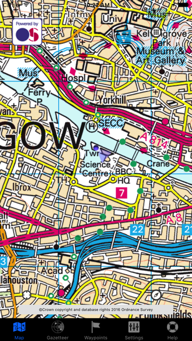
Added 6" historic Ordnance Survey mapping 1843-1882 courtesy of National Library of Scotland
- Rebranding
- 1880-1900 1" Ordnance Survey mapping courtesy of the National Library of Scotland
- ESRI aerial photography layer
Added new Thunderforest map layers: Transport Dark, Outdoors, Spinal Map, Neighbourhood, Pioneer and Mobile Atlas
Corrected issue with Settings not sticking
- Relaunch of the app
- Full integration of What3Words
- OSTerrain50 shaded height mapping for the UK
UI fix for iPads to enable exporting of waypoint groups via email in GPX format
Non-functional graphic and credit attribution changes
- iOS8 support
- Landscape support now fixed
*** Versions of iOS up to, and including, iOS6 are now NO LONGER SUPPORTED ***
- Landscape mode support for iPad
- Easting/northing display bugfix for leading zeros
- Thunderforest Landscape maps
- Thunderforest Transport maps
- Adds two new map tile sources from Stamen Design: Watercolour and Toner
- Adds a quick access icon to the Offline Maps Downloader
- Offline Map Pack Preview Tiles
- OpenCycleMap support
- View speed in kph or mph
- "Auto Lookahead" functionality which is similar to autocentre but tracks the position off the most appropriate side of the screen for the direction of travel to ensure maximum forward visibility on the map
Completely revamped offline map pack management and download functionality.
Recompiled for ARM6 devices to avoid over-optimisation done by Apple LLVM compiler which manifested as diagonal-only map scrolling.
This manifested primarily on iPhone 3G running iOS4. Newer devices (or older iOS versions) were not affected.
*** iPhone 3G/3GS with iOS4 may exhibit scrolling being diagonal. Do not update to 1.3.1 if you are using this combination. 3G/3GS with iOS3 seems fine ***
*** This has been tracked down to a bug with the latest XCode compiler (i.e., not me!). A new build has been submitted to the App Store and will be released shortly ***
Fixes iOS5 issues
*** OUTSIDE MAPS 1.3.0 WILL NOT WORK UNDER iOS 5. WE ARE RECTIFYING THIS AND WILL RELEASE A NEW VERSION SHORTLY ***
- Historic Ordnance Survey map tiles courtesy of the National Library of Scotland
- OpenStreetMap support
- Fixes to projections around display of map tiles of Orkney and north
- Native iPad support (no more pixel doubling!)
- GPS/Compass now overlays the main map screen as a heads-up display
- Online placename, postcode, grid ref, lat/long lookup functionality!
- Waypoint export by email support
- Bugfixes reported in earlier versions
Minor bugfixes.
*** If you are "stuck in Glasgow", please ensure that Location Services is enabled in your general device Settings and that "GPS Enabled" is on in the app settings ***
*** Users seeing 'white tiles with blue lines' should go to 'Settings' and ensure "Download Tiles" is enabled! ***
Several bug fixes:
- "Download Tiles" would be set to "OFF" if autolock not enabled
- Hardware Compass should not be able to be enabled on unsupported hardware
- iOS3 should not crash
*** iOS3 users are recommended to not update to this version. The app has been found to crash on startup. We are looking into this! ***
*** A bug relating to tile downloading has been discovered! On startup, if autolocking is not enabled, tile downloading will be disabled resulting in blank squares (reported in a review). Go to 'Settings' and re-enable "Download Tiles". A new version should be released very soon to rectify this! ***
A large update revolving around the excellent user feedback that I've received! The user interface has been simplified and made considerably more iPhone-like whilst enhancing the power of the original app.
All new UI features can be disabled if desired retaining full backward compatibility (or issues are encountered!)!
User-Requested Features
- New simplified user interface accessed by "long pressing" on the Map Screen. This replaces the various double-tap methods in previous versions. This can be disabled if desired and is only available on iOS4. iOS3 will use the "classic" UI
- "Pinch zoom" and "double-tap to zoom" functionality mimicking the builtin Maps app. This functionality can be disabled if desired. (Experimental feature)
- "Download map packs for what I see". The map pack to download is now based on where you are centred on the screen as opposed to your actual current location
- Dynamic Compass. If you are travelling at < 10mph, use the hardware compass, otherwise switch to the vector-based compass
- Disable auto-lock
Other Features
- Magnetic North/True North. Choose whether the hardware compass orients to true north or magnetic north
- User-configurable altitude adjustment. This applies the -50m OSTN02 altitude adjustment optionally.
- Minor bug fixes