Idaho Pocket Maps

Idaho Pocket Maps


Idaho Outdoor Guide


FreeOffers In-App Purchases

6.3for iPhone, iPad and more
9.1
65 Ratings
Alex Gugel
Developer
90.2 MB
Size
Mar 13, 2024
Update Date
Travel
Category
4+
Age Rating
Age Rating
4+
Apps in this category do not contain restricted content.
9+
Apps in this category may contain mild or occasional cartoon, fantasy or real-life violence, as well as occasional or mild adult, sexually suggestive or horrifying content and may not be suitable for children under 9 years of age.
12+
Apps in this category may contain occasional mild indecent language, frequent or intense cartoon or real-life violence, minor or occasional adult or sexually suggestive material, and simulated gambling, and may be for children under 12 years of age.
17+
You must be at least 17 years old to access this App.
Apps in this category may contain frequent and intense offensive language; Frequent and intense cartoon, fantasy or realistic violence: frequent and intense adult, scary and sexually suggestive subjects: as well as sexual content, nudity, tobacco, alcohol and drugs, may not be suitable for children under 17 years of age.
Idaho Pocket Maps Screenshots
Idaho Pocket Maps posterIdaho Pocket Maps posterIdaho Pocket Maps posterIdaho Pocket Maps posterIdaho Pocket Maps posterIdaho Pocket Maps poster
Idaho Pocket Maps posterIdaho Pocket Maps posterIdaho Pocket Maps posterIdaho Pocket Maps posterIdaho Pocket Maps posterIdaho Pocket Maps posterIdaho Pocket Maps poster

About Idaho Pocket Maps

Be prepared! Plan your next trip to one of the great Idaho parks. Download maps and guides before you venture into the Wi-Fi free wilderness.

- 45+ national parks, state parks, monuments, forests
- 190+ neatly folded maps by the National Park Service, Bureau of Land Management, United States Forest Services, and other agencies.
- Motor Vehicle Use Maps (MVUM), Motor Vehicle Travel Maps (MVTM) and visitor maps for Idaho national forests.
- 1,600+ campgrounds and campsites
- 3,000+ trails and trailheads
- 39,000+ points of interests

Plan

- Download maps, park brochures, and newspapers. These downloads are ready when you are offline and off the grid in the great outdoors.
- Download arbitrary map sections as offline packs.
- Photo galleries, panorama views.
- Share links to parks and maps with friends

Have fun

- GPS and GPX support: record your hikes, import GPX routes, tracks and waypoints for your hiking trails.
- Detailed national park information: alerts, news, visitor centers, campgrounds, driving directions, weather.
- Open your favorite maps app to get a route to the selected park.
- Current weather conditions, easy access to multi-day forecasts, sunrise and sunset times.
- Push notifications for park alerts, park news, weather warnings

So download maps and guides for:

Bear Lake
Bitterroot
Boise
Bridger-Teton
Caribou-Targhee
City of Rocks
Coeur d'Alene Lake
Craters of the Moon
Crystal Lake
Curlew
Deer Flat
Fossil Butte
Grand Teton
Hagerman Fossil Beds
Idaho Panhandle
Jackson
Jim McClure-Jerry Peak
John D Rockefeller Jr
Lewis & Clark
Lost Lake
Lower Salmon River
Minidoka
Morley Nelson Snake River Birds of Prey
Nez Perce
Payette
Pocatello
Salmon-Challis
Sawtooth
West Yellowstone
White Clouds
Widow Mountain
Wilson Creek
Wyoming Range
Yellowstone

- FULL ACCESS is available for a for $3.49/three month (after a free 3-days trial period) or $2.49/two months or $7.49/year. You can subscribe and pay through your iTunes account. The account will be charged for renewal within 24-hours prior to the end of the current period, and identify the cost of the renewal. Your subscription will automatically renew unless canceled at least 24 hours before the end of the current period. Auto-renew can be turned off anytime by going to your Account Settings in iTunes after purchase.

- Continued use of GPS running in the background can dramatically decrease battery life.

LEGAL
Terms of Use: https://www.icoat.de/pocketmaps/terms
Privacy Policy: https://www.icoat.de/pocketmaps/privacy
Show More

What's New in the Latest Version 6.3

Last updated on Mar 13, 2024
Old Versions
Early Spring 2024

Updates: Contains the latest data by the National Park Service (NPS), Bureau of Land Management (BLM), United States Forest Service (USFS) and recreation.gov.
Show More
Version History
6.3
Mar 13, 2024
Early Spring 2024

Updates: Contains the latest data by the National Park Service (NPS), Bureau of Land Management (BLM), United States Forest Service (USFS) and recreation.gov.
6.2
Jan 21, 2024
Winter 2023/2024

Updates: Contains the latest data by the National Park Service (NPS), Bureau of Land Management (BLM), United States Forest Service (USFS) and recreation.gov.
6.1
Dec 30, 2023
Early Winter 2023/2024

New: Reduced download size.
Updates: Grand Teton.
Updates: Contains the latest data by the National Park Service (NPS), Bureau of Land Management (BLM), United States Forest Service (USFS) and recreation.gov.
6.0
Dec 8, 2023
Late Fall 2023

Updates: Contains the latest data by the National Park Service (NPS), Bureau of Land Management (BLM), United States Forest Service (USFS) and recreation.gov.
5.9
Sep 22, 2023
Late Summer 2023

Updates: Caribou-Targhee, Salmon-Challis
Updates: Contains the latest data by the National Park Service (NPS), Bureau of Land Management (BLM), United States Forest Service (USFS) and recreation.gov.
5.8
Aug 5, 2023
Summer 2023

New: Watch some interesting videos and audios, produced by the National Park Service.

Updates: Contains the latest data by the National Park Service (NPS), Bureau of Land Management (BLM), United States Forest Service (USFS) and recreation.gov.
5.7
Jun 13, 2023
Early Summer 2023

Updates: Contains the latest data by the National Park Service (NPS), Bureau of Land Management (BLM), United States Forest Service (USFS) and recreation.gov.
5.6
May 13, 2023
Late Spring 2023

New: We remastered all maps for higher quality and optimized data usage.
Updates: Contains the latest data by the National Park Service (NPS), Bureau of Land Management (BLM), United States Forest Service (USFS) and recreation.gov.
5.5
Mar 17, 2023
Spring 2023

Updates: Boise National Forest, Sawtooth National Forest
Updates: Contains the latest data by the National Park Service (NPS), Bureau of Land Management (BLM), United States Forest Service (USFS) and recreation.gov.
5.4
Jan 20, 2023
Winter 2022/23

New: Earth isn't flat anymore! Check out the new globe view when you zoom way out.
Updates: Caribou-Targhee, Emigrant Trails, Lower Salmon River
Updates: Contains the latest data by the National Park Service (NPS), Bureau of Land Management (BLM), United States Forest Service (USFS) and recreation.gov.
5.3
Nov 25, 2022
Early Winter 2022

New: Hyperlocal weather data for every Point of Interest (POI).
Updates: Contains the latest data by the National Park Service (NPS), Bureau of Land Management (BLM), United States Forest Service (USFS) and recreation.gov.
5.2
Nov 4, 2022
Fall 2022

New: Current weather data and 10-day forecast powered by Apple Weather
Updates: Contains the latest data by the National Park Service (NPS), Bureau of Land Management (BLM), United States Forest Service (USFS) and recreation.gov.
5.1
Sep 3, 2022
Late Summer 2022

Updates: Yellowstone
Updates: Contains the latest data by the National Park Service (NPS), Bureau of Land Management (BLM), United States Forest Service (USFS) and recreation.gov.
5.0
Jul 24, 2022
Summer 2022

New: Redesigned for iPad!
Updates: Contains the latest data by the National Park Service (NPS), Bureau of Land Management (BLM), United States Forest Service (USFS) and recreation.gov.
4.9
Jun 28, 2022
Summer 2022

Updates: Use the new POI search feature and find more than 39000 campgrounds, trailheads, lakes and other points of interest.
Updates: Caribou-Targhee, Yellowstone
Updates: Contains the latest data by the National Park Service (NPS), Bureau of Land Management (BLM), United States Forest Service (USFS) and recreation.gov.
4.8.1
Jun 7, 2022
- Applied insect repellent to recently discovered bugs on iPads near you.
- No actual insects were harmed in the making of this latest production.
4.8
May 25, 2022
Early Summer 2022

Updates: Contains the latest data by the National Park Service (NPS), Bureau of Land Management (BLM), United States Forest Service (USFS) and recreation.gov.
Updates: Payette, Sawtooth, Yellowstone
4.7
Apr 13, 2022
Spring 2022

Updates: With the latest data by NPS, BLM, USFS
Updates: Boise, Oregon Trail, Yellowstone
4.6
Mar 7, 2022
Spring 2022

Updates: improved 3D maps
Updates: Boise National Forest
4.5
Jan 31, 2022
Winter 2021/2022

New: Maps in 3D!
Updates: Yellowstone
4.4
Dec 8, 2021
Winter 2021

Updates for iOS 15 and iPad
Updates: Lewis & Clark, Orogrande, Sheep Mountain-Camp 60
4.3
Nov 5, 2021
Fall 2021

fix: bug prevented update of national park alerts and news
4.1
Aug 29, 2021
Summer 2021

updates: Mackay Mine Hill Tour, Salmon, Yellowstone
3.9
Jun 17, 2021
Summer 2021

new: Download maps directly from the new "maps" menu
new: Reorder maps
updates: Bridger-Teton, Idaho Panhandle, Payette, South Hills, Yellowstone
3.8
May 11, 2021
Spring 2021

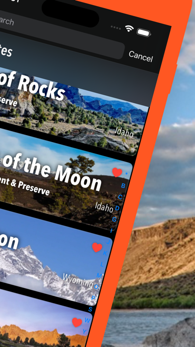
updates: Craters of the Moon, Ice Age Floods, Sawtooth, Yellowstone

Idaho Pocket Maps FAQ

Click here to learn how to download Idaho Pocket Maps in restricted country or region.
Check the following list to see the minimum requirements of Idaho Pocket Maps.
iPhone
Requires iOS 15.0 or later.
iPad
Requires iPadOS 15.0 or later.
iPod touch
Requires iOS 15.0 or later.
Idaho Pocket Maps supports English, German
Idaho Pocket Maps contains in-app purchases. Please check the pricing plan as below:
access all pro features
$7.49
access all pro features
$2.49
access all pro features
$3.49

Idaho Pocket Maps Alternative

You May Also Like

Get more from Alex Gugel