आसरा (AASRA)
無料
3.2for iPhone, iPad and more
Age Rating
आसरा (AASRA) スクリーンショット
About आसरा (AASRA)
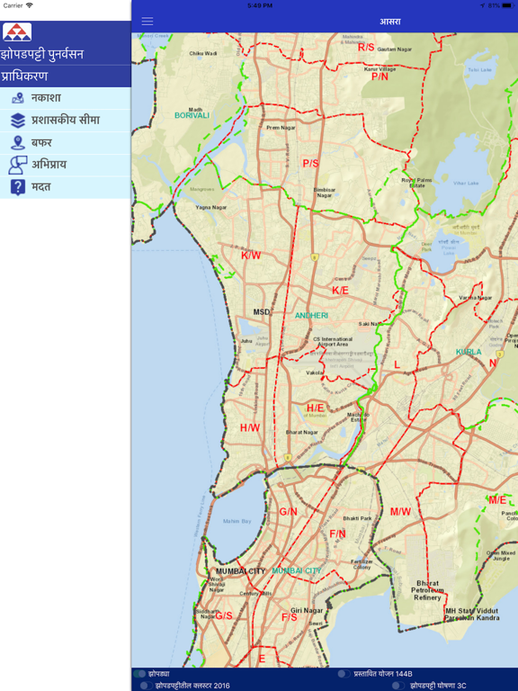
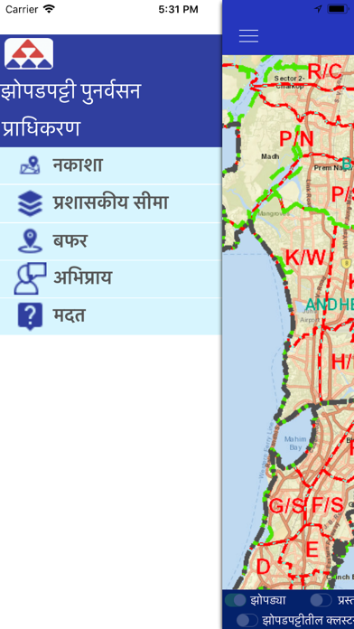
To provide citizen centric information of SR schemes on mobile, based on user location where GIS data for slums spread over entire Mumbai Municipal Corporation area has
been created.This encompasses layers containing boundaries of District,Taluka,Ward,Village,Slum Cluster,SR Schemes,Huts,etc. This GIS Mobile App is developed with the support of Utility Mapping Division of NIC,New Delhi
Show More
最新バージョン 3.2 の更新情報
Last updated on 2021年11月25日
旧バージョン
Updated new SRA secure map services
Show More
Version History
3.2
2021年11月25日
Updated new SRA secure map services
1.1
2019年01月02日
bug fixes
1.0
2018年12月15日
आसरा (AASRA) FAQ
ここをクリック!地理的に制限されているアプリのダウンロード方法をご参考ください。
次のリストをチェックして、आसरा (AASRA)の最低システム要件をご確認ください。
iPhone
iOS 9.1以降が必要です。
iPad
iPadOS 9.1以降が必要です。
iPod touch
iOS 9.1以降が必要です。
आसरा (AASRA)は次の言語がサポートされています。 ドイツ語, フランス語, マラッタ語, 英語