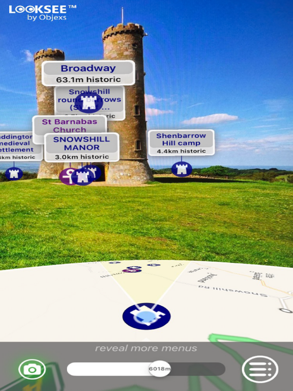
Looksee AR for the Cotswolds, England, is an Augmented Reality (AR) viewer used to find places of interest from close up to 10km away, directly within your phone's camera view and add fun, knowledge and interest to your adventures and tours.
Ideal for both tourists and locals wishing to explore and find out more about their surroundings and beyond: whether by foot, bicycle,car, taxi or Uber!
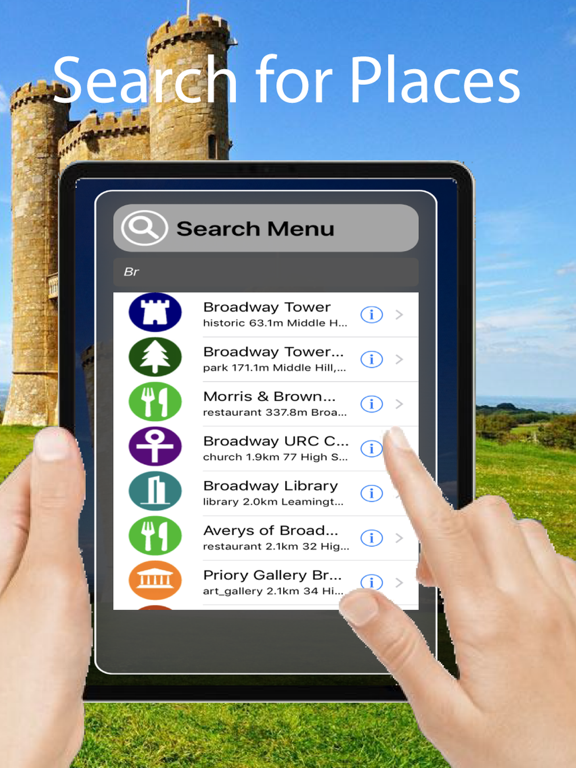
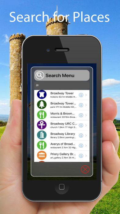
It's simple to use - you just point and go! It includes a choice of Map or Satellite Image in view and a Search function to help locate things.
Once downloaded no wi-fi or cellular network is necessary, so you can use when out and about in the Cotswolds, even when there is no or poor signal coverage.
This version, for the Cotswolds in Southern England, locates places in and around the area. The Cotswolds is a rural area covering parts of 6 counties, notably Gloucestershire and Oxfordshire. Its rolling hills and grassland harbour thatched medieval villages, churches and stately homes built of distinctive local yellow limestone.
This App reaches a rectangle stretching from and including Ettington in the North East to Malmesbury the South West. It includes the Cotswolds Area of Outstanding Natural Beauty (AONB). In-fact it includes everywhere in the region including the cities and towns of Bibury, Burford, Chipping Campden, Cirencester, Cheltenham, Dursley, Stow-onthe-Wold, Stroud and Tetbury.
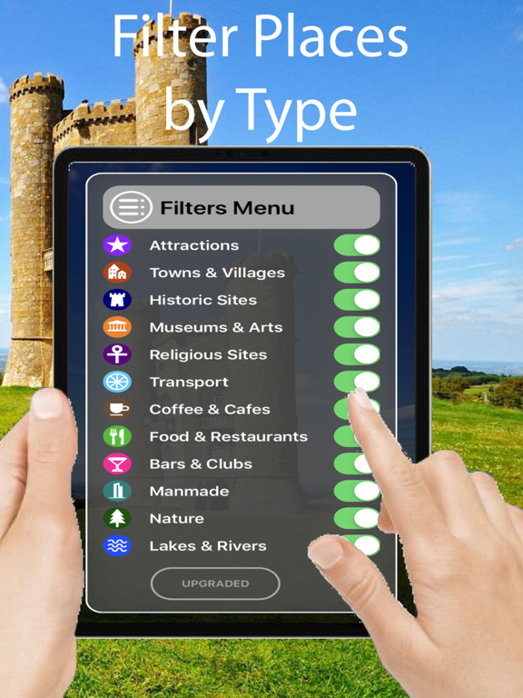
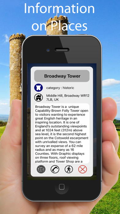
Categories that can be viewed and selected include Tourist Attractions, Hills, Lakes, Parks & Woodlands, Cities, Towns, Suburban Areas, Villages & Hamlets, Cafes, Restaurants, Cafes, Airports, Train & Major Bus Stations, Municipal Buildings, Places of Worship, Historic Sites and Museums & Arts.
Some of the helpful Looksee features include:
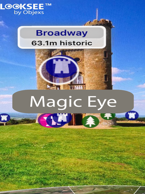
- Interactive objects (that you can touch for more information on them)
- Magic EYE (to declutter the visuals and select only objects within)
- 3D Satellite or Map image in view (can select which or disable completely)
- Search menu (with on-screen directional arrow and indicator graphics)
- Filters menu (using which the categories of points of interest you wish to display can be easily filtered out or selected)
- Distance slider (for an interactive depth of view filter up to 10km)
- Zoom (using an on screen pinch to zoom gesture)
- Snap-shot camera (for annotating your photos)
- Video recorder for saving and sharing interesting places on social media (accessed by holding the camera icon for 1 second)
- Radar view of everything around you on map (hold face down)
So please enjoy adding interest to your Cotswolds outdoor adventures!