RWY Go is an amazing iPhone and Apple Watch™ application to show useful information about nearby airports whilst you are flying.
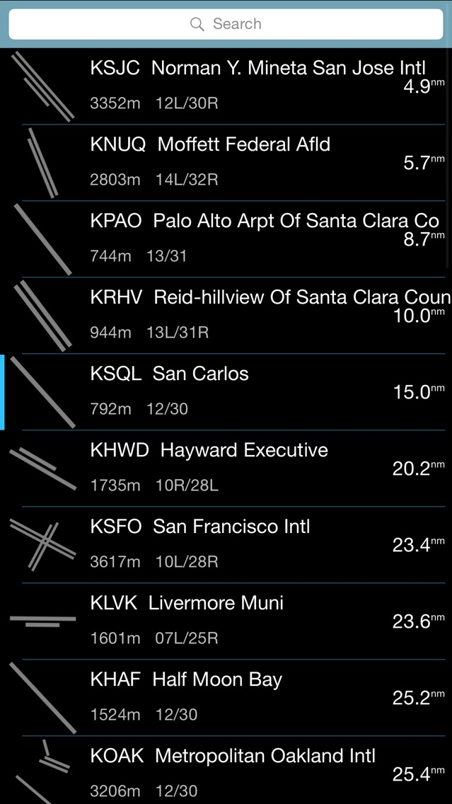
RWY Go contains an updatable database of worldwide runways, navigation aids and frequencies from official sources. Everything from dirt strips to large international airports are covered and you can filter results by runway length.
RWY Go knows what phase of flight you are in and has an intelligent radar that sweeps your area to pick the best airport. It looks at the size of the runways, the relative angles and distances then picks the best one. If you are on descent, it will prioritise the airport ahead of you instead of something off to the side or behind. RWY Go uses a 6 degree glide path when calculating distances so it knows the airport 60nm away on the nose is more useful than the one underneath if you are cruising at 30,000 ft.
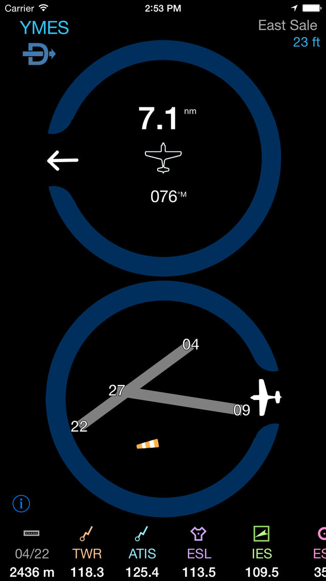
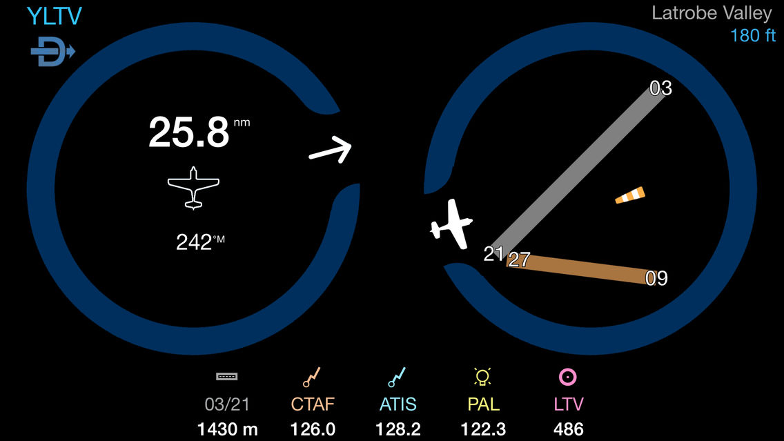
At any time you can turn on Direct-To which locks on to the current airport, for example during approach. You can even bring up a list of nearby airfields or search for any airport in the world.
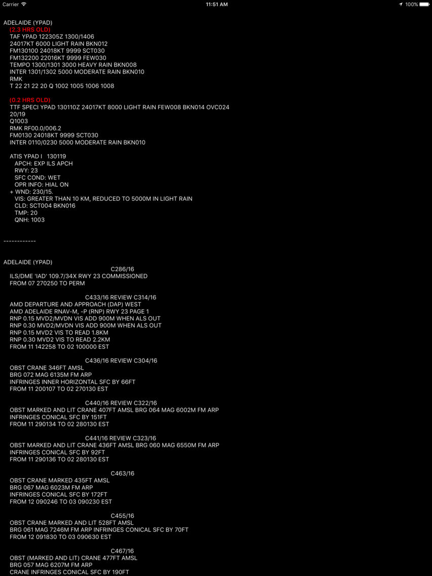
METAR, TAF and NOTAMs are loaded for applicable airports and you will see these by swiping right. If there is a wind direction given in the METAR or TAF/TTF, you will see a windsock on the runway diagram.
Note: Continued use of GPS running in the background can dramatically decrease battery life.