AIS Maps: Marine & Lake charts

AIS Maps: Marine & Lake charts


Detailed nautical & topo maps


무료Offers In-App Purchases

6.4.1for iPhone, iPad and more
Flytomap
Developer
135.8MB
Size
May 3, 2024
Update Date
Navigation
Category
4+
Age Rating
Age Rating
4+
Apps in this category do not contain restricted content.
9+
Apps in this category may contain mild or occasional cartoon, fantasy or real-life violence, as well as occasional or mild adult, sexually suggestive or horrifying content and may not be suitable for children under 9 years of age.
12+
Apps in this category may contain occasional mild indecent language, frequent or intense cartoon or real-life violence, minor or occasional adult or sexually suggestive material, and simulated gambling, and may be for children under 12 years of age.
17+
You must be at least 17 years old to access this App.
Apps in this category may contain frequent and intense offensive language; Frequent and intense cartoon, fantasy or realistic violence: frequent and intense adult, scary and sexually suggestive subjects: as well as sexual content, nudity, tobacco, alcohol and drugs, may not be suitable for children under 17 years of age.
AIS Maps: Marine & Lake charts 스크린 샷
AIS Maps: Marine & Lake charts 포스터AIS Maps: Marine & Lake charts 포스터AIS Maps: Marine & Lake charts 포스터AIS Maps: Marine & Lake charts 포스터AIS Maps: Marine & Lake charts 포스터AIS Maps: Marine & Lake charts 포스터AIS Maps: Marine & Lake charts 포스터AIS Maps: Marine & Lake charts 포스터

About AIS Maps: Marine & Lake charts

새로운 시각에서 세상을 바라보는 AIS Maps: Marine and Lakes Charts by FlyToMap. 우리의 앱은 아름답게 디자인되어 미적 매력과 기능성을 매끄럽게 결합하고 있습니다. 벡터 기반의 지도 요소로 인해 확대하더라도 그래픽 및 텍스트가 매우 자세하게 표시되며, 패닝이 부드럽습니다. 틸트 및 회전하여 지역을 보고도 모든 것이 일관됩니다.

FlyToMap의 모든 기능에 액세스할 수 있는 이 앱은 Apple의 In-App 구매 비즈니스 모델을 통해 FlyToMap 지도를 완전히 활용할 수 있습니다. 또한 온라인 데이터의 표시도 가능합니다.

해당 지도를 합리적인 비용으로 오프라인에서 사용할 수 있도록 모든 맵 (Marine, Travel, Parks, Lakes 등)을 구매할 수 있습니다.
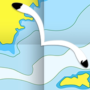
Live AIS
귀하의 보트 및 전 세계에서 근처에 있는 보트의 실시간 맵 뷰.
AIS 수신기가 필요하지 않으며 휴대 전화만 필요합니다.
다양한 아이콘이 다른 선박 카테고리를 나타냅니다.
선택한 대상을 클릭하여 선박 세부 정보보기 : 이름, MMSI, IMO, 호출 부호, 상태, 속도, 헤딩, 좌표, GPS 위치에서의 거리 등.

무료 기능 및 기능 :
√ 좌표 및 경도를 사용하여 즐겨 찾는 장소로 이동
√ 직접 즐겨 찾는 지점 검색
√ 손가락 하나로 줌, 회전 및 팬
√ 벡터 기술 덕분에 한 손가락 터치로 빠르게 개체 정보 얻기
√ GPS 헤딩
√ 거리 측정 도구를 사용하여 쉽게 거리 계산
√ 루트 계획, 웨이 포인트 - 목적지 입력 및 실시간 속도, 거리 및 방향 표시
√ 모든 정보에 대한 확대 렌즈
√ 무제한 트랙, 마커, 지오 태그 된 사진, 레코드. 이메일로 공유, Google에서 보이고, Flytomap Viewer에서 보이며 KMZ 형식으로 공유
√ 깊이 등고선 선택
√ 메뉴 슬라이더
√ Flytomap은 백그라운드에서도 작동합니다. 다른 앱으로 전환하거나 트랙을 기록하면서 전화를 걸거나 SMS를 보낼 수 있습니다.
√ 최적화 된 배터리 사용
√ 빠른 터치로 로컬 마린 날씨 예보 제공 :
• 일일 최고 및 최저 온도 - 현재 온도
• 중요한 파고, 파고, 파고 기간, 파고 방향
• 조수 데이터
• 바다 온도
• 풍속 및 풍향
• 날씨 설명
• 강수 및 습도
• 가시성
• 압력
• 퍼센트 클라우드 커버
• 바람 길/체감 온도
• 물 온도
• 이슬점 온도
• 열 지수 온도

마린 맵
세부적인 전자 항해 차트 (ENC)로는 해안선, 정박 지역, 어항 지역, 제한 지역, 장애물, 바위, 부이, 비콘, 등심, 깊이 등고선, 스폿 사운딩 등이 포함됩니다.

호수 맵
상세한 정보와 중요한 기능이 포함된 고품질 호수 맵 : 깊이 등고선, 보트 램프, 낚시 지점 등. 지도에는 트레일, 도로 및 철도 정보도 포함되어 있습니다.

공원 맵
모든 종류의 트레일 (하이킹, 자전거, 승마 트레일 등)과 포인트 오브 인터레스트 (POI)를 포함하는 고급 전자 차트. 캠프장, 비지터 센터, 전망점, 식당, 레인저 스테이션, 소풍 지역, 보트/카누 램프, 주차 지역 등.

여행 맵
가장 흥미로운 관광 지역의 지도는 바다와 땅 정보를 모두 포함하여 완전한 여행 경험을 제공합니다.

팔로우 하세요 :
▶ Twitter @flytomap
▶ 웹 사이트 flytomap.com
▶ Facebook facebook.com/flytomap

AIS Maps: Marine and Lakes Charts by FlyToMap와 함께 이전과는 다른 탐험과 항해의 모험을 준비하십시오.
Show More

최신 버전 6.4.1의 새로운 기능

Last updated on May 3, 2024
오래된 버전
최신 장치에 맞게 업데이트되었습니다.
Show More
Version History
6.4.1
May 3, 2024
최신 장치에 맞게 업데이트되었습니다.
6.4.0
Feb 8, 2024
차트가 추가되었습니다.
Georgian Bay South
Hudsonriver to Raritanbay
Lake Ontario West
Lake Huron South
Lake Erie East
Lake Huron North
Thousand Islands
Lake Ontario East
Prince William Sound
South Cook Inlet
Shelikof Strait
East Kodiak Island
East Andreanof Islands
6.3.19
Dec 20, 2023
추가 된 차트:
Behm Canal
Bristol Bay
Cape Ulika
Cross Sound - Icy Strait
Delarof Islands
Dixon Entrance
East Andreanof Islands
Northern Cook Inlet
Norton Sound
Peril Strait
Rat Islands
Shumagin Island Sound
Taku Harbor Skagway
Tortuga to Margarita Island
West Kodiak Island
Whal Bay - Peril Strait
Wrangell - Glass Penisula
6.3.18
Feb 24, 2023
추가 된 차트:
Lake Superior East
Maui-Oahu
Hawaii-Maui
Johnston Atoll
Lake Michigan North
North Channel
Lake Michigan South
Georgian Bay Northeast
Main Channel
Lake Erie West
6.3.17
Feb 10, 2023
추가 된 차트:
Apalachee Bay
Fiji
Houston
Massachusetts Bay
Bar Harbour
San Juan Island
Central California
Juan de Fuca Strait
Oahu-Kauai
Columbia River
6.3.16
Jan 6, 2023
추가 된 차트:
Albemarle Sound
Baton Rouge
Black Bay Houma
Cape Elizabeth to Cape Ann
Florida South West
Georges Bank
Laguna Madre
Lake Superior West
Long Island South NY
Rhode Island Sound
Upper Chesapeake
6.3.15
Dec 17, 2022
추가 된 차트:
Cape Fear
Delaware Bay
Florida North West
Los Angeles
Losangeles to San Diego
Lower Chesapeake
Matagorda Bay
Mississippi River Delta
Nantucket Sound
New Jersey
New Orleans
Newhaven Sandyhook
Northatlantic Canyons East
Outerdelmarvapen Insula
Pamlico Sound
Penobscot Bay
Potomac River
Puget Sound North
Puget Sound South
San Francisco
South East Cuba
South Maine
Tampa Florida
Vermilion Bay Port Arthur
York River James River
6.3.13
Nov 18, 2022
추가 된 차트:
Abaco Berry Islands
Andros Island Approaches
Eleuthera to Cat Islands
Great Exuma to Long Island
Charleston to Hilton Head
Georgia
Jacksonville Florida
Cape Canaveral Florida
Florida South East
Florida Keys
6.3.12
Aug 25, 2022
추가 된 차트:
Browning Entrance
Chatham Sound
Portland Canal
Moresby Island
SW Nova Scotia
South West Cuba
North West Cuba
North East Cuba
Clair Engle and Trinity Lake
Atoka Reservoir
Hugo Lake Oklahoma
Lake Stanley Draper
6.3.11
Aug 6, 2022
추가 된 차트:
Strait of Georgia
Desolation Sound
Port Neville Blunden Harbor
Queen Charlotte Strait
Northwest Vancouver Island
Nootka Sound Chart
Clayoquot Barkley Sound
Kings Island
Namu Harbor Hiekish Narrows
Caamano Sound Laredo Sound
6.3.10
Jul 23, 2022
추가 된 차트:
Saratoga Lake
Muritz Kolpinsee
Mecklenburg Vorpommern
Switzerland
Río de la Plata
Mississippi
Vancouver PittLake
SE Sweden
Sicilia
Gulfislands Jervis Inlet
6.3.9
May 22, 2022
추가 된 차트:
Gulf Islands
Shetland Islands
Liverpool to Glasgow
Stord Lindesnes
Sognefjorden to Haugesund
Lake Starnberg
Melilla to Arzew
Tangier to Melilla
Pepacton Reservoir
Lake Otesgo Canadarago Lake
6.3.8
Feb 4, 2022
추가 된 차트:
Woods Reservoir Tennessee
Reelfoot Lake
Lake Ray Roberts
Tims Ford Lake
North-South Lake
Lake Tiorati
Tunisia
Oslo
Puerto Rico
Vancouver Approaches
6.3.7
Jan 26, 2022
추가 된 차트:
Logan Martin Lake
Table Rock Lake
Lake Wakatipu
Norfork Lake
Mill Wood Lake
Madeira Islands
Virgin Islands
Lake Whitney
Waurika Lake
Sauk Lake
Mississippi River Pool 10
Hodstradt Lake
Zurichsee
6.3.6
Dec 15, 2021
Update of American Charts
6.3.5
Nov 10, 2021
추가 된 차트:
Saginaw Bay
Lake Shelbyville
Vanern
Vattern
Malaren
Lake Taupo New Zealand
Stora Le
Lake Norris Tennessee
Lake Wallenpaupack
6.3.4
Nov 4, 2021
추가 된 차트:
Walensee
ZugerSee, Agerisee
Wagitalersee, Sihisee, Klontalersee
ThunerSee, Brienzersee
Sempachersee, Hallwilersee, Baldeggersee
Lungerer See, Sarnersee
Sebago Lake
Lake Pend Oreille
Smith Mountain Lake
Mississippi River to Galveston
6.3.3
Oct 15, 2021
추가 된 차트:
Lake Seminole
Spirit Lake
Lake Perris
Lake Vermilion
Okoboji Lake
Lake Winnipesaukee
Lake Sammamish
Lake Maggiore
Sardis Lake
Wister Reservoir

6.3
Oct 5, 2021
추가 된 차트:
Cannonsville Reservoir
Black Lake
Cantabria
Canada Lake, Caroga Lake, East Caroga Lake
Canadice Lake
Chile
Cuiuni River
Don Pedro Reservoir
Finger Lakes
Flaming Gorge Reservoir
Folsom Lake
6.2
Aug 27, 2021
추가 된 차트:
Great Sacandaga Lake
Lac dela Gruyere
5.5.9
Feb 10, 2021
추가 된 차트-:
Anguilla Saint Martin and Saint Barthelemy
Anzio Amantea
Arzew Dellys
Bari Porto Barricata
Bejaia Tabarka
Corfu To Patrai
Corse North Sardegna
Darss Kolobrzeg
Fehmarn Swinoujscie
Husum Hals
Kefalinia Korcula
Liguria Porto Ercole
Montserrat
San Vincenzo Salerno
Suez Canal Iskandariya
Sweden South
Sweden West
Tobruch Iskandariya
Turks and Caicos Islands
5.5.7
Jan 16, 2021
추가 된 차트
Delfzijl Tuemlauer
DenHelder Jadebusen
Harlesiel Mandoe
Ireland North Scotland West
Isle of Man
Nieuwpoort Den Oever
Orkney Islands
Portland to Walton on the Naze
Portugal South
Scotland North and East
Southend to Anstruther
Sweden East
Waterford to Belfast
5.5.6
Dec 9, 2020
차트가 업데이트되었습니다.
5.5.5
Oct 31, 2020
현지화 개선
5.5.4
Oct 19, 2020
추가 된 차트-:
Arcachon Penerf
Bilbao Olonne
Falmouth to Chichester
Jersey Le Treport
Ile De Batz Carentan
Little hampton to Scarborough
Lorient Paimpol
Olonne Douarnenez
Saint Valery Zeebrugge

AIS Maps: Marine & Lake charts FAQ

AIS Maps: Marine & Lake charts는 다음 제한 국가 이외의 지역에서 제공됩니다.
Denmark
AIS Maps: Marine & Lake charts은 다음 언어를 지원합니다. 독일어, 스페인어, 영어, 이탈리아어, 포르투갈어, 프랑스어
AIS Maps: Marine & Lake charts에는 인앱 구매가 포함되어 있습니다. 아래 요금제를 확인하세요.
Flytomap Pro HD
$5.99
Florida HD GPS Nautical Charts
$4.99
Lake Powell HD Nautical Charts
$5.99
Marine: USA All (West, East, Great Lakes, Rivers) HD
$4.99
Marine&Lakes: Florida Fishing HD
$5.99
Lakes: Wisconsin HD
$2.99
Marine: US East HD
$4.99
Chesapeake Bay Nautical Charts
$6.99
Louisiana Miss. Alabama HD
$4.99
Boating Texas Nautical Charts
$4.99
제한된 국가 또는 지역에서 AIS Maps: Marine & Lake charts를 다운로드하는 방법을 알아보려면 여기를 클릭하십시오.
AIS Maps: Marine & Lake charts의 최소 요구 사항을 보려면 다음 목록을 확인하십시오.
iPhone
iOS 12.0 이상 필요.
iPad
iPadOS 12.0 이상 필요.
Apple Watch
watchOS 5.0 이상 필요.
iPod touch
iOS 12.0 이상 필요.

관련 동영상

Latest introduction video of AIS Maps: Marine & Lake charts on iPhone

AIS Maps: Marine & Lake charts 대안

당신은 또한 좋아할 수도 있습니다

Flytomap에서 더 많은 것을 얻기