FishTrack - Charts & Forecasts
SST, tides, currents, & maps
무료Offers In-App Purchases
3.0.0for iPhone, iPad and more
9.1
1K+ Ratings
Surfline/Wavetrak
Developer
83.4MB
Size
Apr 15, 2024
Update Date
Weather
Category
4+
Age Rating
Age Rating
FishTrack - Charts & Forecasts 스크린 샷
About FishTrack - Charts & Forecasts
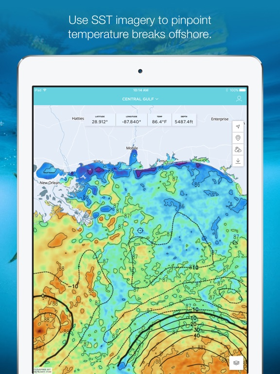
FishTrack provides saltwater anglers with everything they need to find fish. The FishTrack app offers Cloud-free Sea Surface Temperature (SST) charts, high-definition global satellite imagery, including water temperature charts, water color, currents, tides, moon phase and marine weather forecasts – all in one layered tool. Users can mark ‘hot spots’ and record GPS locations of temperature breaks and color barriers. Save imagery and overlay data for offline use to identify bite zones while navigating offshore.
With FishTrack you can:
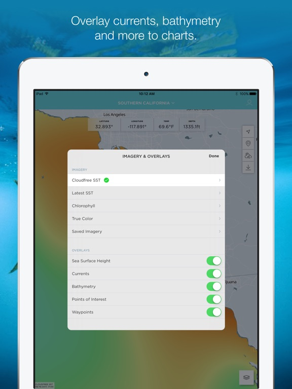
-View the Latest SST and Chlorophyll imagery
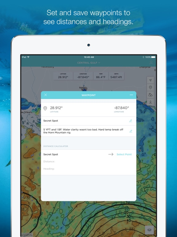
-Mark, name and save data of potential hot spots
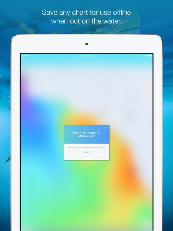
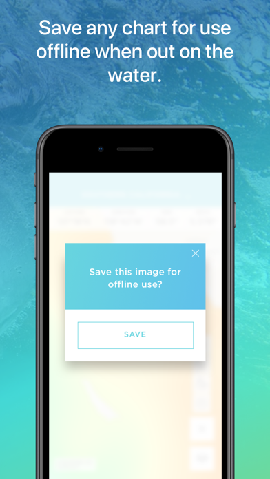
-Save fishing chart imagery for offline use
-Plot waypoints and calculate distances
-Overlay bathymetry, ocean currents and sea surface height
-View marine weather forecasts
-View your current location while offline
Don't fish blind. Save time and fuel with the FishTrack app. Download now to get started!
We want to hear from you! Submit your questions or comments through our app to let us know what you think. If you'd like to speak directly with our customer service team, please e-mail us at: support@fishtrack.com.
— FishTrack Premium purchase small print —
• Subscription services/benefits (described above) are rendered for 1 month or 1 year period depending on product selection
• Payment will be charged to iTunes Account at confirmation of purchase
• Subscription automatically renews unless auto-renew is turned off at least 24-hours before the end of the current period
• Account will be charged for renewal within 24-hours prior to the end of the current period, and identify the cost of the renewal
• Subscriptions may be managed by the user and auto-renewal may be turned off by going to the user's Account Settings after purchase
• Any unused portion of a free trial period, if offered, will be forfeited when the user purchases a subscription to that publication, where applicable
• Full terms and conditions can be found here https://www.fishtrack.com/terms-of-use http://www.fishtrack.com/privacy-policy/
Show More
최신 버전 3.0.0의 새로운 기능
Last updated on Apr 15, 2024
오래된 버전
We've updated the app for iOS 17 and made some small improvements.
As always, we appreciate any feedback - your comments help us continue working to build the best fishing app possible. Feel free to leave a review, or drop us a line at support@fishtrack.com
As always, we appreciate any feedback - your comments help us continue working to build the best fishing app possible. Feel free to leave a review, or drop us a line at support@fishtrack.com
Show More
Version History
3.0.0
Apr 15, 2024
We've updated the app for iOS 17 and made some small improvements.
As always, we appreciate any feedback - your comments help us continue working to build the best fishing app possible. Feel free to leave a review, or drop us a line at support@fishtrack.com
As always, we appreciate any feedback - your comments help us continue working to build the best fishing app possible. Feel free to leave a review, or drop us a line at support@fishtrack.com
2.1.1
Sep 20, 2022
We've fixed a crash affecting editing waypoints on the map and updated our help section located on the settings screen.
As always, we appreciate any feedback - your comments help us continue working to build the best fishing app possible. Feel free to leave a review, or drop us a line at support@fishtrack.com
As always, we appreciate any feedback - your comments help us continue working to build the best fishing app possible. Feel free to leave a review, or drop us a line at support@fishtrack.com
2.1.0
Jul 26, 2022
We've fixed some bugs and made some small improvements to the app.
As always, we appreciate any feedback - your comments help us continue working to build the best fishing app possible. Feel free to leave a review, or drop us a line at support@fishtrack.com
As always, we appreciate any feedback - your comments help us continue working to build the best fishing app possible. Feel free to leave a review, or drop us a line at support@fishtrack.com
2.0.14
Nov 18, 2021
- Fixes a crash for rendering region imagery.
- Other minor bug fixes and perfomance improvements.
- Other minor bug fixes and perfomance improvements.
2.0.13
Sep 30, 2021
- Improves rendering of current and bathymetry overlays for regions around New Zealand.
- Fixed a cache issue that some users were experiencing for Cloudfree SST charts.
- Other minor bug fixes and perfomance improvements.
- Fixed a cache issue that some users were experiencing for Cloudfree SST charts.
- Other minor bug fixes and perfomance improvements.
2.0.12
Jul 12, 2021
- Fixes a crash that some users were experiencing after logging in.
- Removes persistent review pop-up from appearing when accessing imagery and overlays.
- Minor bug fixes and improvements.
- Removes persistent review pop-up from appearing when accessing imagery and overlays.
- Minor bug fixes and improvements.
2.0.11
Feb 17, 2021
- Fixed saved offline imagery rendering
- Minor Bug fixes
- Minor Bug fixes
2.0.10
Aug 13, 2020
Fixed the Offline Mode Bug. Other minor updates.
2.0.8
Mar 18, 2020
Map bug fix. Thanks for your patience!!! If you would like to give us feedback or want us to make things right for you, don't hesitate to email support@fishtrack.com.
2.0.7
Aug 6, 2018
- Contact preferences for new users
- Minor ding repairs
- Minor ding repairs
2.0.6
Mar 12, 2018
- Improvements to map zoom functionality
- Fix for marine forecast bug
- New user account messaging
- Fix for marine forecast bug
- New user account messaging
2.0.4
Feb 22, 2018
- Fix for background map rendering
- Other minor bug fixes and performance improvements.
- Other minor bug fixes and performance improvements.
2.0.3
Oct 20, 2017
- Improved zooming performance on the map.
- Fixes issue showing time on the tide graph.
- Bug fixes and performance improvements.
- Fixes issue showing time on the tide graph.
- Bug fixes and performance improvements.
2.0.2
Sep 22, 2017
Optimized for iOS 11 and iPhone X
2.0.1
Sep 14, 2017
- Minor bug and crash fixes
- Fix for utilizing AVHRR imagery in Oceania regions
- Design adjustments
- Spanish Localization
- Fix for utilizing AVHRR imagery in Oceania regions
- Design adjustments
- Spanish Localization
2.0.0
Aug 22, 2017
- Totally reimagined UI/UX
- Quicker access to all the tools that make FishTrack stand out from the competition
* Saved Imagery, Waypoints, Weather, Tides, and Solunar accessible in one click from the Map interface
- Region selection/change is now in a quick dropdown at the top of the Map
- Ability to save one Waypoint and take detailed notes on your favorite spots
- Distance/Heading calculator that let's you find the distance/heading between any two Waypoints
- Integrated and more versatile Offline Mode
1.1.0
Dec 20, 2015
- New login experience
- Email/password only registration enabled
- Improved chart thumbnail display
- Links to provide customer feedback
- Updated style changes to app
- Email/password only registration enabled
- Improved chart thumbnail display
- Links to provide customer feedback
- Updated style changes to app
1.0.1
Jul 27, 2015
-Implemented in-app purchase for subscriptions
-Added newest regions in Asia
-Added newest regions in Asia
1.0
Feb 18, 2015
FishTrack - Charts & Forecasts FAQ
제한된 국가 또는 지역에서 FishTrack - Charts & Forecasts를 다운로드하는 방법을 알아보려면 여기를 클릭하십시오.
FishTrack - Charts & Forecasts의 최소 요구 사항을 보려면 다음 목록을 확인하십시오.
iPhone
iOS 13.0 이상 필요.
iPad
iPadOS 13.0 이상 필요.
iPod touch
iOS 13.0 이상 필요.
FishTrack - Charts & Forecasts은 다음 언어를 지원합니다. 스페인어, 영어
FishTrack - Charts & Forecasts에는 인앱 구매가 포함되어 있습니다. 아래 요금제를 확인하세요.
FishTrack Premium Monthly
₩18,000
FishTrack Premium Annual
₩119,000
FishTrack.com & App
₩110,000
FishTrack.com & App
₩22,000

