HAWAII ISLANDS – Marine Map
Raster Nautical Charts
₩4,400
3.5for iPhone, iPad and more
Age Rating
HAWAII ISLANDS – Marine Map 스크린 샷
About HAWAII ISLANDS – Marine Map
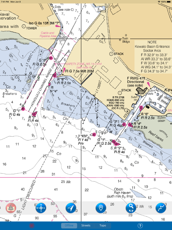
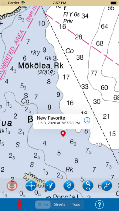
THE ALL NEW ADVANCED MARINE RASTER NAUTICAL CHARTS APP FOR BOATERS AND SAILORS!
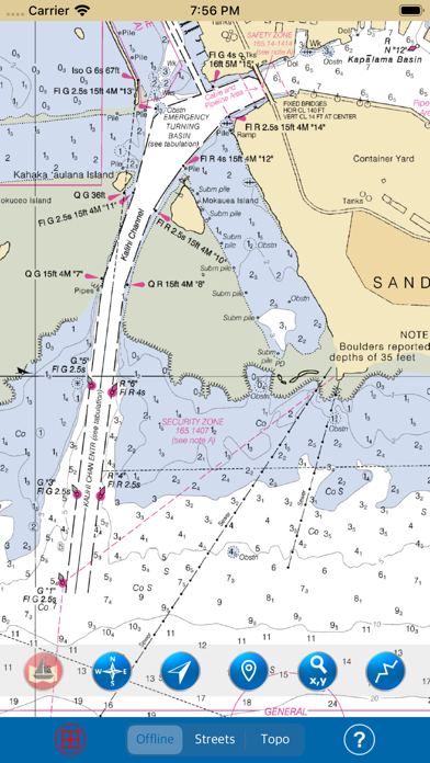
THIS MAP PROVIDES ALL THE NECESSARY TOOLS FOR EASY NAVIGATION ON WATER. CONTINUOUS CHARTS DISPLAY MAKES IT MORE EASIER FOR SAILING AND AS THERE WILL BE NO INTERNET ON SEA, THIS CHART IS FASTER FOR NAVIGATION.
NO WAITING TIME FOR NAUTICAL CHART DOWNLOADS. READY TO USE, SEAMLESS FOR CONTINUOUS NAVIGATION!
COMBINATION OF COASTAL CHARTS, SMALL CRAFT AND HARBOR CHARTS FOR EASY NAVIGATION.
ALL CHARTS OVERLAY IS ARRANGED IN A SEAMLESS ORDER, BASED ON CHART SCALE AND PRIORITY.
NO NEED TO CHANGE CHARTS MANUALLY, THEY ARE READY FOR CONTINUOUS NAVIGATION.
● ALL MARINE RASTER NAUTICAL CHARTS ARE FROM NOAA SOURCES.
● ALL CHARTS ALIGNED WITH ORIGINAL CHART CO-ORDINATES, ARE ACCURATE FOR USE.
● GPS - SHOWS & UPDATES USER CURRENT LOCATION ON MAP.
● SEAMLESS CHART OVERLAY DISPLAY, USE THEM AS LONG AS YOU BOAT.
● HIDE AND SHOW CHART OVERLAY TO SEE DIFFERENCE IN AERIAL OR OTHER MAPS.
● INTERACTIVE COMPASS, MOVE AND PLACE ANYWHERE ON MAP SCREEN.
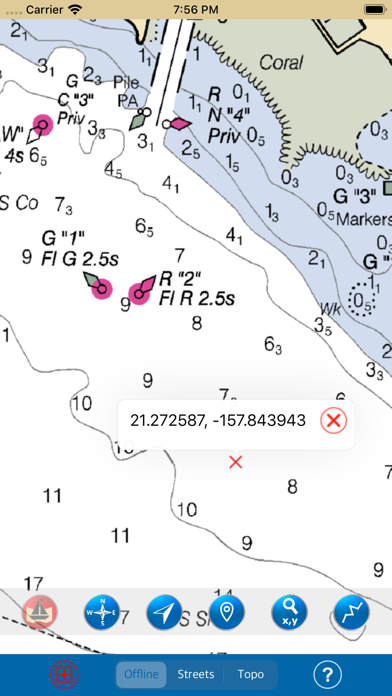
● KNOW ANY LOCATION COORDINATE WITH A SINGLE TAP.
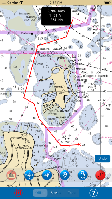
● FIND DISTANCES WITH ROUTE TOOL, DRAW ON MAP AND NAVIGATE ALONG THE ROUTE.
● GOTO MAP LOCATION BY ENTERING LATITUDE/LONGITUDE.
● INSERT UNLIMITED FAVOURITE MARKERS ON MAP. PHOTO TAGGED FACILITY FOR MARKERS WITH EMAIL OPTION. ADD MULTIPLE PHOTOS TO FAVOURITE MARKERS (MAX 3 ALLOWED). EMAIL FAVOURITE MARKERS AS KMZ FILE.
● MAP USER INFORMATION.
NOTE: All charts are Geo-positioned to match the exact location of features displayed on charts but there may be some difference between the positions of actual objects that are in the water or sea and charts because of the different chart scales.
Disclaimer: The Raster Nautical Charts data provided in all charts is from NOAA and is for reference purposes only and not for navigation.
We strive to provide the best products to the customers. Any suggestions from the users of this product are welcome to make the app more useful.
HAPPY BOATING AND SAILING ALL THE TIME!
Show More
최신 버전 3.5의 새로운 기능
Last updated on Jun 8, 2020
오래된 버전
- Important bug fixed where map not showing in lower zoom levels in iOS 13.
- Updated to new devices and iOS 13.
- Updated to new devices and iOS 13.
Show More
Version History
3.5
Jun 8, 2020
- Important bug fixed where map not showing in lower zoom levels in iOS 13.
- Updated to new devices and iOS 13.
- Updated to new devices and iOS 13.
3.0
May 30, 2019
1. iOS 12 Compatibility and supports latest iPhone and iPad devices.
2. Completely New Feature Interface and Design.
3. Faster chart viewing experience.
4. Interactive Compass (Move and Place anywhere on Map screen).
5. Improved Favourite feature, Add more photos to Favourite and Email supports Kmz file export.
6. Ability to clear Co-ordinate info pin. either use clear button (newly provided) or tap back on the same pin.
7. Minor bugs fixed.
1.0
Jun 2, 2017
HAWAII ISLANDS – Marine Map FAQ
제한된 국가 또는 지역에서 HAWAII ISLANDS – Marine Map를 다운로드하는 방법을 알아보려면 여기를 클릭하십시오.
HAWAII ISLANDS – Marine Map의 최소 요구 사항을 보려면 다음 목록을 확인하십시오.
iPhone
iOS 10.0 이상 필요.
iPad
iPadOS 10.0 이상 필요.
iPod touch
iOS 10.0 이상 필요.
HAWAII ISLANDS – Marine Map은 다음 언어를 지원합니다. 영어


