The app contains all offline mile markers and information for the Pacific Crest Trail. A must have for hiking the PCT in 2019 and data for 2019.
Every section for the 3 states are available to download and keep offline.
Includes an Apple Watch app to provide the hiker with GPS and altitude information.
Includes a hiker chat to share notes with other hikers around you. Send real time messages with your location. Receive all messages from the trail with their location.
Every single mile is available offline thanks to halfmile up to date information.
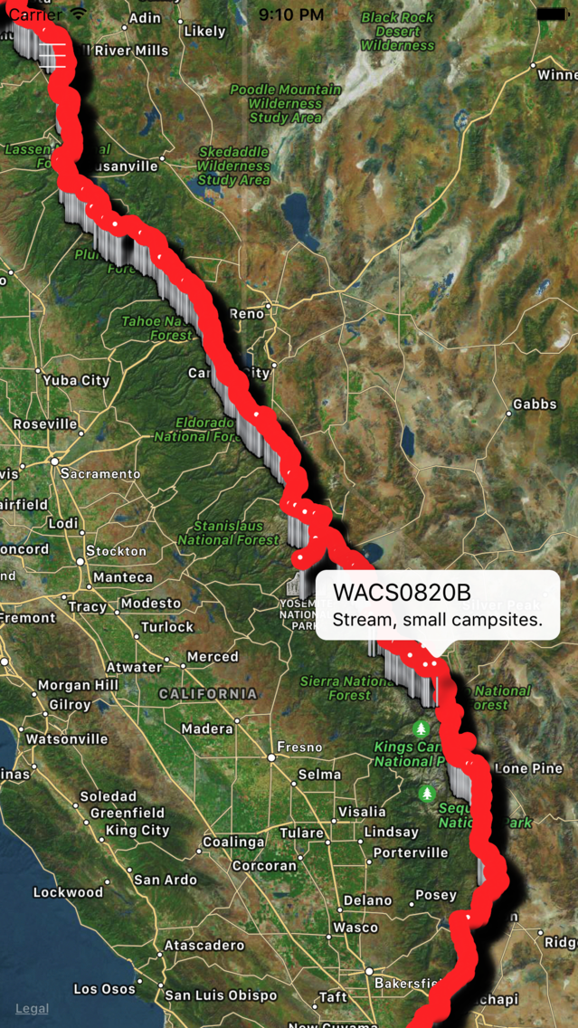
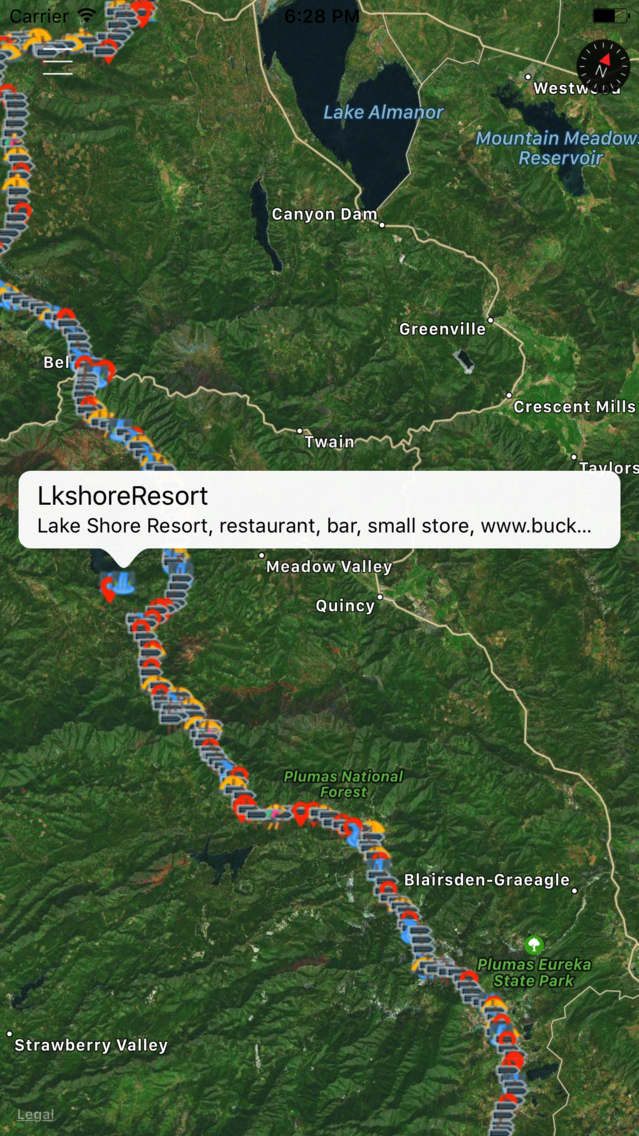
This app provides information to hikes that other hikes have reported, PCT makers, water spots, shops, check points, other hikers on the trail, transportation, snow issues as well as trail magic caches.
The app includes a scrollable elevation chart with every important location and elevation with mile markers.
All this information is contributed by hikers with this app, so please, report all that information for other hikers behind you. All the reported information is tag by location and time.
Hikers can leave messages on their geographic location for other hikers to find.
Hikers can add permanent and temporal features.
Now hikers can let other hikers where new water cashes are, trail angels or dangers in any location.
When hikers have connection to the internet they can edit the features to help other hikers behind find water, shelter, food, alert for snakes, leave notes to other hikers.
The app includes online up to date water reports as well as offline water reports for the PCT provided by Halfmile.
All new offline maps for the new year ahead. All offline PDFs are available for download.
The app works uses your location to enter the information.
Credit to https://www.pctmap.net/gps/ for the gps data.
This application may continue to use GPS in the background, which can dramatically decrease battery life.