App Description
SafeAround lets you travel safely. Crime mapping, fast & safe itinerary, community alerts and emergency calls on over 80 cities around the world
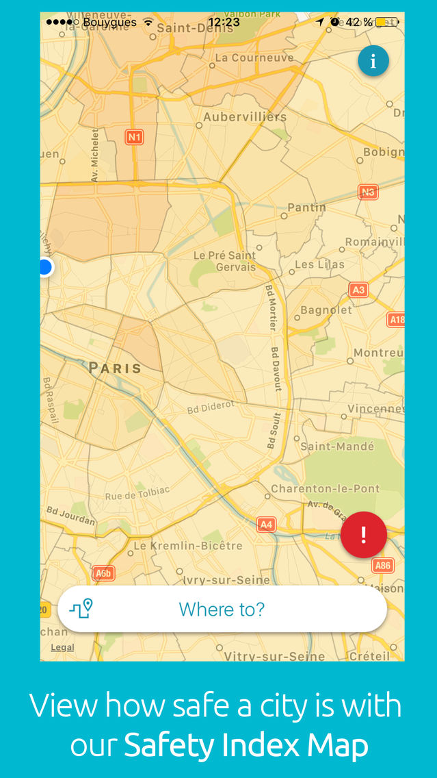
RISK MAPPING
Are you travelling? SafeAround maps dangerous urban zones in the world’s major cities such as PARIS, LONDON, NEW YORK CITY, RIO DE JANEIRO...
Based on official public data, when available, our SAFETY INDEX aggregates traffic accidents, assaults and theft data to assess the safety level of every place.
The map colors (Light Yellow to Red) reflect each zone’s Safety Index.
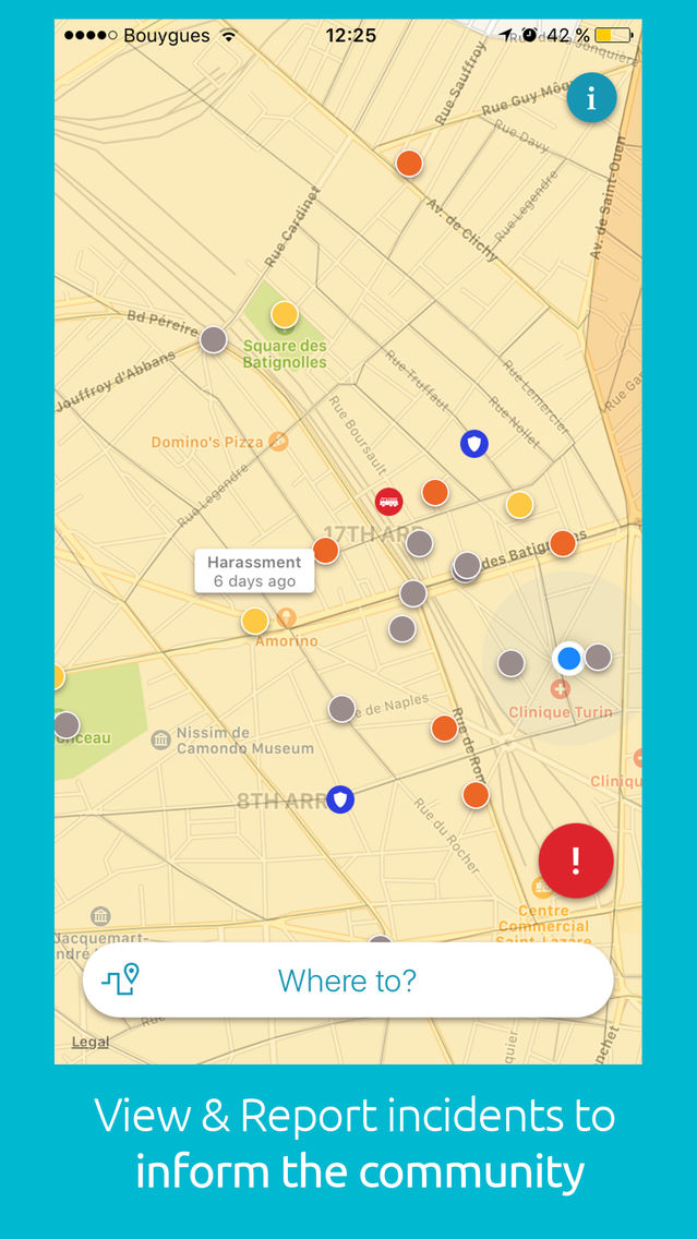
You can find on the map some useful points of interest:
-police stations
-firestations
-hospitals
View the places where incidents have happened.
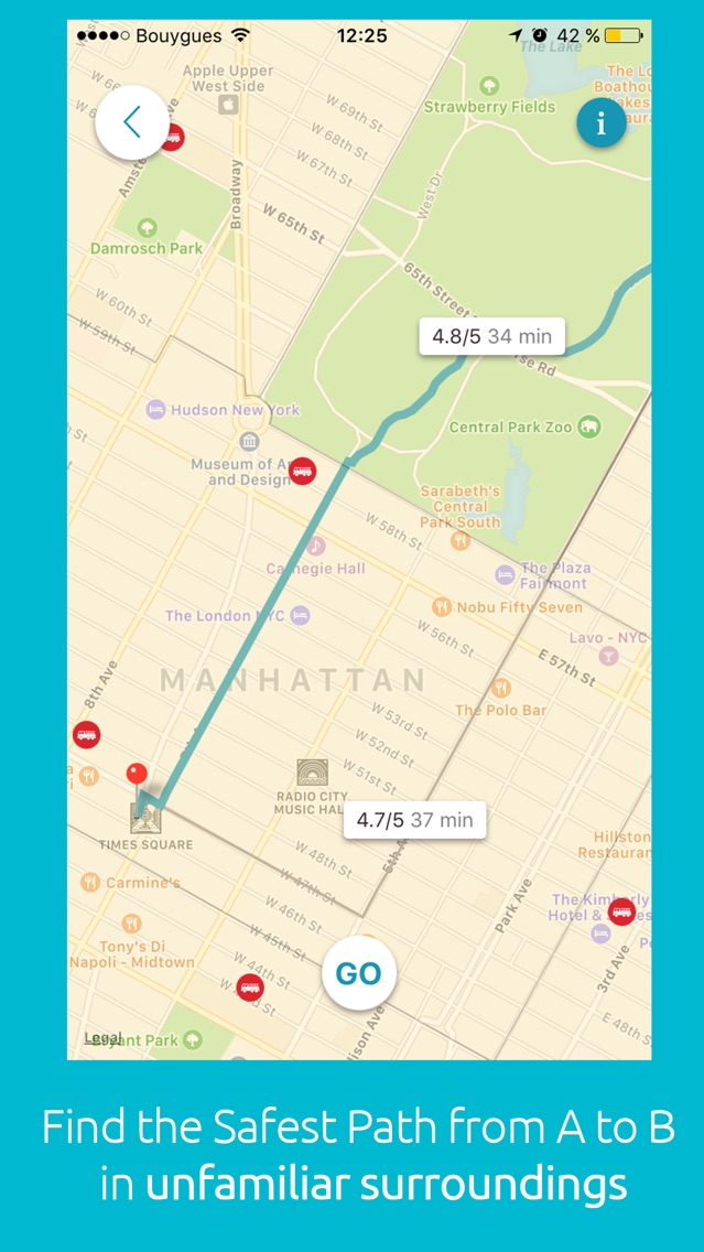
ITINERARY: AVOID DANGERS
Avoid dangerous areas when you travel in unfamiliar places.
Assess the danger of alternative itineraries by safety and length : for each itinerary, you can see its Safety Index and the journey time, in order to chose the one that suits you.
INTERNATIONAL EMERGENCY CALLS
Whichever country you’re in, call local emergencies with our unique Emergency Call Button
INFORMATION
Signal incidents
INFORMATION
Report incidents of which you are a witness or victim:
*Assault
*Sexual assault
*Harassment
*Theft & Pickpocket
*Protest
*Other
CONTACT & DETAILS
Visit our website: https://www.city-safe.com for even more details on city safe travel.
Questions or suggestions about itineraries? Send us an email at contact@safearound.com
Follow us on Facebook: https://www.fb.com/SafeAround/
The app requires an internet access (Wifi or Roaming) and needs access to localization services. Continuous usage of the GPS might increase battery usage. Emergency Call might induce fees depending on the country you’re in.