The Wildfire Tracker: Be aware of every wildfire around the world with an all-in-one wildfire map & weather tracker right on your phone.
The Wildfire Tracker app is an essential tool for anyone living in high-risk wildfire areas or planning to travel to such areas. The Wildfire Tracker provides you with real-time wildfire map, detailed wildfire updates, weather forecasts, wind map, air quality info & real-time allerts from trusted sources like The National Interagency Fire Center, Canadian Interagency Forest Fire Centre and NASA to help users stay safe.
KEEP YOURSELF SAFE:
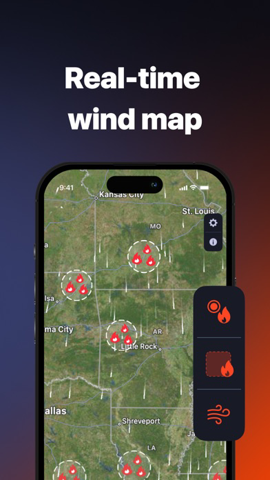
- See all the active hotspots and wildfires on the interactive map with all the details about active wildfires you might need;
- Track all active warnings, watches, alerts and statements from the National Weather Service, represented as interactive polygons on a map. Hold down on a polygon to see the full details;
- Receive push notifications whenever there’s a wildfire alert for the bookmarked location;
- Choose the most convenient map type (standard, hybrid, satellite), search locations, add them to bookmarks, and stay out of harm’s way.
- Get detailed Air Quality Index (AQI) data & wind directions to keep yourself safe & healthy during the fire season.
PLAN YOUR LIFE AROUND FIRES:
- Keep yourself safe with real-time updates on wildfire hotspots in the US, Canada, and globally, complete with behaviour and spread details;
- Stay informed through push notifications on wildfires near your location or bookmarked areas;
- Use interactive maps to understand fire proximity and track its movement.
STAY AHEAD WITH WEATHER FORECASTS:
- Get precise weather forecasts anywhere in the world;
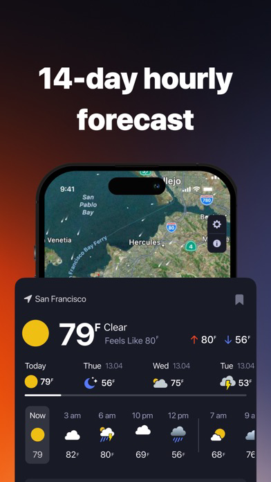
- Access daily and hourly forecasts, including temperature, precipitation amount and probability, wind speed and direction, visibility, humidity, and pressure;
- Understand wind patterns with our animated wind map - vital for anticipating fire spread direction.
ENSURE HEALTHY LIVING CONDITIONS:
- Check the Air Quality Index for any global location with an hourly forecast for 84 hours;
- Learn about the primary pollutant and AQI values of all pollutants.
INTERACT WITH EASE:
- Find locations through text search, auto-location, or a simple tap on the map;
- Choose from standard, hybrid, or satellite background maps for better clarity and understanding.
Get The Wildfire Tracker Premium:
- Comprehensive 14-day forecasts;
- Hourly weather forecast;
- Air pollutants details;
- Ad-free usage.
Subscription payments will be charged to your App Store account upon confirmation of your purchase. Subscriptions will automatically renew and you will be charged unless auto-renew is turned off or unless you cancel at least 24 hours prior to the end of the current subscription or trial period. Any unused portion of a free trial period will be forfeited when you purchase a premium subscription during the free trial period. The cost of renewal depends on the Subscription Plan you choose.
Subscriptions and auto-renewal may be managed by going to Account Settings after purchase or by contacting Customer Support.
Privacy Policy: https://retenica.com/privacy_policy
Terms: https://retenica.com/terms_of_use