Age Rating
4+
Apps in this category do not contain restricted content.
9+
Apps in this category may contain mild or occasional cartoon, fantasy or real-life violence, as well as occasional or mild adult, sexually suggestive or horrifying content and may not be suitable for children under 9 years of age.
12+
Apps in this category may contain occasional mild indecent language, frequent or intense cartoon or real-life violence, minor or occasional adult or sexually suggestive material, and simulated gambling, and may be for children under 12 years of age.
17+
You must be at least 17 years old to access this App.
Apps in this category may contain frequent and intense offensive language; Frequent and intense cartoon, fantasy or realistic violence: frequent and intense adult, scary and sexually suggestive subjects: as well as sexual content, nudity, tobacco, alcohol and drugs, may not be suitable for children under 17 years of age.
Uinta 스크린 샷
Uinta 포스터Uinta 포스터Uinta 포스터Uinta 포스터Uinta 포스터Uinta 포스터Uinta 포스터Uinta 포스터

About Uinta

Improve your fieldwork with Uinta Mapping and Data Collection Software – the ultimate solution for seamless and efficient mapping and field data management. Designed to revolutionize the way you collect, visualize, and share data, Uinta offers a comprehensive suite of features tailored to meet the diverse needs of professionals across various industries, including many customization abilities to help Uinta adapt to your workflow, not the other way around. This is mapping software that goes way beyond mapping!

Top Features

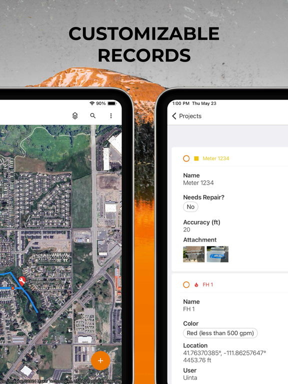
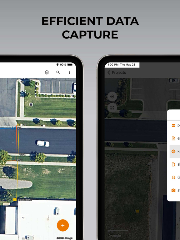
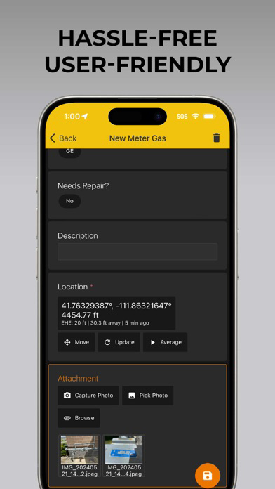
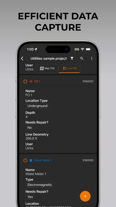
• Efficient Data Capture - Replace paper forms with efficient electronic data entry forms, for use with or without maps
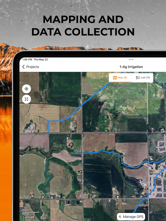
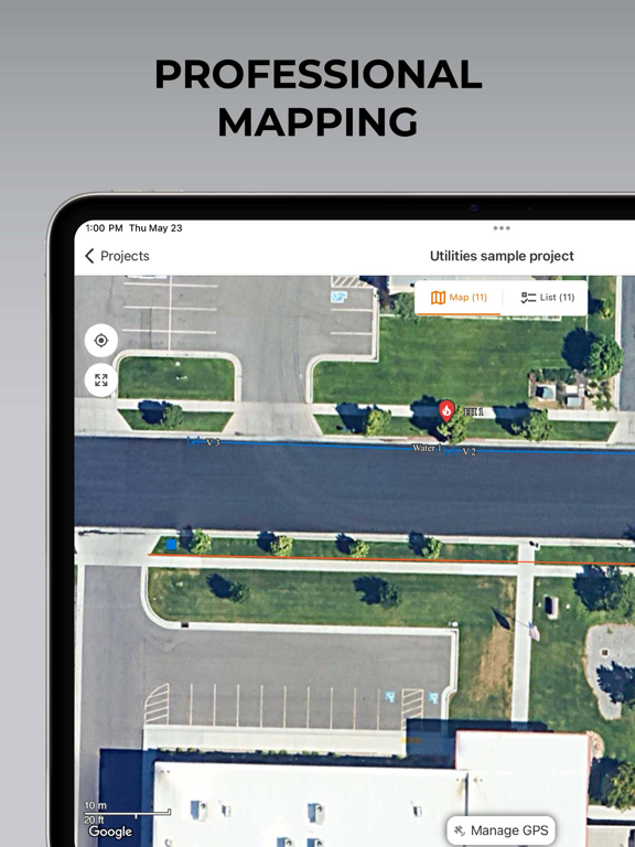
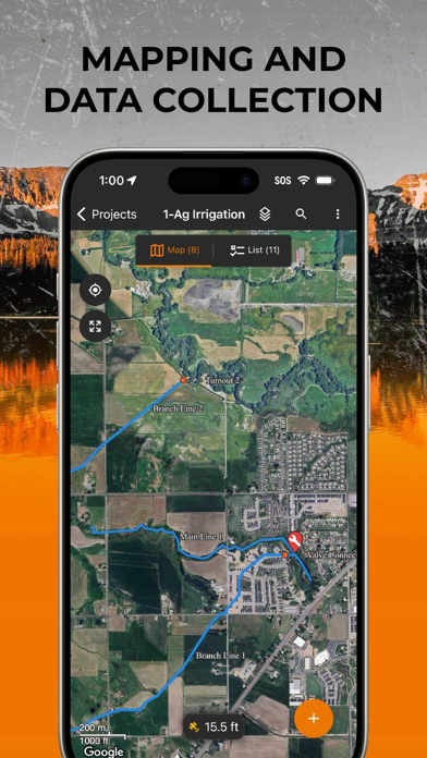
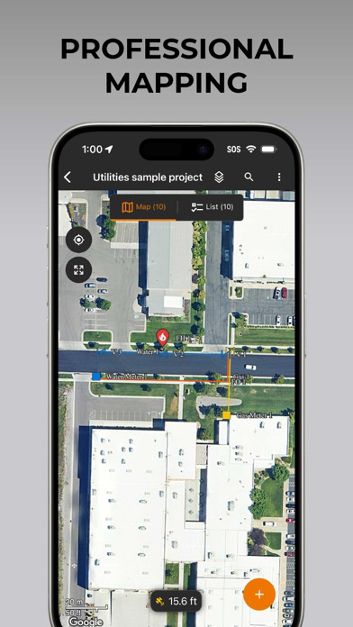
• Professional Mapping - Quickly map points, lines, and areas. High-accuracy mapping supported
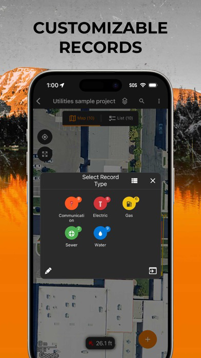
• Customizable - Create custom project templates so field-collected data reflects your job(s)
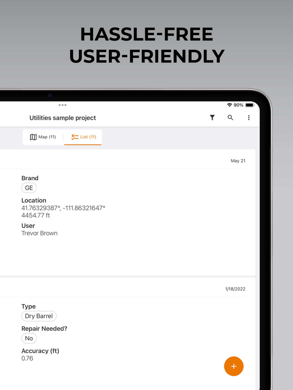
• User-friendly - Simple interface allows users to be trained and collecting data in minutes
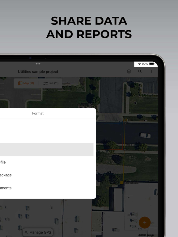
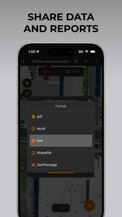
• Sharable - Export data to a file, print professional PDF map reports, and create optional cloud projects
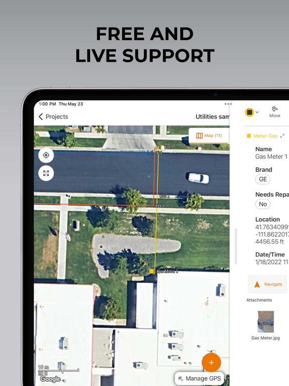
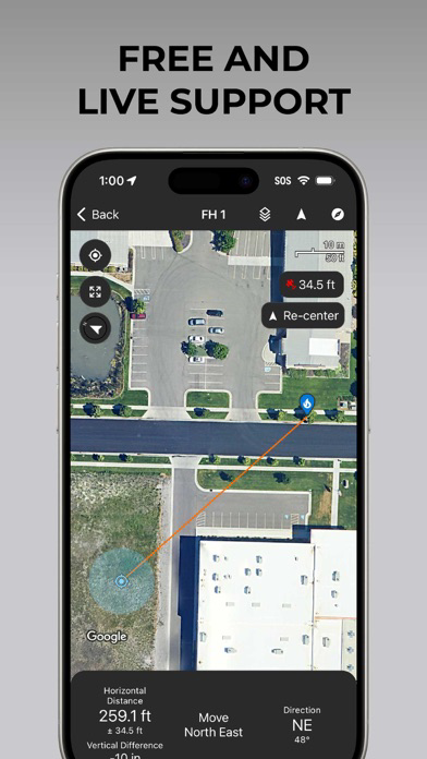
• Included Live Support - Get a jump start on your project with help from Juniper Systems' in-house customer success team


Uinta software is designed to be easily customized to your job. Users may create and save re-usable project templates. Free templates are available for common customer applications such as utility mapping, irrigation, wetland delineations, natural resources, and many more.
Show More

최신 버전 2.8.0의 새로운 기능

Last updated on May 21, 2026
오래된 버전
• Improved the account-selection process during sign-in.
• Remembers reference layer selections for each project and restores the selections when reopening the project.
• Increased area and perimeter precision to three decimal places for acres and square feet.
• Allow users to specify the update rate using a Spire GNSS receiver with Uinta.
Show More
Version History
2.8.0
May 21, 2026
• Improved the account-selection process during sign-in.
• Remembers reference layer selections for each project and restores the selections when reopening the project.
• Increased area and perimeter precision to three decimal places for acres and square feet.
• Allow users to specify the update rate using a Spire GNSS receiver with Uinta.

Uinta FAQ

제한된 국가 또는 지역에서 Uinta를 다운로드하는 방법을 알아보려면 여기를 클릭하십시오.
Uinta의 최소 요구 사항을 보려면 다음 목록을 확인하십시오.
iPhone
iPad

Uinta 대안

당신은 또한 좋아할 수도 있습니다

Juniper Systems Inc.에서 더 많은 것을 얻기