WinGPS Marine
무료
1.27for iPhone, iPad and more
2.5
3 Ratings
Stentec Software
Developer
120.6MB
Size
Nov 7, 2023
Update Date
Navigation
Category
4+
Age Rating
Age Rating
WinGPS Marine 스크린 샷
About WinGPS Marine
Ideal for navigation onboard of your sailing yacht, motorship, canoe or longboat:
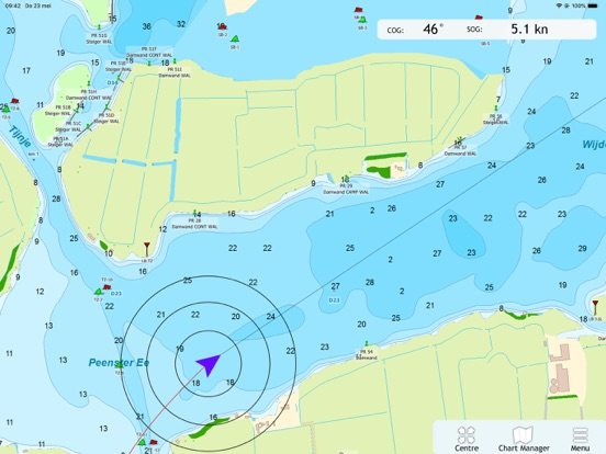
- Always know where you are, how fast you go and what your course is using a GPS receiver (internal or Bluetooth).
- Download the chart of your sailing area and check the current depths, buoys and other nautical information.
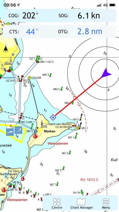
- Place a navigation waypoint and sail to your destination using the course line, Course to Go and Distance to Go.
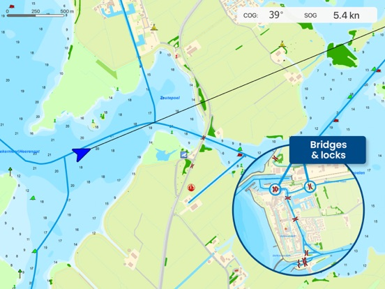
- Waterway network: View the information of the bridges, locks and waterways.
- View your sailed track on the chart.
- Show the distance circles around your GPS position.
At the first start-up of the app, you will be asked to log in with your account. The free default online charts from Apple are available in the app for orientation. The DKW-charts of 2018 and newer, which are connected to your account, can be downloaded directly in this app and be used for navigation.
Show More
최신 버전 1.27의 새로운 기능
Last updated on Nov 7, 2023
오래된 버전
- Update to enable waterway network in 2024 edition charts.
Show More
Version History
1.27
Nov 7, 2023
- Update to enable waterway network in 2024 edition charts.
1.26
Aug 11, 2023
- Waypoints will no longer be duplicated when their respective maps are disabled.
- Fix for usage on Airplay and Apple TV
- Various other enhancements.
- Fix for usage on Airplay and Apple TV
- Various other enhancements.
1.25
Aug 8, 2023
- Waypoints will no longer be duplicated when their respective maps are disabled.
- Fix for usage on Airplay and Apple TV
- Various other enhancements.
- Fix for usage on Airplay and Apple TV
- Various other enhancements.
1.21
Apr 4, 2023
- Problem solved about showing bridges and some other objects.
1.20
Feb 23, 2023
- Improvement that results in fewer crashes.
- Various other improvements and bugfixes.
- Various other improvements and bugfixes.
1.19
Jan 24, 2023
- Waterway Network enabled for 2023 charts.
- New feature: Transparancy enabled for chart that support it.
- Various fixes.
- New feature: Transparancy enabled for chart that support it.
- Various fixes.
1.18
Aug 22, 2022
-Follow-chart better fixated during and after scrolling or zooming
1.17
Aug 18, 2022
- Improvements with data for bridges and locks in all charts
- Improvements in display of other waypoints
- Various other updates
- Improvements in display of other waypoints
- Various other updates
1.16
Jul 4, 2022
- Navigation following the waterways of the route network.
- Various updates in stability.
- Various updates in stability.
1.15
May 9, 2022
- Network active for 2022 charts.
- Solutions for some crashes.
- Solutions for some crashes.
1.14
Sep 23, 2021
- Fix for rotation of the user location marker
1.13
Sep 10, 2021
- Improvements in stabillity
1.12
Aug 26, 2021
- Solution for some Gps problems.
- Improvements in stabillity.
- Improvements in startup speed.
- Improvements in stabillity.
- Improvements in startup speed.
1.11
Jul 29, 2021
- Display of the waterway-network, and extra info on each specific location.
- Solution for some Gps problems.
- Improvements in stabillity
- Solution for some Gps problems.
- Improvements in stabillity
1.10
Jul 21, 2021
- Display of the waterway-network, and extra info on each specific location.
- Solution for some Gps problems.
- Solution for some Gps problems.
1.9
Dec 29, 2020
- Improvements in stability.
1.8.4
Jun 30, 2020
- Small changes in the background when Apple Maps is disabled.
1.8.2
Jun 23, 2020
- A bug was fixed where charts would not be sharp at certain zoom levels.
1.8
Jan 9, 2020
Several stability improvements.
1.6
Sep 23, 2019
Track will be saved after closing the app.
NOAA Tiles added (online only).
Several stability improvements.
German language added.
NOAA Tiles added (online only).
Several stability improvements.
German language added.
1.5
Aug 23, 2019
Track will be saved after closing the app.
NOAA Tiles added (online only).
Several stability improvements.
German language added.
NOAA Tiles added (online only).
Several stability improvements.
German language added.
1.4
Jul 30, 2019
Solved issues regarding showing waypoints.
Improved performance.
Have a nice sailing season!
Improved performance.
Have a nice sailing season!
1.3
Jul 17, 2019
In this release we added some new features:
-Distance circles are now placed around your GPS position.
-Your sailed track is now shown on the chart.
We also made some other small changes and improvements:
-There is a new GPS indicator. It blinks green with every new location update and it blinks red when the location updates are inaccurate.
-You can restart the app with the "Stop Session" function in the main menu.
- Stability fixes.
Have a nice sailing season!
1.2
Jun 6, 2019
- Incremental updates
1.0
May 29, 2019
WinGPS Marine FAQ
제한된 국가 또는 지역에서 WinGPS Marine를 다운로드하는 방법을 알아보려면 여기를 클릭하십시오.
WinGPS Marine의 최소 요구 사항을 보려면 다음 목록을 확인하십시오.
iPhone
iOS 12.1 이상 필요.
iPad
iPadOS 12.1 이상 필요.
iPod touch
iOS 12.1 이상 필요.
WinGPS Marine은 다음 언어를 지원합니다. 네덜란드어, 독일어, 영어


