Real-time Charts for Real-time Navigation!
Experience the zest of Boating, Sailing & Fishing the marine waters with the real-time NOAA's Raster Nautical Charts Overlay.
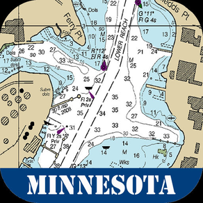
Suitable range of nautical charts arranged as per their geo-co-ordinates that covers complete state for boating sailing. All charts are derived from NOAA's latest edition and are ready to use on the map.
This new version of map contains very user-friendly interface and a soft exploration of charts for easy navigation.
Map Features:
Easy to use map overlay management.
Select Charts by Chart No.
GPS functionality.
Change map types according to the best possible visibility on device to clear appearance with Nautical Charts.
Find Distance between two points on map
Find Area on the map
Get weather updates of anyplace
Adjust transparency according to the best possible visibility
Add to favorites and access them later
Zoom IN & Zoom OUT
Check direction using compass
These Raster Charts are designed to simplify the navigation by that much and tried to keep it simple for boaters and sailors.
Features:
User Friendly Design
Developer with latest technology
Fully Functional App
Universal app (supports all devices)
share with everybody through instant messaging clients and email
All the cool features & updates are available with no restrictions & ads
Disclaimer:
The Information Provided on this app is for Informational Purposes Only, "NOT TO BE USED FOR NAVIGATION".
Internet connection is required to avail features in the app
Maps and map related products available on this app, including but not limited to imagery, data, and data sources are hereby specifically identified as being unsuitable for use in navigation."
Continued use of GPS running in the background can dramatically decrease battery life.