Late Winter 2023/2024
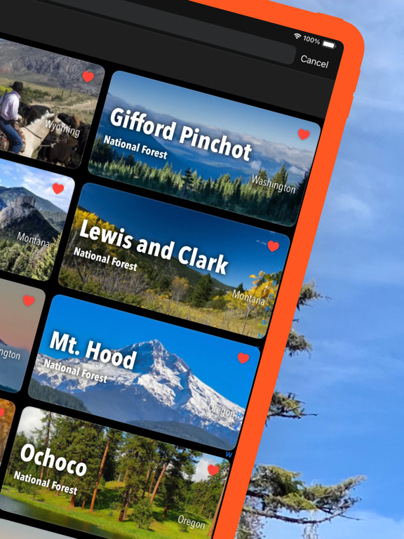
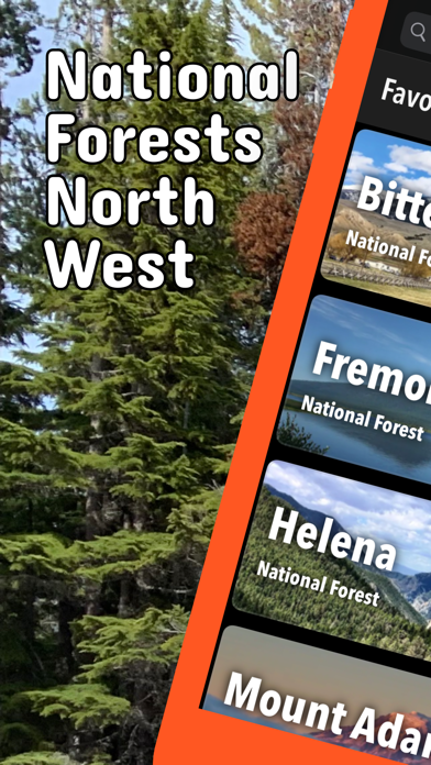
Updates: Chugach National Forest, Kenai Peninsula, Tongass National Forest, Custer Gallatin National Forest, Ochoco National Forest, Umpqua National Forest, Willamette National Forest, Mt. Baker-Snoqualmie National Forest
Updates: Contains the latest data by the National Park Service (NPS), Bureau of Land Management (BLM), United States Forest Service (USFS) and recreation.gov.
Early Winter 2023/2024
New: Reduced download size.
Updates: Colville National Forest.
Updates: Contains the latest data by the National Park Service (NPS), Bureau of Land Management (BLM), United States Forest Service (USFS) and recreation.gov.
Late Fall 2023
Updates: Contains the latest data by the National Park Service (NPS), Bureau of Land Management (BLM), United States Forest Service (USFS) and recreation.gov.
Late Summer 2023
Updates: Caribou-Targhee, Salmon-Challis
Updates: Contains the latest data by the National Park Service (NPS), Bureau of Land Management (BLM), United States Forest Service (USFS) and recreation.gov.
Summer 2023
Updates: Contains the latest data by the National Park Service (NPS), Bureau of Land Management (BLM), United States Forest Service (USFS) and recreation.gov.
Early Summer 2023
Updates: Contains the latest data by the National Park Service (NPS), Bureau of Land Management (BLM), United States Forest Service (USFS) and recreation.gov.
Late Spring 2023
New: We remastered all maps for higher quality and optimized data usage.
Updates: Contains the latest data by the National Park Service (NPS), Bureau of Land Management (BLM), United States Forest Service (USFS) and recreation.gov.
Spring 2023
Updates: Boise, Chugach, Custer Gallatin, Ochoco, Sawtooth, Tongass
Updates: Contains the latest data by the National Park Service (NPS), Bureau of Land Management (BLM), United States Forest Service (USFS) and recreation.gov.
Winter 2022/23
New: Earth isn't flat anymore! Check out the new globe view when you zoom way out.
Updates: Black Hills, Bridger-Teton, Caribou-Targhee, Deschutes, Ochoco, Willamette
Updates: Contains the latest data by the National Park Service (NPS), Bureau of Land Management (BLM), United States Forest Service (USFS) and recreation.gov.
Early Winter 2022
New: Hyperlocal weather data for every Point of Interest (POI).
Updates: Contains the latest data by the National Park Service (NPS), Bureau of Land Management (BLM), United States Forest Service (USFS) and recreation.gov.
Fall 2022
New: Current weather data and 10-day-forecast powered by Apple Weather
Updates: Contains the latest data by the National Park Service (NPS), Bureau of Land Management (BLM), United States Forest Service (USFS) and recreation.gov.
Late Summer 2022
Updates: Flathead, Idaho Panhandle Flathead, Lolo
Updates: Contains the latest data by the National Park Service (NPS), Bureau of Land Management (BLM), United States Forest Service (USFS) and recreation.gov.
Summer 2022
Updates: Use the new POI search feature and find more than 280.000 campgrounds, trailheads, lakes and other points of interest.
Updates: Contains the latest data by the National Park Service (NPS), Bureau of Land Management (BLM), United States Forest Service (USFS) and recreation.gov.
- Applied insect repellent to recently discovered bugs on iPads near you.
- No actual insects were harmed in the making of this latest production.
Early Summer 2022
New: Use the new search feature and find trail heads, campgrounds and all other points of interest in no time.
Updates: Contains the latest data by the National Park Service (NPS), Bureau of Land Management (BLM), United States Forest Service (USFS) and recreation.gov.
Updates: Bridger-Teton, Colville, Payette, Sawtooth
Spring 2022
Updates: With the latest data by NPS, BLM, USFS
Updates: Bighorn, Colville, Idaho Panhandle, Ochoco, Tongass, Umatilla
Spring 2022
Updates: improved 3D maps
Updates: Boise, Kenai Peninsula
Winter 2021/2022
New: Maps in 3D!
Updates: Chugach, Custer Gallatin, Deschutes, Gifford Pinchot, Okanogan-Wenatchee, Rogue River-Siskiyou, Shoshone, Wallowa-Whitman
Winter 2021
Updates for iOS 15 and iPad
Updates: Chugach, Custer Gallatin, Deschutes
Fall 2021
updates: Colville, Deschutes, Malheur, Mt. Baker-Snoqualmie, Mt. Hood, Oregon Dunes, Rogue River-Siskiyou, Santiam Pass, Sawtooth, Siuslaw, Willamette
Summer 2021
new: Download maps directly from the new "maps" menu
new: Reorder maps
updates: Bridger-Teton, Colville, Flathead, Idaho Panhandle, Mt. Baker-Snoqualmie, Payette, Santiam Pass, Sawtooth, Umatilla
Spring 2021
fixed: app didn't start on iOS 12 devices
updates: Custer Gallatin, Helena-Lewis and Clark
Spring 2021
new: streamlined navigation
new: better off-the-grid support and new low data settings
new: improved photo gallery
updates: Colville, Chugach, Custer Gallatin, Deschutes, Mt. Hood, Ochoco, Tongass, Willamette
Winter 2020/21
new: Easily show/hide any category of map markers: trail heads, visitor centers, campgrounds, campsites, restrooms, picnic areas, interpretive exhibits, viewing areas, public transit, parking, things to do, webcams, people, articles, land markers, other sites