THE ALL NEW ADVANCED NATIONAL PARK MAPS ARE FOR HIKERS, CAMPERS, ADVENTURE SEEKERS, NATURE LOVERS COMBINED FOR ALL RECREATIONAL ACTIVITIES!
NOW COMPATIBLE TO ALL LATEST IOS DEVICES!
NEW MAPS – FAST AND EASY PARK MAP OVERLAY!
HAVE FUN ALL THE TIME WITHOUT INTERNET CONNECTION!
NATIONAL PARK MAP COMPRISES ALL THE PARK POI & TRAILS INFORMATION COLLECTED FROM THE NATIONAL PARK SERVICE AND RELEVANT OPEN SOURCES.
MAP CONTAINS ALL TYPES OF TRAILS, ATTRACTIONS, CAMPGROUNDS, FOOD POINTS, VISITOR CENTRE, PICNIC AREAS, PARKING AREAS, DRINKING WATER, RANGER STATION AND ALL POINT OF INTERESTS AVAILABLE WITHIN THE PARK COVERAGE.
MAP DATA:
▪ INCLUDES ALL LAKES, RIVERS, STREAMS, TRAILS!
▪ ELEVATION CONTOURS WITH 25 METER INTERVAL!
▪ ALL ROADS AND RAILWAYS FROM TIGER!
▪ ALL PARK BOUNDARIES ARE FROM NATIONAL PARK SERVICE!
MAP FEATURES:
▪ GPS FEATURE – SHOWS HEADING DIRECTION!
▪ INTERACTIVE CHART OVERLAY DISPLAY, USE THEM AS LONG AS YOU HIKE, BIKE, WALK, CLIMB OR DO ANY ACTIVITY WITHIN THE PARK!
▪ HIDE OR SHOW CHART OVERLAY TO SEE DIFFERENCE IN ARIEL OR OTHER VIEWS!
▪ HIDE OR SHOW PARK POINT OF INTERESTS!
▪ INSERT UN-LIMITED FAVOURITE MARKERS ON MAP!
▪ ADD 3 PHOTOS TO MARKERS WITH EMAIL AS KMZ OPTION!
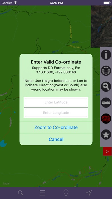
▪ FIND DISTANCE BETWEEN ANY 2 POINTS ON MAP!
▪ SEARCH LOCAL PLACES OR POINTS (works online)!
▪ SET MAP TYPES CLICKING SINGLE BUTTON!
MAP USER INFORMATION!
NOTE: All data on map are embedded to match the exact location of features displayed on NPS & reference sources but there may be some difference between the positions of actual objects.
Disclaimer: National Park Map and Points presented are for information and reference purposes only and not for navigation.
We strive to provide the best products to the end users. Any suggestions from the users of this product are welcome to make the app more useful.
HAPPY NATIONAL PARK RECREATION ALL THE TIME!