i-Boating:Germany Marine Chart
Lake Fishing Maps & Navigation
HK$ 288.00
114.0.0for iPhone, iPad and more
Age Rating
i-Boating:Germany Marine Chart 螢幕截圖
About i-Boating:Germany Marine Chart
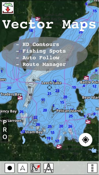
This App offers access to marine vector covering German waters (derived from BSH data). First marine GPS app to have route assistance with Voice Prompts for marine navigation. You can create new boating routes or import existing GPX/KML routes. It supports Nautical Charts course up orientation. Includes Tide & Currents prediction.
►FEATURES
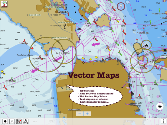
√ Beautiful and detailed Hardware/GPU accelerated vector charts (text stays upright on rotation)
√ Long press to query the details of Marine object (Buoy, Lights, Obstruction etc).
√ Customizable depth(Ft/Fathom/Meter) and distance units (km/mi/NM)
√ Customizable Shallow Depth.
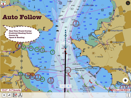
√ Record tracks, Autofollow with real-time track overlay & predicted path vector.
√ Voice Prompts for marine navigation (requires GPS )
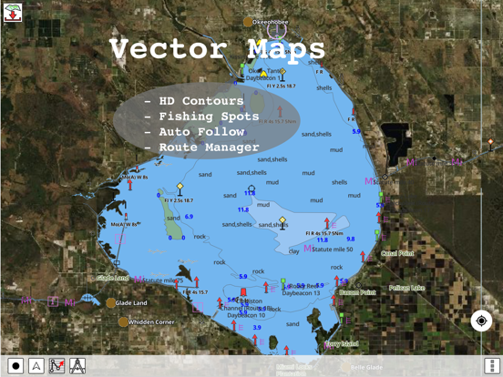
√ 1ft / 3ft depth contour maps for anglers for selected lake maps.
√ Supports GPX/KML for boating route editing/import.
√ Tide & Currents prediction.
√ Seamless chart quilting of marine charts
√ Enter or import Waypoints.
► MAPS
The maps include coverage of Germany (both coastal and inland waters) (derived from BSH data).
►ROUTE MANAGEMENT / TRIP PLANNING
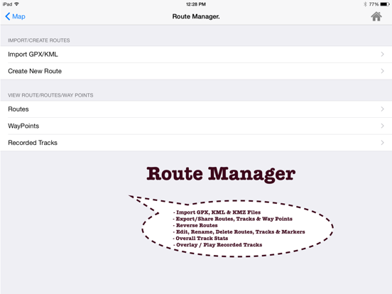
√ Create New Route/Edit Existing Routes
√ Move Points
√ Add points to an existing route leg
√ Delete / Rename points
√ Import GPX, KML & KMZ files
√ Plot/Edit Routes
√ Enter Waypoints
√ Share/Export Routes, Tracks & Markers
√ Reverse Routes
►GPS FEATURES
√ Auto Follow
* Real Time Track Overlay
* Predicted Path Vector
* Course Up (Text stays upright)
* Speed & Heading
√ Route Assistance With Voice Prompts
* Prompts when approaching a boating route marker
* Continous distance and ETA updates
* Alerts when sailing/boating off route
* Alerts when boating in wrong direction
√ Record Tracks
►TIDE & CURRENTS
* For US, Canada, UK, Germany & New Zealand
* High/Low Tides
* Tidal Current Prediction
* Active Current Stations
► SHARING
* Share tracks/routes/markers on Facebook & Twitter
* Export tracks/routes/markers as compressed GPX files.
Sample Nautical Charts (please visit http://gpsnauticalcharts.com/main/de-nautical-charts-by-folio.html)
►Dysentery
►Berlin-Spandau navigation canal
►Spree-Oder Waterway
►Rhine-Herne Canal
►Wesel-Datteln Canal
►Elbe-Havel Canal
►Lower Havel Waterway (Spandau - Plaue)
►Saar
►Dortmund-Ems Canal
►Elbe Lateral Canal
►Weser
►Rhine-Main-Danube Canal
►Havel-Oder Waterway
►West Or
►Neckar
►Danube
►Moselle
►Mittellandkanal
►Main
►North Sea
►Rhine
►Elbe
►Baltic Sea
Show More
最新版本114.0.0更新日誌
Last updated on 2022年03月16日
歷史版本
- Anchor alarm support
- Compiled with latest version of Xcode
- Compiled with latest version of Xcode
Show More
Version History
114.0.0
2022年03月16日
- Anchor alarm support
- Compiled with latest version of Xcode
- Compiled with latest version of Xcode
84.0.0
2019年01月18日
- Compiled with latest version of Xcode
- Support for perspective mode/bird's eye view mode
- More lakes added in Bavaria region
- Support for perspective mode/bird's eye view mode
- More lakes added in Bavaria region
52.0.0
2015年11月05日
i-Boating:Germany Marine Chart 價格
今日:
HK$ 288.00
最低價格:
HK$ 278.00
最高價格:
HK$ 288.00
i-Boating:Germany Marine Chart FAQ
i-Boating:Germany Marine Chart在以下限制國家以外的其他地區可用:
Taiwan
i-Boating:Germany Marine Chart支持俄文, 巴克摩挪威文, 德文, 法文, 瑞典文, 芬蘭文, 英文, 荷蘭文
點擊此處瞭解如何在受限國家或地區下載i-Boating:Germany Marine Chart。
以下為i-Boating:Germany Marine Chart的最低配置要求。
iPhone
須使用 iOS 8.0 或以上版本。
iPad
須使用 iPadOS 8.0 或以上版本。
iPod touch
須使用 iOS 8.0 或以上版本。
相關視頻
Latest introduction video of i-Boating:Germany Marine Chart on iPhone


