MapOut
Beautiful hiking & cycling map
HK$ 38.00
3.4.12for iPhone, iPad and more
Age Rating
MapOut 螢幕截圖
About MapOut
“MapOut saves the day by using a simple interface to draw routes, and check out elevation profiles… I’m pretty blown away by its capabilities.” – Alee from cyclingabout.com
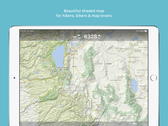
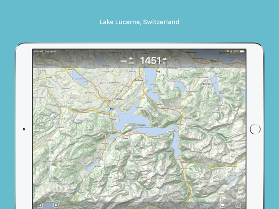
Offline map covering the whole world for iPhone and iPad. Almost as beautiful as a paper map - only more versatile.
- For hikers: With an easy-to-read representation of the terrain, even in the furthest corners without internet
- For cyclists: With cycling route network, speed and distance display
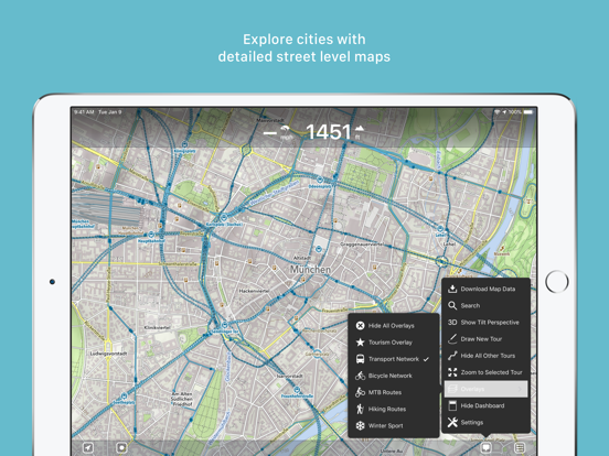
- For city travelers: City maps with tourist information
- For the connoisseur: Simply beautiful map to look at
3D tilt view
- Tilt the device in any direction to get a better impression of the terrain. More information on https://mapout.app.
Search feature
- Search for places, streets, mountains, etc. No internet connection required.
Map material
- MapOut is based on the OpenStreetMap project, the “Wikipedia of Maps” - you can make corrections and additions yourself on OpenStreetMap.org. The latest maps are delivered with periodic updates.
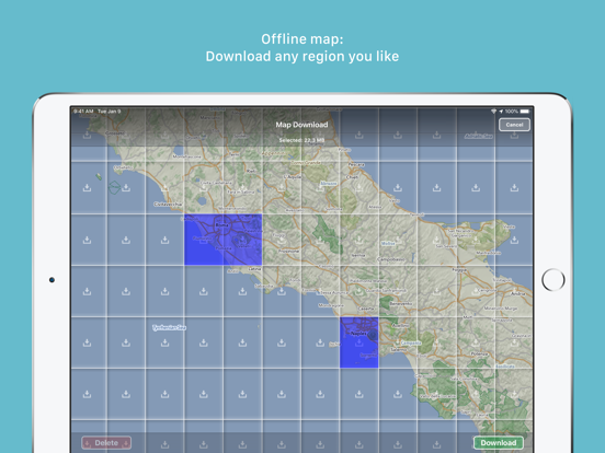
- Download the regions of your choice - the maps can now be displayed without an internet connection (offline map).
Tours
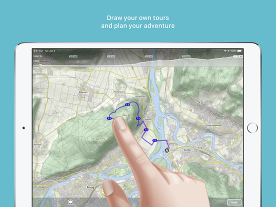
- Drawing: Draw your own routes and waypoints directly on the map. Retouch existing tours and imported GPX files or let them directly snap to the road network.
- Import: With a free “MapOut.me” account you can send directions by email to your device. GPS-Tours can be found as gpx or kml files on many websites with tips for hiking or biking (e.g. on www.gpsies.com)
Record: Take recordings of your own tours and share them with friends.
Information: Quick overview of each tour - length, altitude change, map section and route profile
Map view
- Fast map display (hardware accelerated)
- Step-free zoom, always a pixel-perfect map
- Topographical map with contour lines and shading
- Selectable overlays: Bike/hike/ski routes, sightseeing, public transport
Find all answers to your questions in our user manual: https://mapout.app/manual
Map data © OpenStreetMap contributors (https://www.openstreetmap.org/copyright)
Show More
最新版本3.4.12更新日誌
Last updated on 2023年12月09日
歷史版本
- various bug fixes
Show More
Version History
3.4.12
2023年12月09日
- various bug fixes
3.4.11
2022年11月18日
- various bug fixes
- iOS 16 adaptations
- iOS 16 adaptations
3.4.10
2022年06月03日
- various bug fixes
- added new icons for your waypoint markers
- added new icons for your waypoint markers
3.4.9
2021年09月04日
- various bug fixes
3.4.8
2021年05月09日
- various bug fixes
3.4.7
2021年02月12日
- We have added house numbers (this requires updating the map data on the device)
- various bug fixes
- various bug fixes
3.4.6
2020年11月29日
- various bug fixes
- adaptation for new iPhone devices
- adaptation for new iPhone devices
3.4.5
2020年10月17日
- various bug fixes (sharing tours, missing elements on map)
3.4.4
2020年09月17日
- Plan your tour even better: The dashboard now displays estimated walking and cycling times for selected routes in real time
- Tour organizer: For all your tours, walking and cycling times are given. With a tap on the times you can switch between: walking, cycling or the recorded time
- Map improvements and bug fixes
- Tour organizer: For all your tours, walking and cycling times are given. With a tap on the times you can switch between: walking, cycling or the recorded time
- Map improvements and bug fixes
3.4.3
2020年08月23日
- fixed a crash on some devices during startup
3.4.2
2020年08月15日
- Optimized manual map rotation behavior
- Added setting to disable manual map rotation altogether
- Minor bug fixes
- Added setting to disable manual map rotation altogether
- Minor bug fixes
3.4.1
2020年08月03日
- fixes some new bugs
3.4:
- Rotate the map freely in any direction you like
- Search has been completely revised: better, search-as-you-type results, distance display and the possibility to add waypoints from the search results
- Improved map style
- Many reported bugs fixed (e.g. export of ZIP files with special characters, dashboard problems and more)
3.4
2020年07月29日
- Rotate the map freely in any direction you like
- Search has been completely revised: better, search-as-you-type results, distance display and the possibility to add waypoints from the search results
- Improved map style
- Many reported bugs fixed (e.g. export of ZIP files with special characters, dashboard problems and more)
- Search has been completely revised: better, search-as-you-type results, distance display and the possibility to add waypoints from the search results
- Improved map style
- Many reported bugs fixed (e.g. export of ZIP files with special characters, dashboard problems and more)
3.3.6
2020年01月28日
- minor bug fixes
3.3.5
2019年12月23日
- minor bug fixes
3.3.4
2019年12月07日
- fixed some altitude display related bugs
3.3.3
2019年12月04日
- improved ascent/descent calculation
- improved recording of tours
- fixed some bugs
- improved recording of tours
- fixed some bugs
3.3.2
2019年10月25日
- Various bug fixes
3.3.1
2019年09月28日
- Various bug fixes
3.3
2019年09月19日
By popular request: In the tour organizer you can now make a multi-selection of tours and share, edit or move several elements in one go
- Added icons for mines, quarries and springs
- Improvements in the mountain bike overlay, supplemented by a dot pattern to indicate difficulty
- Enhancements to contour lines and text labels
- iOS 13 adjustments
- Added icons for mines, quarries and springs
- Improvements in the mountain bike overlay, supplemented by a dot pattern to indicate difficulty
- Enhancements to contour lines and text labels
- iOS 13 adjustments
3.2.4
2019年08月16日
- Added icons for fireplaces and playgrounds
- Bug fixes (mostly in export / backup)
- Bug fixes (mostly in export / backup)
3.2.3
2019年08月03日
- Bulk export / backup of all tours (Settings – Tour Organizer – Backup Tours)
- Minor bug fixes
- Minor bug fixes
3.2.2
2019年07月11日
- Improvements for Dutch cyclists
- Workaround for Garmin Connect interoperability
- New round of bug fixes
- Workaround for Garmin Connect interoperability
- New round of bug fixes
3.2.1
2019年07月06日
- Many reported bugs have been fixed
- Added new setting to permanently display map scale
Version 3.2
- Colors! Select different colors for your waypoints and tours
- Choose unique icons for your waypoints
- Drawing/routing tours has been enhanced: You can now choose between different routing options (hiking, biking, shortest and freeform) and select the street width and elevation preference
- Many improvements to our map style: We now added much more icons for rural areas to find drinking water, picnic sites, shelters/huts, caves, etc.
- Overlays are now selectable directly on the main menu
3.2
2019年06月27日
- Colors! Select different colors for your waypoints and tours
- Choose unique icons for your waypoints
- Drawing/routing tours has been enhanced: You can now choose between different routing options (hiking, biking, shortest and freeform) and select the street width and elevation preference
- Many improvements to our map style: We now added much more icons for rural areas to find drinking water, picnic sites, shelters/huts, caves, etc.
- Overlays are now selectable directly on the main menu
- A lot of reported bugs have been fixed
MapOut FAQ
點擊此處瞭解如何在受限國家或地區下載MapOut。
以下為MapOut的最低配置要求。
iPhone
須使用 iOS 8.0 或以上版本。
iPad
須使用 iPadOS 8.0 或以上版本。
iPod touch
須使用 iOS 8.0 或以上版本。
MapOut支持德文, 法文, 英文

