Torres del Paine Park Map
$2.99
5.0.1for iPhone, iPad
Age Rating
Torres del Paine Park Map 螢幕截圖
About Torres del Paine Park Map
"Best digital road and trail map of Torres del Paine National Park."
8 Base Maps:
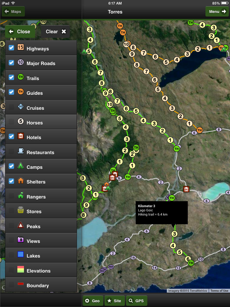
OFFLINE Map (no internet or phone service required), 3 premium imagery map providers, 2 sets of streets, online Terrain and Topo maps
17 Geographic Overlays:
Highways, major roads, trails, guided trails, cruises, horse trails, hotels, restaurants, camps, shelters, rangers, stores, peaks, views, lakes, elevation and park boundary.
Hiking Trails in the App
Bahia Maitenes - Hiking trail = 9.4 km
Cascada Paine - Hiking trail = 8.5 km
Ferrier Peak - Hiking trail = 3.5 km
Glacier Grey - Hiking trail = 7.0 km
La Peninsula - Hiking trail = 9.9 km
Lago Brush - Hiking trail = 17 km
Lago Del Jote Norte - Hiking trail = 4.0 km
Lago Del Jote Sur - Hiking trail = 6.5 km
Lago Del Toro Norte - Hiking trail = 4.4
Lago Geikie - Hiking trail = 10.8 km
Lago Goic - Hiking trail = 6.4 km
Lago Grey East - Hiking trail = 10.0 km
Lago Grey Wharf - Hiking trail = 3.3 km
Lago Paine - Hiking trail = 11.7 km
Laguna Azul View - Hiking trail = 5.0
Laguna Verde - Hiking trail = 12.9 km
Refugio Las Torres - Hiking trail = 10 km
Refugio Los Cuernos - Hiking trail = 11.9 km
Rio De Los Hielos - Hiking trail = 3.5 km
Rio Grey - Hiking trail = 15.0 km
Rio Paine - Hiking trail = 5.7 km
Rio Paine Valley - Hiking trail = 3.3 km
Rio Paso - Hiking trail = 6.0 km
Rio Serrano - Hiking trail = 4.0 km
Rio Serrano West - Hiking trail = 12.7 km
Salto Grande Norte - Hiking trail = 3.0 km
Salto Los Perros - Hiking trail = 10.0 km
Valle Ascencio - Hiking trail = 8.3 km
Valle Del Frances - Hiking trail = 5.0 km
Valley Encantado - Hiking trail = 10.6 km
Valley Pingo - Hiking trail = 12.5 km
Guided Hikes in the App
Cabeza Del Indio - Guided Hike = 8.3 km
Camp Japones - Guided Hike = 4.6 km
Centinela Peak - Guided Hike = 10.2 km
Lago Paine Norte - Guided Hike = 11 km
Lago Quemado - Guided Hike = 9.0 km
Laguna Azul Norte - Guided Hike = 8.6 km
Laguna Cebolla - Guided Hike = 11 km
Punta Negra - Guided Hike = 4.0 km
Vega de la Paloma - Guided Hike = 8.3 km
Social Media:
Videos, Photos, Facebook and Twitter.
Services:
GPS and weather
Languages:
English, Spanish and Portuguese
Show More
最新版本5.0.1更新日誌
Last updated on 2015年09月15日
歷史版本
Software, geography and data updates
Performance improved
Error correction
Show More
Version History
5.0.1
2012年07月29日
Software, geography and data updates
Performance improved
Error correction
Torres del Paine Park Map FAQ
點擊此處瞭解如何在受限國家或地區下載Torres del Paine Park Map。
以下為Torres del Paine Park Map的最低配置要求。
iPhone
iPad
Torres del Paine Park Map支持English


