Early Spring 2024
Updates: Zion National Park
Updates: Contains the latest data by the National Park Service (NPS), Bureau of Land Management (BLM), United States Forest Service (USFS) and recreation.gov.
Winter 2023/2024
Updates: Fishlake National Forest, Zion National Park
Updates: Contains the latest data by the National Park Service (NPS), Bureau of Land Management (BLM), United States Forest Service (USFS) and recreation.gov.
Early Winter 2023/2024
Updates: Bryce Canyon, Capitol Reef, Hovenweep
Updates: Contains the latest data by the National Park Service (NPS), Bureau of Land Management (BLM), United States Forest Service (USFS) and recreation.gov.
Fall 2023
Updates: Antelope Island, Bryce, Coral Pink Sand Dunes, Dead Horse Point, Dixie, Escalante Petrified Forest, Flight, Fremont Indian, Goblin Valley, Green River, Jordanelle, Little Wild Horse Canyon, Moab, Kodachrome Basin, Palisade, Quail Creek, Red Fleet, Sand Hollow, Snow Canyon, Steinaker, Uinta-Wasatch-Cache, Utah Field House of Natural History, Wasatch Mountain, Wild Horse
Updates: Contains the latest data by the National Park Service (NPS), Bureau of Land Management (BLM), United States Forest Service (USFS) and recreation.gov.
Summer 2023
New: Watch some interesting videos and audios, produced by the National Park Service.
Updates: Contains the latest data by the National Park Service (NPS), Bureau of Land Management (BLM), United States Forest Service (USFS) and recreation.gov.
Early Summer 2023
Updates: Tilted Mesa
Updates: Contains the latest data by the National Park Service (NPS), Bureau of Land Management (BLM), United States Forest Service (USFS) and recreation.gov.
Late Spring 2023
New: We remastered all maps for higher quality and optimized data usage.
Updates: Contains the latest data by the National Park Service (NPS), Bureau of Land Management (BLM), United States Forest Service (USFS) and recreation.gov.
Spring 2023
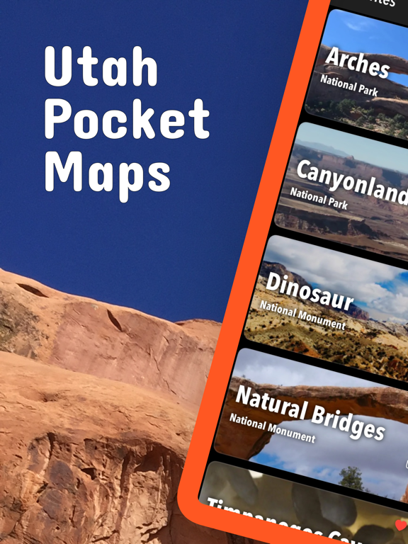
Updates: Arches, Canyonlands, Dinosaur, Sawtooth, Zion
Updates: Contains the latest data by the National Park Service (NPS), Bureau of Land Management (BLM), United States Forest Service (USFS) and recreation.gov.
Winter 2022/23
New: Earth isn't flat anymore! Check out the new globe view when you zoom way out.
Updates: Cedar Breaks, Dixie, Emigrant Trails.
Updates: Contains the latest data by the National Park Service (NPS), Bureau of Land Management (BLM), United States Forest Service (USFS) and recreation.gov.
Early Winter 2022
Updates: Contains the latest data by the National Park Service (NPS), Bureau of Land Management (BLM), United States Forest Service (USFS) and recreation.gov.
Late Fall 2022
New: Current weather data and 10-day forecast powered by Apple Weather
New: Hyperlocal weather data for every Point of Interest (POI).
Updates: Contains the latest data by the National Park Service (NPS), Bureau of Land Management (BLM), United States Forest Service (USFS) and recreation.gov.
Fall 2022
Updates: Arches, Canyonlands, Fishlake, Zion
Updates: Contains the latest data by the National Park Service (NPS), Bureau of Land Management (BLM), United States Forest Service (USFS) and recreation.gov.
Summer 2022
New: Redesigned for iPad!
Updates: Bears Ears, Cedar Mesa
Updates: Contains the latest data by the National Park Service (NPS), Bureau of Land Management (BLM), United States Forest Service (USFS) and recreation.gov.
Summer 2022
Updates: Use the new POI search feature and find more than 41000 campgrounds, trailheads, lakes and other points of interest.
Updates: Contains the latest data by the National Park Service (NPS), Bureau of Land Management (BLM), United States Forest Service (USFS) and recreation.gov.
Early Summer 2022
New: Use the new search feature and find trail heads, campgrounds and all other points of interest in no time.
Updates: Dixie, Sawtooth
Spring 2022
Updates: Contains the latest data by the National Park Service (NPS), Bureau of Land Management (BLM), United States Forest Service (USFS) and recreation.gov.
Updates: Arches, Canyonlands, Dixie, Manti-La Sal, Zion
Spring 2022
Updates: With the latest data by NPS, BLM, USFS
Updates: Coyote Buttes North (The Wave), Dixie, Pony Express
Spring 2022
Updates: improved 3D maps
Updates: Lower Calf Creek Falls, Westwater Canyon
Winter 2021/2022
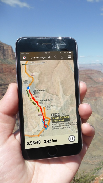
New: Maps in 3D!
Updates: Zion
Winter 2021
Updates for iOS 15 and iPad
Updates: Dinosaur
Fall 2021
fix: bug prevented update of national park alerts and news
updates: Arches, Bryce Canyon, Canyonlands, Capitol Reef, Manti-La Sal, Sawtooth, Zion
Summer 2021
updates: with the latest data provided by the National Park Service, U.S. Forest Service and Bureau of Land Management.
Summer 2021
new: Download maps directly from the new "maps" menu
new: Reorder maps
updates: Dixie, Uinta-Wasatch-Cache
Spring 2021
updates: Arches, Canyonlands, Moab, Old Spanish Trail, Poison Spider Mesa, Sawtooth, Zion
Spring 2021
fixed: app didn't start on iOS 12 devices
updated: Cameo Cliffs, Canyonlands, Wyoming Range