*** If you are running iOS7 or above do not install this version. Please install Whale Alert 2.0 instead ***
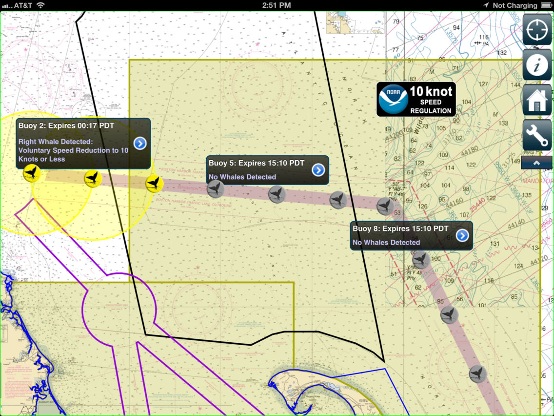
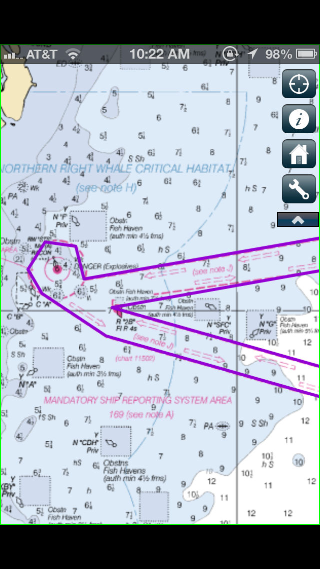
Whale Alert benefits right whale conservation and the maritime community by depicting active right whale management areas, required reporting areas, recommended routes, areas-to-be-avoided and near real-time warnings of the presence of North Atlantic right whales in shipping lanes in and around the Stellwagen Bank National Marine Sanctuary derived from automatic passive acoustic buoys. This information allows vessel operators to avoid collision with right whales by slowing down and heightening their visual awareness. Whale Alert can help reduce the likelihood of ships colliding with these endangered whales, which can injure or kill them.
The Whale Alert App is designed to complement existing protective measures by providing mariners and others with all relevant right whale conservation and management measures in a single location displayed on NOAA nautical charts.
For more information, including a start-up manual and video tutorial go to http://stellwagen.noaa.gov/ and click on Whale Alert.
Whale Alert features include:
• NOAA Atlantic Seasonal Management Areas
• NOAA Atlantic Dynamic Management Areas
• NOAA Atlantic MSR Boundaries
• NOAA Atlantic Recommended Routes
• NOAA and IMO Atlantic designated Areas-to-be-Avoided
• Near Real-time Boston-area Acoustic Whale Detection Buoys
• Receipt of Acoustic Buoy detections and Dynamic Management Areas via Internet or
AIS over WIFI
• Seamless Nautical Chart of the Atlantic Coast
• GPS Position Tracking and Alert for Entering Management Areas
Whale Alert does not provide individual sighting location of whales.
Whale Alert has been developed by a collaboration of government agencies, academic institutions, non-profit conservation groups and private sector industries, led by scientists at NOAA’s Stellwagen Bank National Marine Sanctuary. Collaborating organizations include: Bioacoustics Research Program at the Cornell Laboratory of Ornithology, Boston Harbor Pilots, Center for Coastal and Ocean Mapping at the University of New Hampshire, EarthNC, Excelerate Energy, EOM Offshore, Gaia GPS, International Fund for Animal Welfare, Massachusetts Port Authority, NOAA Fisheries Service, NOAA Stellwagen Bank National Marine Sanctuary, National Park Service, Cape Cod National Seashore, NYK Line (North America), United States Coast Guard and the Woods Hole Oceanographic Institution.
*****
Continued use of GPS running in the background can dramatically decrease battery life.