"FingerGIS" è la prima applicazione GIS (Geographical Information System) / SIT (Sistemi informativi territoriali) per iPad, iPhone, iTouch.
Con "FingerGIS" si potranno disegnare (georeferenziandole):
- forme 2D come ad esempio siti, terreni, strade o percorsi percorribili in automobile, in aereo o a piedi (in città, in aperta campagna, in collina, in montagna, in mare, ecc...)
- forme 3D come ad esempio superfici multiple nello spazio, rotte aeree, ecc...
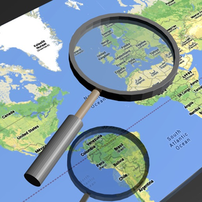
Le forme generiche 2D e 3D potranno essere disegnate sopra le mappe terrestri (2D e 3D) visualizzate da "FingerGIS" sullo schermo (Google Maps o Apple Maps), come si disegna con una applicazione CAD.
Sarà possibile interrogare le mappe ed i punti geografici inseriti o registrati per ottenere lunghezze, distanze tra punti geografici, misura di aree e perimetri, lunghezza totale di un percorso (polyline), ecc...
"FingerGIS" fornisce diverse modalità di registrazione automatica o inserimento manuale dei punti geografici di interesse; si potranno:
- salvare le posizioni attuali durante l'esplorazione di un sito (utilizzando il GPS per localizzare con esattezza la vostra posizione e premendo il pulsante di salvataggio veloce dei punti geografici per memorizzarla)
- inserire nuovi punti geografici manualmente utilizzando la finestra di inserimento manuale (con latitudine, longitudine, altezza, heading (utilizza la bussola interna del dispositivo), raggio, descrizione; questi dati possono essere inseriti in modo automatico toccando con un dito un punto di interesse sulle mappe visualizzate sullo schermo o in modo manuale scrivendo i valori numerici/testo tramite la tastiera del dispositivo)
- associare immagini ai punti geografici inseriti manualmente o registrati (si possono inserire immagini scattate con la fotocamera in tempo reale o immagini memorizzate nel foto album del dispositivo)
- memorizzare infiniti punti geografici isolati e/o aree circolari di raggio noto, ecc...
- registrare siti automaticamente attivando la funzione di registrazione automatica e camminando sul perimetro del sito da registrare
- disegnare ogni tipo di oggetto 2D e 3D sulle mappe terrestri, utilizzando layers multipli, come normalmente si fa con le comuni applicazioni CAD/GIS/SIT per personal computer.
Tutti i punti geografici inseriti sulle mappe, con le relative descrizioni, misure ed immagini, potranno essere salvati nell'archivio documenti di "FingerGIS" e potranno essere condivisi con altre applicazioni installate o con sistemi cloud come ad esempio dropbox.
"FingerGIS" è in grado di esportare i punti geografici salvati:
- nel formato .csv (nativo di "FingerGIS")
- nel formato nativo di "FingerCAD" (potrete disegnare i vostri progetti CAD sopra mappe geografiche registrate o siti georeferenziati con "FingerGIS")
- nel formato nativo di "pathRecorder" (navigatore satellitare con indicazioni automatiche per raggiungere destinazioni, seguendo percorsi registrati o disegnati)
- come allegato email (file .zip contenente al suo interno i geopoints registrati e le immagini georeferenziate)
Con "FingerGIS" avrete una applicazione GIS completa nel vostro dispositivo portatile.
Condivisione documenti (IN/OUT) con:
- DROPBOX (remote storage system, cloud)
- Open In
- iTunes Files Sharing
- allegati email
- FingerCAD (HD , WS , PRO) (utilizzando "Open In" - 3D data export/sharing)
- pathRecorder - come back (utilizzando "Open In")
Utilizzando FingerCAD assieme a FingerGIS:
Sarà possibile esportare i siti registrati utilizzando il formato di file .DXF (compatibile con le applicazioni CAD per Mac o PC) oppure il formato .OBJ (compatibile con i modellatori tridimensionali per MAC o PC) oppure il formato .PDF .
Archivio documenti:
- possono essere salvati un numero infinito di documenti nell'archivio documenti di FingerGIS
Display:
- Retina display supported
Tipo applicazione:
- UNIVERSAL APP (la paghi una sola volta e gira su tutti i dispositivi)