*** The BEST Speedometer-App in the Store! ***
New: Share tracks between multible devices via iClound
GPSSpeed HD is the ultimate speedometer for all iPhone/iPad with GPS.
List of features:
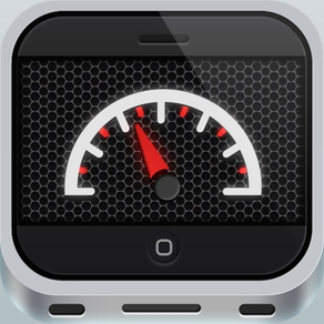
* Speedometer with speed profile
* Altimeter with height profile history
* Logs in sleep-mode if the application is running
* Logs in background if supported by iOS
* In statistics, the recorded profiles are available for analysis
* Display the recorded tracks on the map
* Display the current track on the map
(Using maps requires internet connection)
* These routes can be sent as an email in the formats KML, GPX and CSV with including histogram
* Show average speed and track distance
* Display of ascent and descent
* G-Meter
Background GPS tracking needs more power than standby. If the battery power is less than 10% it will stop background tracking!
Please note that for an accurate height measurement, a very good GPS signal is required. This signal is independent of the mobile phone reception.
Within and between buildings, the reception is restricted. When you see just a red signal indicator the GPS reception is to bad.
Please try again with a clear view to the sky.
If you have any questions or problems, please feel free to send an email to appsupport [at] mwaysolutions.com
We will attend to your request as soon as possible.