iTopography - Area Calculator

iTopography - Area Calculator


The area calculator you need


USD 3.99

4.3.5for iPhone, iPad and more
i-SmartSolutions
Developer
18.8 MB
Size
25/06/2021
Update Date
Utilities
Category
4+
Age Rating
Age Rating
4+
Apps in this category do not contain restricted content.
9+
Apps in this category may contain mild or occasional cartoon, fantasy or real-life violence, as well as occasional or mild adult, sexually suggestive or horrifying content and may not be suitable for children under 9 years of age.
12+
Apps in this category may contain occasional mild indecent language, frequent or intense cartoon or real-life violence, minor or occasional adult or sexually suggestive material, and simulated gambling, and may be for children under 12 years of age.
17+
You must be at least 17 years old to access this App.
Apps in this category may contain frequent and intense offensive language; Frequent and intense cartoon, fantasy or realistic violence: frequent and intense adult, scary and sexually suggestive subjects: as well as sexual content, nudity, tobacco, alcohol and drugs, may not be suitable for children under 17 years of age.
لقطات الشاشة لـ iTopography - Area Calculator
iTopography - Area Calculator الملصقiTopography - Area Calculator الملصقiTopography - Area Calculator الملصقiTopography - Area Calculator الملصق
iTopography - Area Calculator الملصقiTopography - Area Calculator الملصقiTopography - Area Calculator الملصقiTopography - Area Calculator الملصقiTopography - Area Calculator الملصقiTopography - Area Calculator الملصق

About iTopography - Area Calculator

Key Features:

- Computes the angles of any up to 5 vertices polygon

- Obtain coordinates (longitude, latitude) from the Google Map

- Create an infinite number of projects

- Import simple DXF files

- Email the data (longitude, latitude and altitude, and the coordinates of the points)

- Export the coordinates in a DXF file and then email it

- Zoom in/out on the map

- Rotate the map (360 degrees)

- Manually add points by giving the Longitude/Latitude of the point

- Compute the area of any sub-region on the fly
--------------------------------------------------

Calculating the area of a surface has never been easier!

Whether you are a civil engineer, a topographer, a student or a person who likes to build things on his/her own, you will find iTopography an invaluable tool.

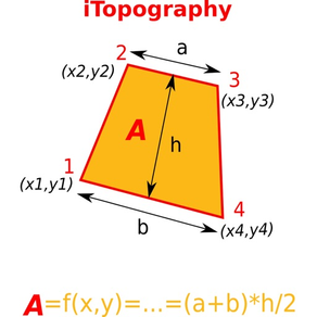
iTopography is developed on the premise that a surface can be approximated as a polygon of finite number of lines and vertices (points). Therefore, iTopography can calculate the area of any surface, whether this surface is a garden, the living room, a field or even a geometrical shape for a homework class.

iTopography uses the GPS device to obtain the longitude and latitude of the current position. In the case of a weak signal (e.g., inside the house), the user is asked to give the distance and angle between two adjacent points.

In order for iTopography to compute the area of a surface, the user must move along the borders of the surface in a clockwise or counter-clockwise direction. When the user inserts a point, iTopography will connect the adjacent points with a straight line, draw the surface, and calculate the area of the surface along with its perimeter.
Show More

تحديث لأحدث إصدار 4.3.5

Last updated on 25/06/2021
الإصدارات القديمة
Fixes a bug in the code that imports DXF files
Several minor changes in the UI (both iPhone and iPad)
Show More
Version History
4.3.5
25/06/2021
Fixes a bug in the code that imports DXF files
Several minor changes in the UI (both iPhone and iPad)
4.3.4
26/01/2021
Fixes a UI issue in the info screen
Fixes a bug that could cause the app to crash when you try to purchase one of the two extra features
4.3.3
21/09/2020
- Clone a Project
- Rename a Project
- Compute the height: The distance between a point and the opposite side
4.3.2
06/09/2020
Fixes a bug that caused the app to crash when you tap on the decimal symbol in the keyboard
4.3.1
31/08/2020
- Fixes several UI issues, especially for iPad
- A new Settings screen
- Improve the GPS performance
4.3
30/10/2018
Fixes a bug in the code for computing the angles of a square
4.2
17/10/2018
- Fixes the UI for iPhone X devices
- Computes the angles of any up to 5 vertices polygon
- Minor changes in the UI
4.1
16/08/2018
Minor changes in the UI
4.0
20/06/2018
- Add a button to create a regular polygon by giving the length of a size and the number of vertices
- Drag points and iTopography will automatically compute its new angle and distance (This feature does not work in the GPS mode)
- Minor fixes in the code for computing the position of the points when the distance / angles are given
- Minor changes in the UI
3.1
17/10/2017
- show error in the calculation of distances (when it is available)
- bug fixes
3.0
09/10/2017
- Fix compatibility issues with iOS 11
- New UI
- Bug fixes
2.5
12/11/2013
- Fixed a bug that could cause the application to crash on iPhone devices
2.4
20/10/2013
- iOS 7 compatible

- Email data in WGS (X,Y,Z) format and in EGSA87 format
- Fixes minor bugs
2.3
24/09/2012
- Add support for the hectare unit
- Supports landscape and portrait mode on iPad
2.2
28/06/2012
- Long press on the Google Map to get the coordinates
- Long press on a pin to drag it
- Minor changes in the UI
- Increased the rotation angle from 180 degrees to 360 degress
2.1
28/02/2012
As it was requested:
1) iTopography runs natively on iPad
2) iTopography supports Google map (click on the "g" button to enable/disable it)
2.0
20/12/2011
- Create an infinite number of projects
- Improve the GPS signal
- Import simple DXF files
- Minor bug fixes
- Better UI to rotate and zoom in/out on the map
1.8
24/01/2011
- Minor bug fixes
- Compute the area of any sub-region on the fly
1.6
30/11/2010
- Fixed minor bugs with the GPS device
- The app is fully compatible with OS4
- The user can properly zoom in/out on the map
- The user can rotate the map
- The user can Manually add points by giving the Longitude/Latitude of the point
- Spherical trigonometry is implemented to accurately calculate the angles and distances.
1.4
29/10/2010
- The GPS device reports the altitude of the position.
- When the user clicks on the button "Edit", he/she can delete and reorder the points.
- In the settings, the user can select if he/she wants to use the GPS device. This will improve the GPS signal.
- Also, the user can select if the altitude of the position should be used in the calculation of the perimeter, the distance, and the angle.
- A bug was fixed in the code that draws the map
- In the map tab, the button with the letter "i" gives the coordinates of the points, along with the length of the sides and the angle of the vertices.
- Also, the search button provides an interface to compute the distance between any two points, and the angle between any three points.
- The user can email the data (longitude, latitude and altitude, if the GPS device is used, and the coordinates of the points)
- The user can export the coordinates in a DXF file, which then can email it.
1.2
02/10/2010
- The first two points are labeled on the map.
- On the map, the user can click on the button with the calligraphic letter "i" to read the sides of the polygon (distance between two adjacent points), and the angle of the vertices.
1.0
17/09/2010

iTopography - Area Calculator FAQ

انقر هنا لمعرفة كيفية تنزيل iTopography - Area Calculator في بلد أو منطقة محظورة.
تحقق من القائمة التالية لمعرفة الحد الأدنى من المتطلبات iTopography - Area Calculator.
iPhone
Requiere iOS 9.0 o posterior.
iPad
Requiere iPadOS 9.0 o posterior.
iPod touch
Requiere iOS 9.0 o posterior.
iTopography - Area Calculator هي مدعومة على اللغات Inglés
في iTopography - Area Calculator عمليات شراء داخل التطبيق. يرجى التحقق من خطة الأسعار على النحو التالي:
iTopography Height
USD 0.99
Arrange points on the map
USD 0.99

بدائل لـ iTopography - Area Calculator

ربما يعجبك أيضا

أكثر البرنامج من i-SmartSolutions