Precision Gateway
Gratis
1.19.9for iPhone, iPad and more
Ideal It Development Solutions (pty) Ltd
Developer
49.5 MB
Size
11/12/2023
Update Date
Business
Category
4+
Age Rating
Age Rating
لقطات الشاشة لـ Precision Gateway
About Precision Gateway
Precision Gateway Mapping is the mobile version for managing spatial data within the SGS Precision Gateway platform. The mapping app gives you access to all the geospatial data gathered on the farm, this includes maps such as:
• Nutrient Index
• Soil Physical
• Soil Chemical
• Satellite Imagery
• VRT
• Yield
Interaction with the data is made possible by using your devices’ GPS coordinates, enabling a new dimension of working with the data.
Registration on the app is required in order for us to provide a username and password. Once the registration is received, our operators will be in contact to further assist.
Show More
تحديث لأحدث إصدار 1.19.9
Last updated on 11/12/2023
الإصدارات القديمة
• Added version number
• Added new Satellite Image History types
• Fixed Compare Analysis not working for some map types
• Added new Satellite Image History types
• Fixed Compare Analysis not working for some map types
Show More
Version History
1.19.9
11/12/2023
• Added version number
• Added new Satellite Image History types
• Fixed Compare Analysis not working for some map types
• Added new Satellite Image History types
• Fixed Compare Analysis not working for some map types
1.19.8
15/09/2023
• Added App Check
1.19.7
18/07/2023
• Bug fixes and Enhancements
1.19.6
07/07/2023
• Bug fixes and Enhancements
1.19.5
22/06/2023
• Bug fixes and Enhancements
1.19.4
18/06/2023
• Fixed Compare Analysis showing wrong analysis
• Fixed date selector on field overview
• Fixed overlay functionality of NDVI
• Added search functionality to tenant selection
• Bug fixes and Enhancements
• Fixed date selector on field overview
• Fixed overlay functionality of NDVI
• Added search functionality to tenant selection
• Bug fixes and Enhancements
1.19.3
01/06/2023
• Bug fixes and Enhancements
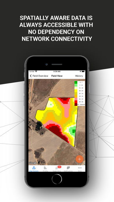
• Offline functionality logic fixed
1.19.2
21/04/2023
• Minor Bug Fixes
1.19.1
29/03/2023
• Added support for new map types.
• Made enhancements and bug fixes.
1.19
29/06/2022
• Added option to delete account
• Made enhancements and bug fixes
1.18
19/12/2021
• Made enhancements and bug fixes
1.17
03/03/2021
- Added facilities to switch off crop growth warning notifications
- Other enhancements and bug fixes
1.16
12/02/2021
- Replaced the MapBox background optical satellite images with Google Maps
- Enhancements to the display on boundaries to include names on farm level and show only boundary outlines
- Enhanced download speeds of map data, and decreased storage space requirements
- Enhanced NDVI overlay on Farm level to include a variance on the date to enable historic NDVI to be displayed on a farm level
- Enhanced the offline pin sync functionality
- Other enhancements and bug fixes
1.15
09/02/2021
- Replaced the MapBox background optical satellite images with Google Maps
- Enhancements to the display on boundaries to include names on farm level and show only boundary outlines
- Enhanced download speeds of map data, and decreased storage space requirements
- Enhanced NDVI overlay on Farm level to include a variance on the date to enable historic NDVI to be displayed on a farm level
- Enhanced the offline pin sync functionality
- Other enhancements and bug fixes
- Enhancements to the display on boundaries to include names on farm level and show only boundary outlines
- Enhanced download speeds of map data, and decreased storage space requirements
- Enhanced NDVI overlay on Farm level to include a variance on the date to enable historic NDVI to be displayed on a farm level
- Enhanced the offline pin sync functionality
- Other enhancements and bug fixes
1.14
02/02/2021
- Replaced the MapBox background optical satellite images with Google Maps
- Enhancements to the display on boundaries to include names on farm level and show only boundary outlines
- Enhanced download speeds of map data, and decreased storage space requirements
- Enhanced NDVI overlay on Farm level to include a variance on the date to enable historic NDVI to be displayed on a farm level
- Enhanced the offline pin sync functionality
- Other enhancements and bug fixes
- Enhancements to the display on boundaries to include names on farm level and show only boundary outlines
- Enhanced download speeds of map data, and decreased storage space requirements
- Enhanced NDVI overlay on Farm level to include a variance on the date to enable historic NDVI to be displayed on a farm level
- Enhanced the offline pin sync functionality
- Other enhancements and bug fixes
1.13
27/01/2021
- Replaced the MapBox background optical satellite images with Google Maps
- Enhancements to the display on boundaries to include names on farm level and show only boundary outlines
- Enhanced download speeds of map data, and decreased storage space requirements
- Enhanced NDVI overlay on Farm level to include a variance on the date to enable historic NDVI to be displayed on a farm level
- Enhanced the offline pin sync functionality
- Other enhancements and bug fixes
- Enhancements to the display on boundaries to include names on farm level and show only boundary outlines
- Enhanced download speeds of map data, and decreased storage space requirements
- Enhanced NDVI overlay on Farm level to include a variance on the date to enable historic NDVI to be displayed on a farm level
- Enhanced the offline pin sync functionality
- Other enhancements and bug fixes
1.12
21/01/2021
- Replaced the MapBox background optical satellite images with Google Maps
- Enhancements to the display on boundaries to include names on farm level and show only boundary outlines
- Enhanced download speeds of map data, and decreased storage space requirements
- Enhanced NDVI overlay on Farm level to include a variance on the date to enable historic NDVI to be displayed on a farm level
- Enhanced the offline pin sync functionality
- Various other enhancements and bug fixes
1.11
23/05/2020
- Virtual Consultant message management enhancements (deletion of messages)
- Offline capability enhancements
- App performance enhancements
- Data management enhancements
- Security Enhancements for multi users on single app
- Other minor enhancements
- Offline capability enhancements
- App performance enhancements
- Data management enhancements
- Security Enhancements for multi users on single app
- Other minor enhancements
1.10
09/02/2020
In this release, we made a few minor performance enhancements and fixed a few bugs.
1.9
13/11/2019
In this release, we included:
- Rainfall Management
- Notifications for crop monitoring
We also made a few minor performance enhancements and fixed a few bugs.
- Rainfall Management
- Notifications for crop monitoring
We also made a few minor performance enhancements and fixed a few bugs.
1.6
27/07/2019
In this release, we included:
- Virtual Consultant as part of the App.
- Satellite imagery now available on a farm level.
- Crop monitoring module.
- Crop and cultivar information on field level.
We also made a few minor performance enhancements and fixed a few bugs.
- Virtual Consultant as part of the App.
- Satellite imagery now available on a farm level.
- Crop monitoring module.
- Crop and cultivar information on field level.
We also made a few minor performance enhancements and fixed a few bugs.
1.5
17/04/2019
In this release, we included Spanish language support and enabled Soil Type and NDVI maps on farm level.
We also made a few minor performance enhancements and fixed a few bugs.
1.4
04/03/2019
Minor performance enhancements and bug fixes. Also included language support for Turkey.
1.3
24/01/2019
Fixed some bugs that caused the login process to fail for some users.
1.2
16/01/2019
This release brings enhancements to data syncing, ensuring you always have the most accurate view of your data possible.
We have also fixed some bugs and made some stability improvements.
Precision Gateway FAQ
انقر هنا لمعرفة كيفية تنزيل Precision Gateway في بلد أو منطقة محظورة.
تحقق من القائمة التالية لمعرفة الحد الأدنى من المتطلبات Precision Gateway.
iPhone
Requiere iOS 12.1 o posterior.
iPad
Requiere iPadOS 12.1 o posterior.
iPod touch
Requiere iOS 12.1 o posterior.
Precision Gateway هي مدعومة على اللغات Español, Inglés, Turco