Alpe Adria Trail
무료
1.1for iPhone, iPad and more
Age Rating
Alpe Adria Trail 스크린 샷
About Alpe Adria Trail
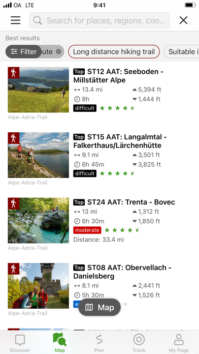
The Alpe-Adria-Trail connects the three regions of Carinthia, Slovenia and Friuli-Venezia Giulia, and covers a total of 43 stages. The long distance hiking route leads from the foot of the highest mountain in Austria, the Grossglockner, through the beautiful Carinthian mountain and lake districts near where the three countries – Austria, Italy and Slovenia – meet. The Triglav National Park, the Soča Valley, the wine-growing regions of Colli Orientali and Goriška Brda and the Karst are further unique areas you will pass before finally reaching Muggia at the Adriatic Sea.
An essential component of the app is the detailed information that is provided for each stage: the course of the stages, attractions and establishments.
The tours/stages, including all tour details and relevant map sections, can be stored on a smartphone and can be accessed offline, if required (for example, if you are in another country, in areas with weak network coverage, or when data roaming would be too expensive).
The tour descriptions contain all the facts, images and elevation profiles you might need. As soon as a tour is started, you can determine your own position (including determining which direction you are facing) easily in the topographic map and, in this way, follow the course of the route.
Please note: In other countries high roaming costs can occur, therefore, when using the app, make sure all necessary information can be accessed offline by downloading it at a flat rate or via Wi-Fi before starting your journey.
Background use of the app with activated GPS reception can drastically shorten battery life!
Apple Health:
When you record a cycling, hiking, walking or running track you are able to save work outs to Apple Health. Data from HealthKit will not be used for marketing or promotional purposes.
Show More
최신 버전 1.1의 새로운 기능
Last updated on May 4, 2022
오래된 버전
In this version we fixed some bugs and made some performance improvements.
Show More
Version History
1.1
May 4, 2022
In this version we fixed some bugs and made some performance improvements.
1.0
Feb 15, 2022
Alpe Adria Trail FAQ
제한된 국가 또는 지역에서 Alpe Adria Trail를 다운로드하는 방법을 알아보려면 여기를 클릭하십시오.
Alpe Adria Trail의 최소 요구 사항을 보려면 다음 목록을 확인하십시오.
iPhone
iOS 13.2 이상 필요.
iPad
iPadOS 13.2 이상 필요.
iPod touch
iOS 13.2 이상 필요.
Alpe Adria Trail은 다음 언어를 지원합니다. 독일어, 영어, 이탈리아어


