"Best map of Easter Island. Fabulous cartography and data."
Works OFFLINE! - No phone or internet required
5 Base Maps:
OFFLINE Map and imagery, 1 premium imagery map provider and 2 different street maps.
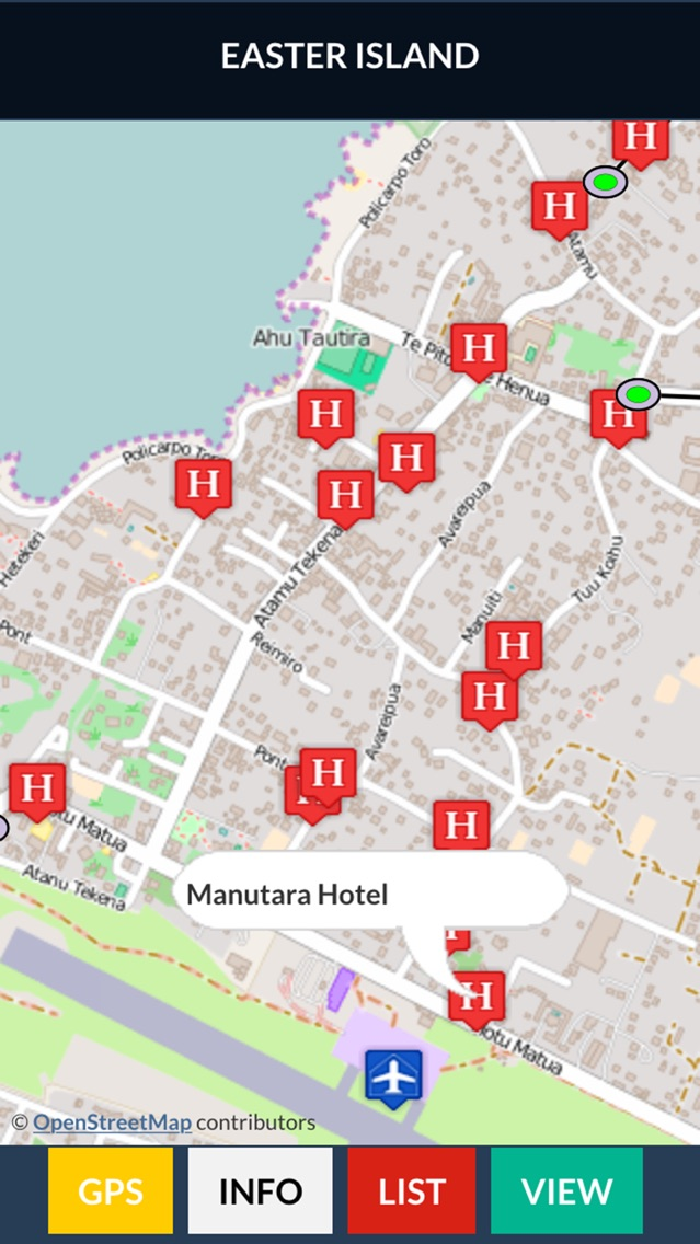
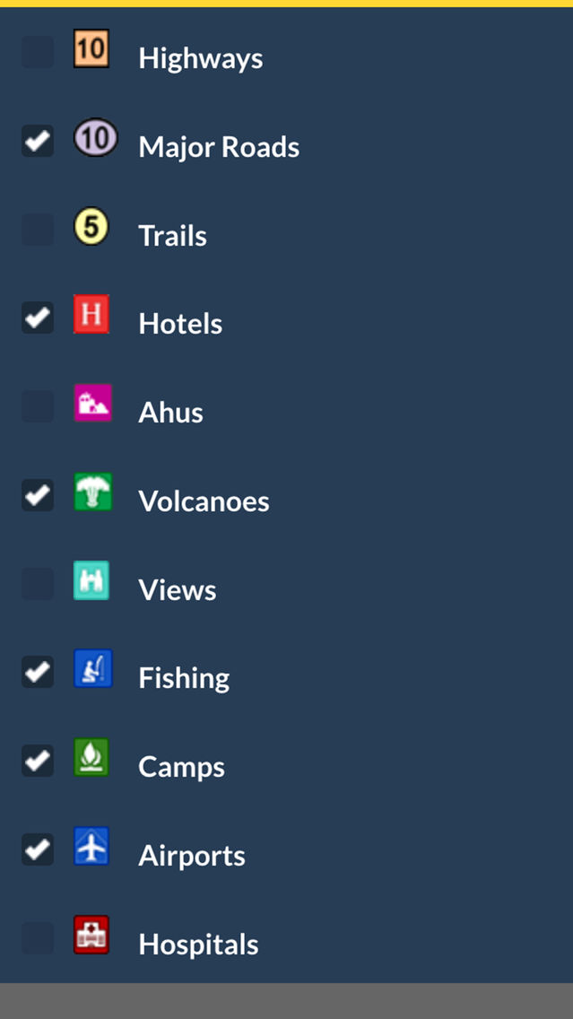
11 Geographic Overlays OFFLINE:
Highways, major roads, trails, hotels, camps, views, volcanoes, fishing, airports, hospitals and ahus.
Social Media:
Videos, Photos, Facebook and Twitter.
Services:
GPS and weather
Languages:
English, Spanish and Portuguese